          00:00 Title
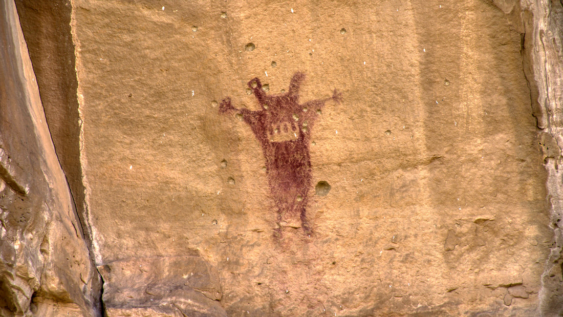
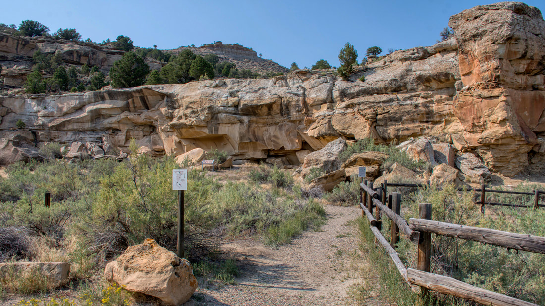
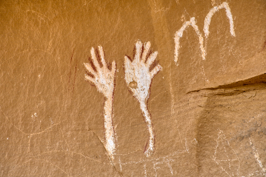
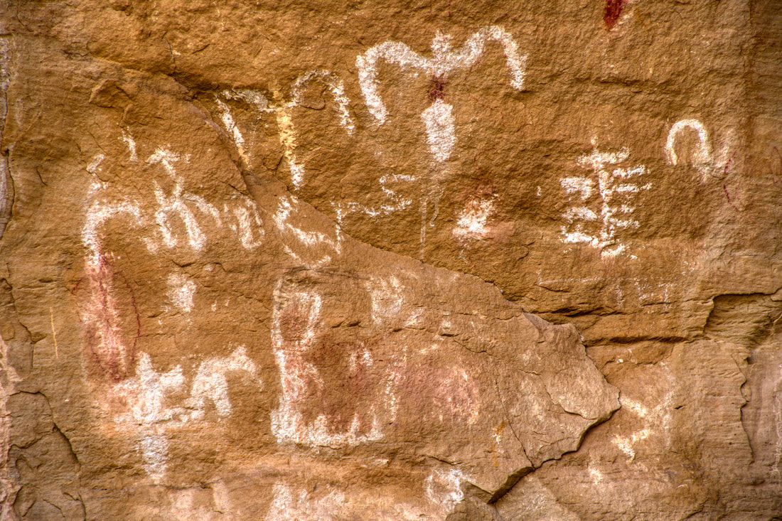
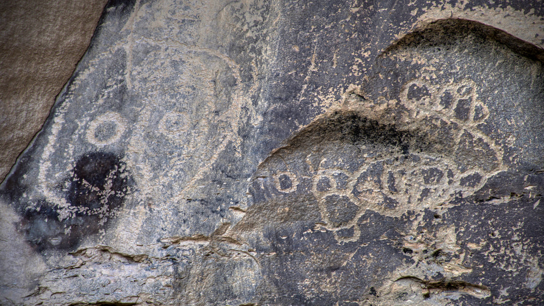
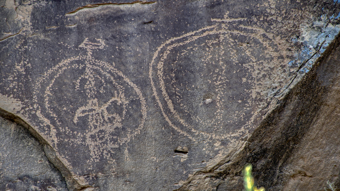
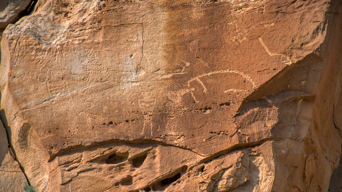
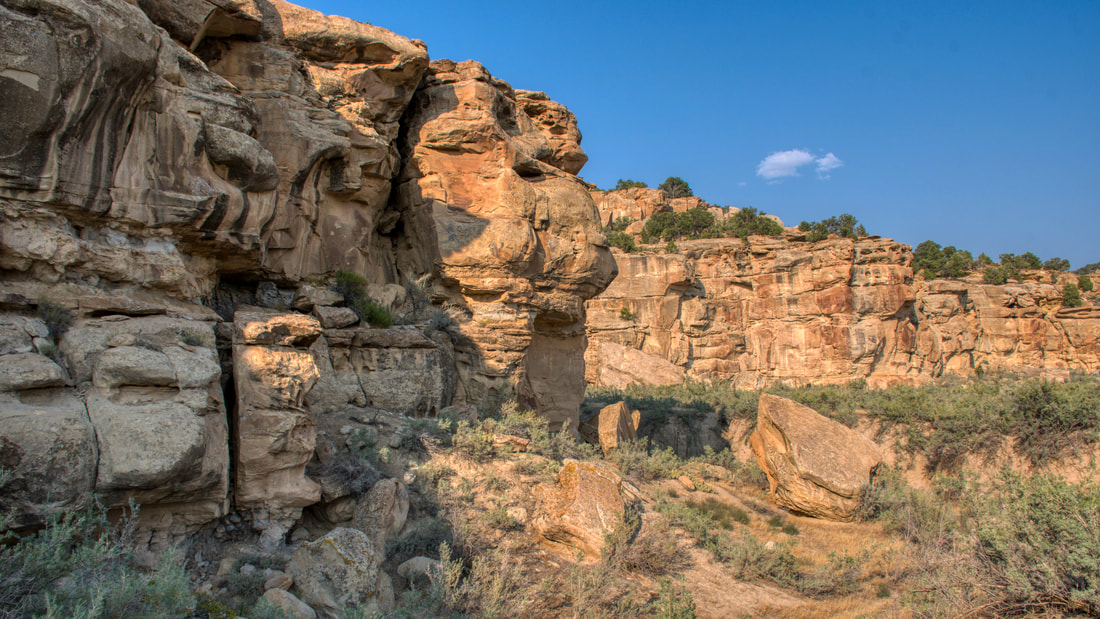
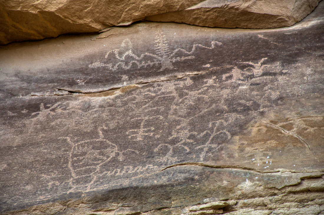
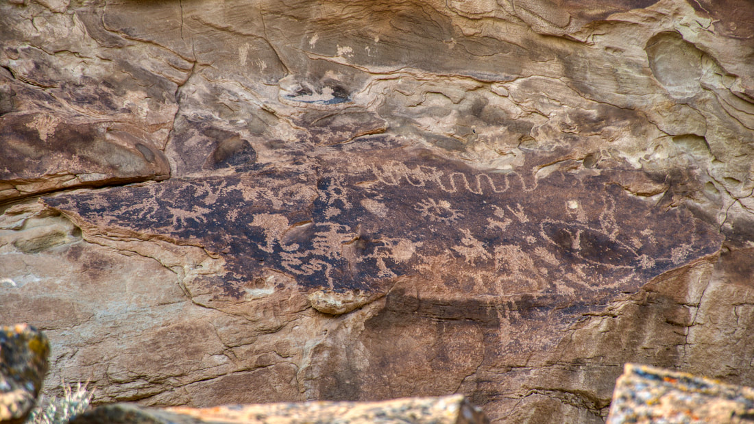
00:17 Waving Hands 02:32 White Birds 04:27 Cow Canyon 07:11 State Bridge 09:51 East Four Mile 14:36 Lookout Point 15:14 Fin The Canyon Pintado National Historic District is easy to access because a paved highway runs through this park. Canyon Pintado is located on Colorado Highway 139 between Fruita and Rangely in the northwestern end of the state. This highway is the pathway from Grand Junction to Dinosaur National Monument and there really is nothing but wide open spaces in between. There is very little daily traffic along this road, so slowing down to take in the scenic views is easy to do. The signs for the Canyon Pintado roadside interpretive sites appear near the midway point and each site is well worth checking out. The Canyon Pintado National Historic District covers about 15 miles of Highway 139 and there are several unique roadside attractions that offer an opportunity to stretch the legs during the long drive. The signage for the interpretive site is easy to spot and there is an orientation center at the southern end of the park. Most of the ancient sites only require about 30 minutes to check out, but the East Four Mile Interpretive Site does have an extensive trail system that can take more than one half day to experience. The entire Canyon Pintado complex only takes few hours to a full day to cover, so be sure to set aside sufficient time, especially when commuting between the big national parks in Fruita and Dinosaur. Canyon Pintado (Painted Canyon) was discovered way back in the 1770s during the Dominguez-Escalante expedition. Ancient rock art from the Fremont indigenous culture adorns this landscape for many miles around and some of the archaeological sites date back over 11,000 years. The lengthy timeline shows that this corridor was both traveled through and occupied for many centuries, so there is plenty to ponder over when visiting this sacred place. Much of the rock art depicts local agricultural practices and the nearby fertile wetlands that were an important resource. There are also celestial depictions in the mix, so there is plenty to peruse when viewing the Canyon Pintado newspaper rocks. On a side note, social responsibility does come into play when touring the Canyon Pintado interpretive sites. It is important to remember that the ancient artwork is protected by federal law and the penalties for vandalism are extreme. It is forbidden to touch or deface the ancient artwork and any suspicious activity must be reported. Canyon Pintado maps are available on the web, but a map really is not necessary since all of the points of interest are located along Highway 139. Interpretive sites to keep an eye out for include Waving Hands, White Birds, Kokopelli, Cow Canyon, State Bridge, East Four Mile and Lookout Point. Some have modern facilities and all have adequate parking. Most of these sites require a short hike, but the lengthy East Four Mile trails can take a few hours to cover. All of the ancient rock art has a story to tell, so each is worth having a look. Photographing the artwork is the best way to take the old newspapers home and the pictures certainly can be pondered over for many years to come!
0 Comments
Your comment will be posted after it is approved.
Leave a Reply. |
Leave no trace!
New!
Destination West YouTube channel! https://www.youtube.com/@DestinationWestOrg *The Destination West website upgrading project is well underway. Unique YouTube slideshows are replacing the outdated Flickr photo galleries. The new videos feature modern graphics and alternative music instrumentals that enhance the viewing experience. Some articles are being condensed, while others are getting much needed edits. As everybody knows, the bulk of the original articles and photos were published on the fly during the Covid camping venture and there were limitations. Upgrading is the way to go and more articles will receive a makeover each week until this project is completed. After that, I will be able to gather new material. There is light at the end of the tunnel!
JD Lane Archives
July 2024
|
