                 00:00 Title
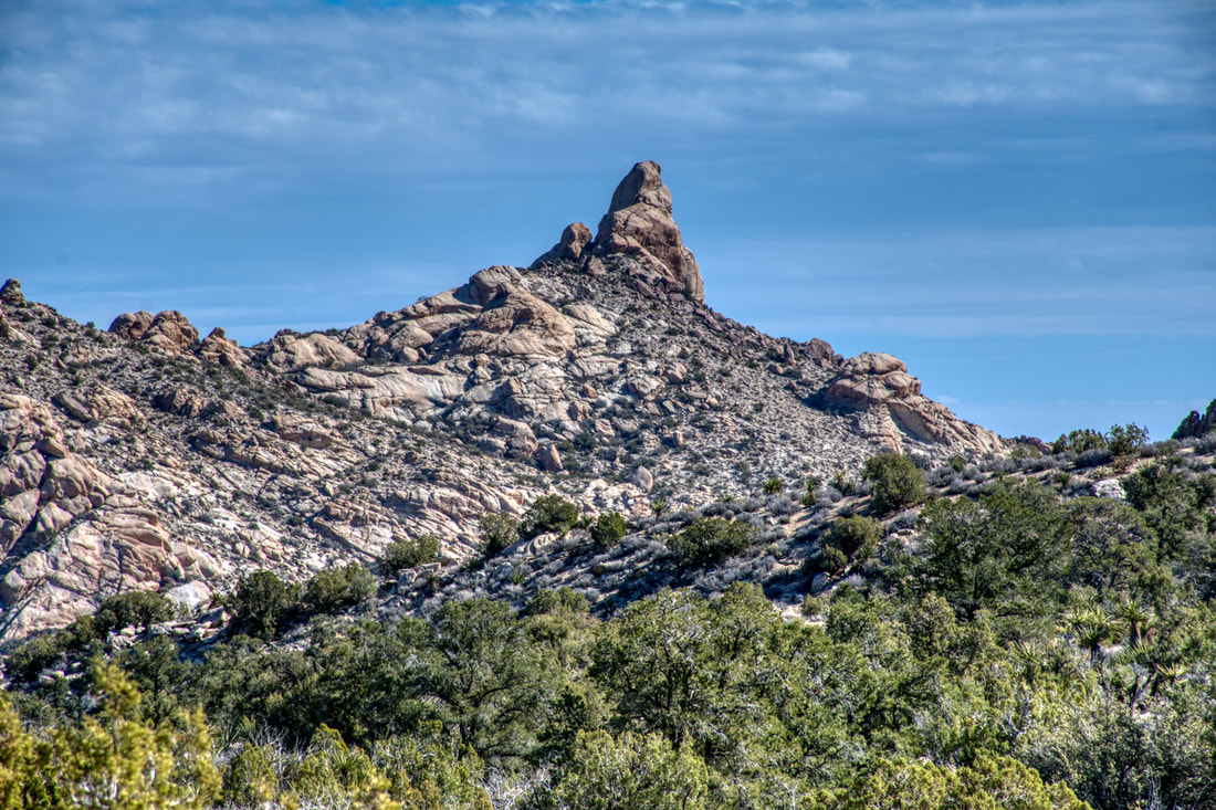
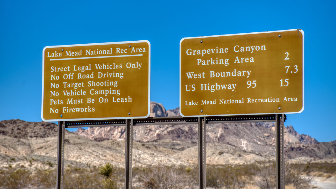
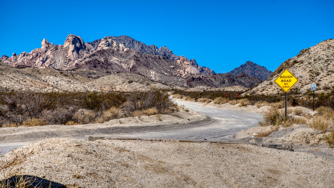
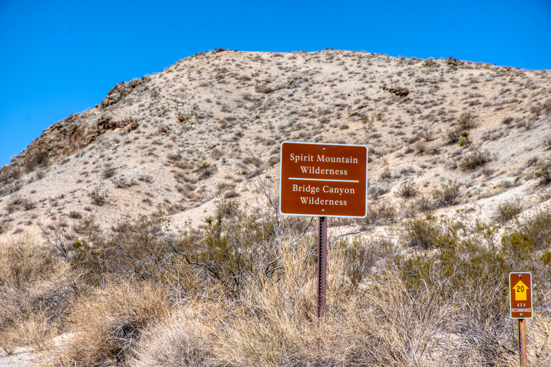
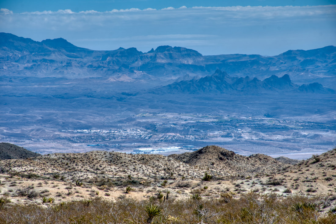
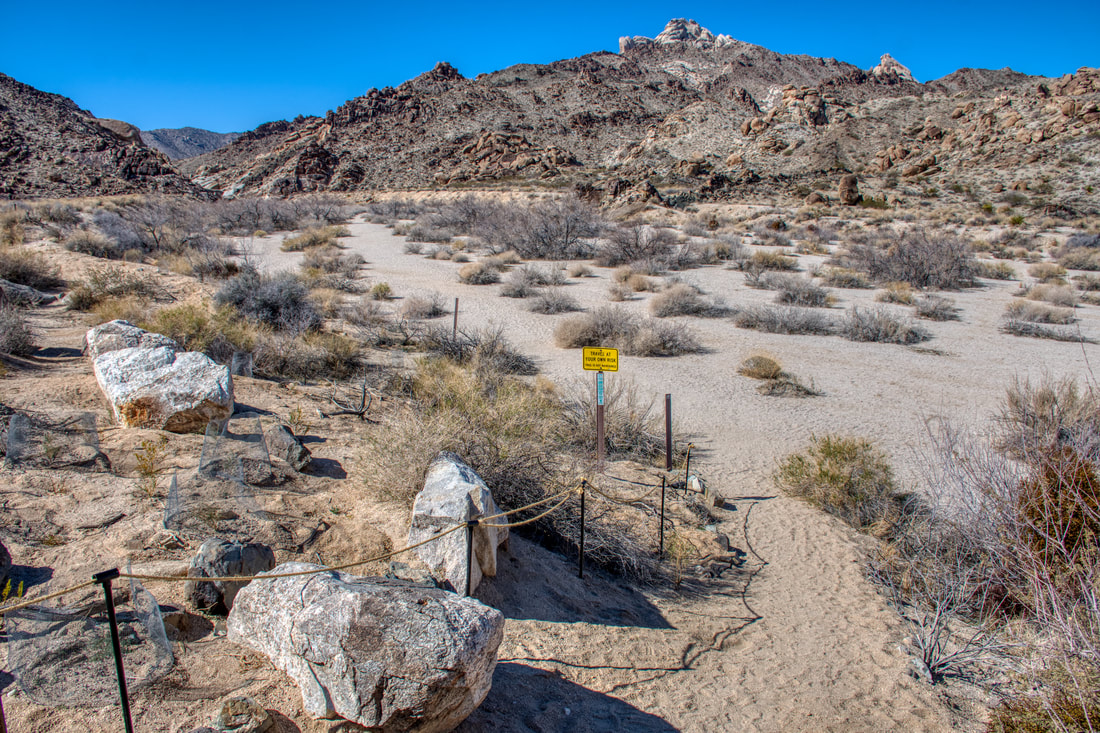
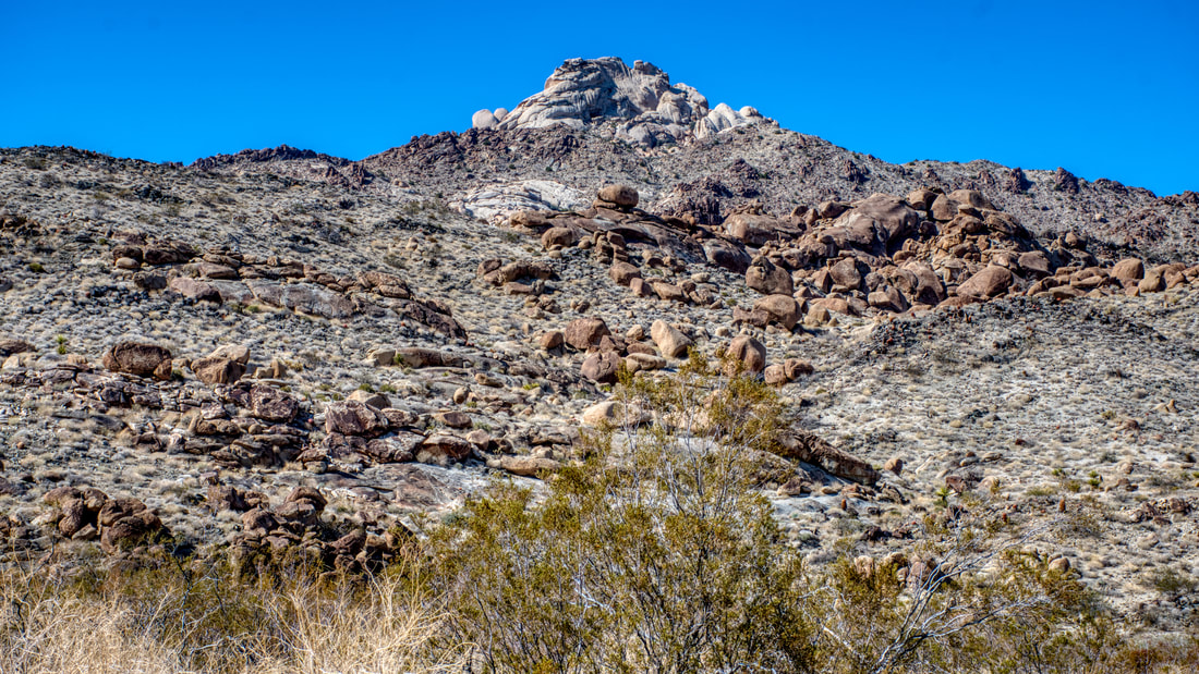
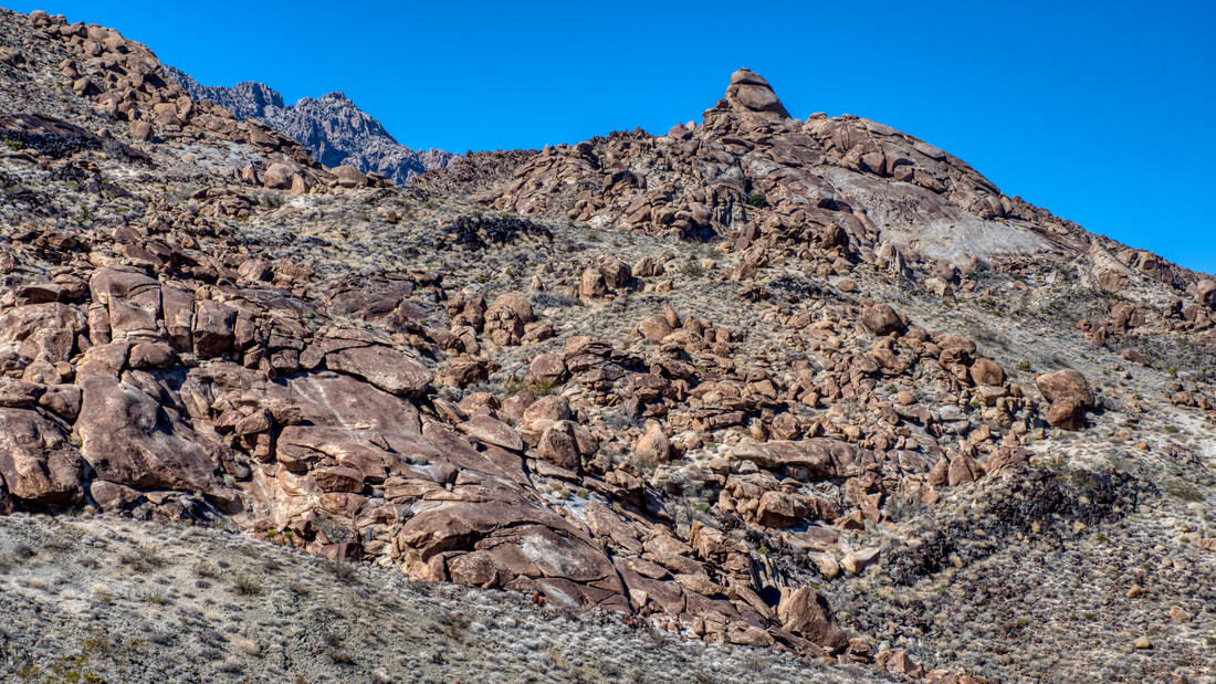
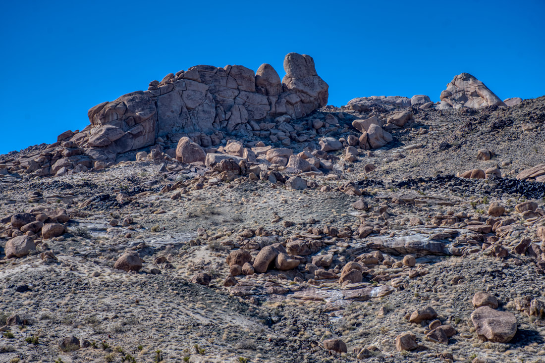
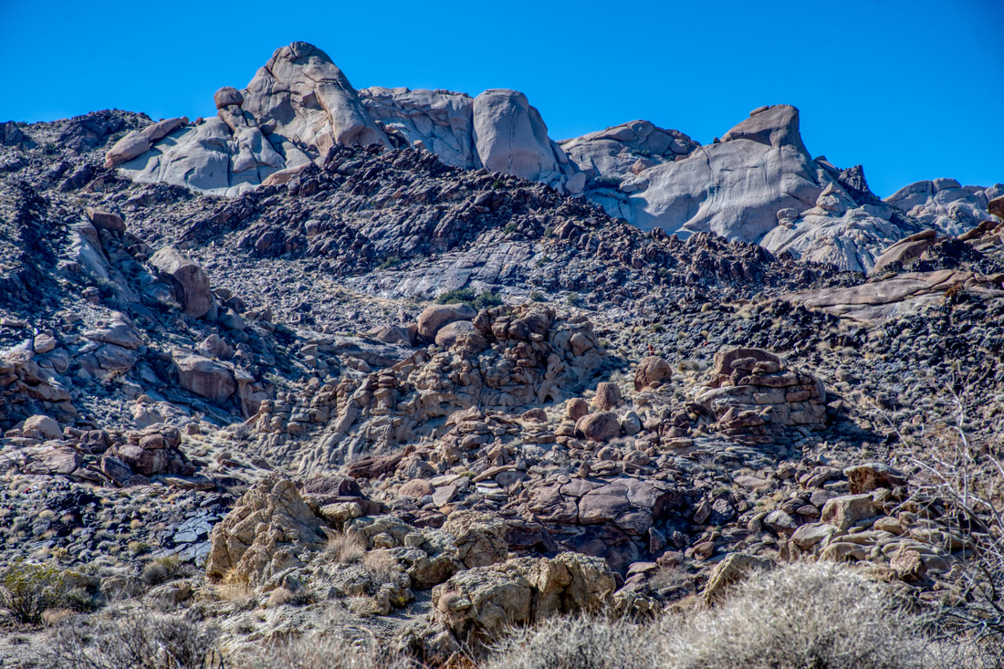
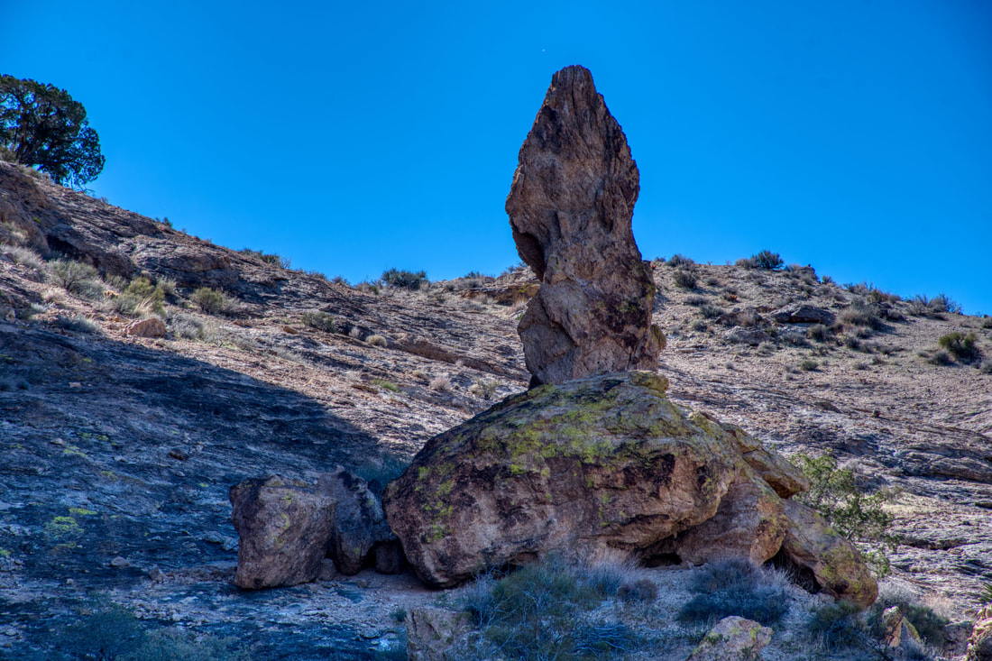
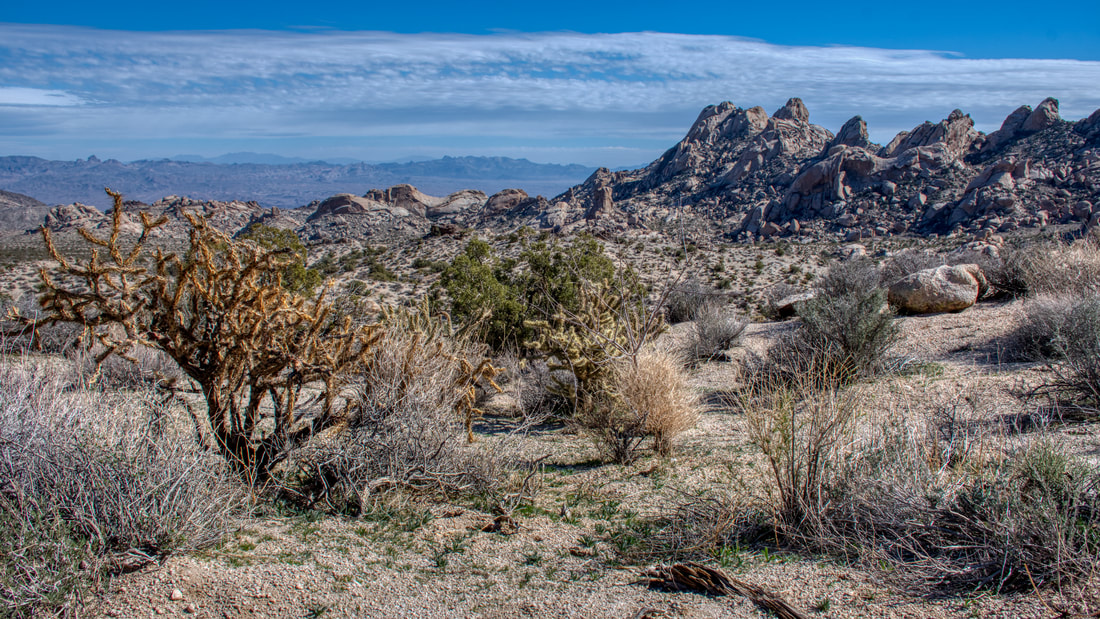
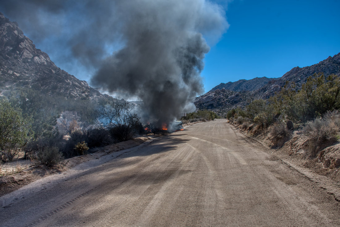
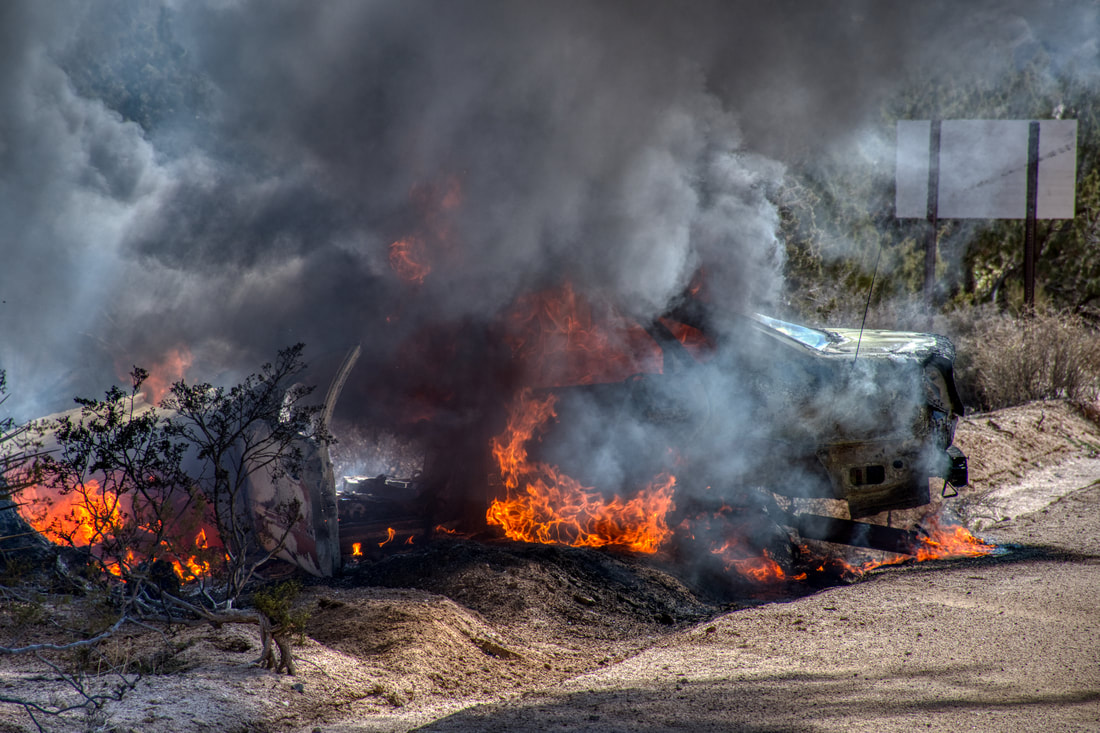
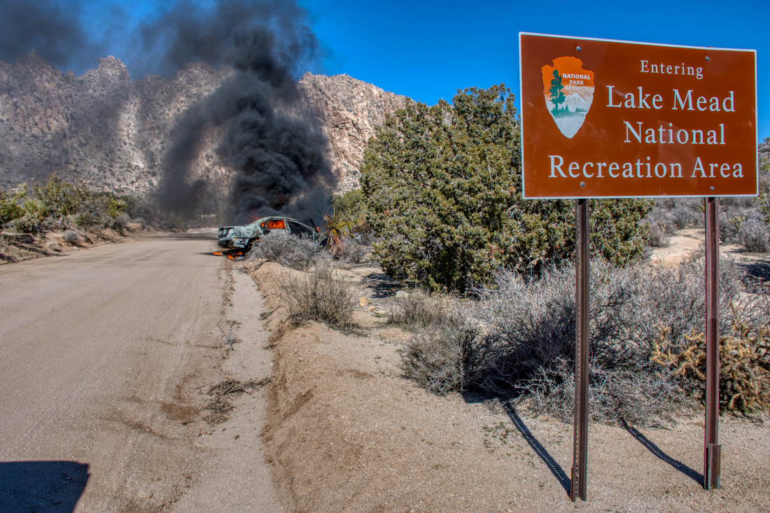
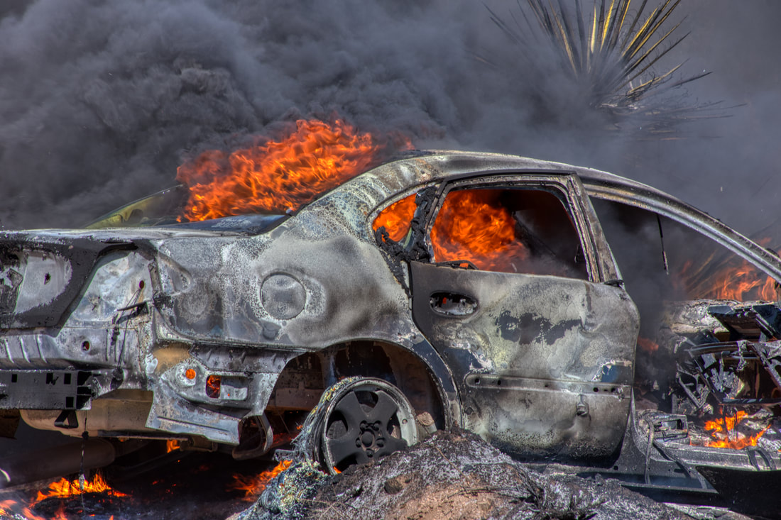
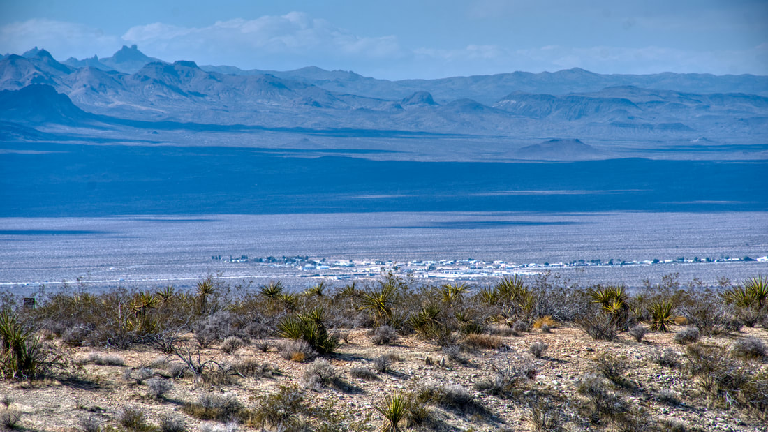
00:14 Lake Mojave 04:12 Cottonwood Cove 07:15 Christmas Tree Pass 14:40 Mike O'Callaghan-Pat Tillman Memorial Bridge 20:03 Fin Christmas Tree Pass Road is a popular backcountry touring route in the south end of the Lake Mead National Recreation Area. The starting point is located on Highway 163 a short distance west of Laughlin, Nevada and the signage is easy to spot. This dirt road runs about 15 miles up and over the mountains to Highway 95 just south of the community of Cal-Nev-Ari. Traffic can go both directions, so this is also the scenic way to get to Laughlin. This dirt road is usually well maintained but it can be rough for passenger cars, so a high ground clearance vehicle is recommended. There are several hiking trails and many unique rock formations to explore along Christmas Tree Pass Road. The Grapevine Canyon Trail is best for the cool weather seasons and this trek goes to several ancient rock art sites. A visitor will discover many ancient indigenous markings from the past and this entire mountain actually is a native sacred place. Christmas Tree Pass Road is the access corridor for the newly designated Avi Kwa Ame National Monument, which is also known as Spirit Mountain. Near the crest of the pass is where the Spirit Mountain Trailhead can be found and the views are breathtaking to see. The photos were taken back when this area was called the Spirit Mountain Wilderness, so there will be new signage along the way. The views of the desert mountain landscape are astounding every inch of the way along this dirt road, so be sure to pack a camera. The elevations are higher than the dusty haze level in the valley down below and the fresh air is invigorating. The foot trails provide plenty to do and there are some good spots for a picnic. It only takes about one hour to complete the trail, yet an entire day of activities await. On the downside, the Lake Mead National Recreation Area is the most dangerous park in the nation, so it pays to be well aware of the surroundings and proceed with caution. This is especially true when driving, because an accident is guaranteed to be very costly in this remote area. An example of carelessness can be seen in the burning car photos. The car went out of control off the road and the catalytic converter ignited the dried up bushes. In a matter of minutes the car was a total loss, but at least there were no injuries. I met the fire crew as they were rolling up the other side of the mountain and showed them the pictures while filling them in on some details. They appreciated seeing the debacle they were facing and we parted ways. The emergency response fee, vehicle extraction fee and citations likely added up to a five digit figure, so it is easy to see why driving safe and slow is the best way to go in this vast recreation area.
0 Comments
Your comment will be posted after it is approved.
Leave a Reply. |
Leave no trace!
New!
Destination West YouTube channel! https://www.youtube.com/@DestinationWestOrg *The Destination West website upgrading project is well underway. Unique YouTube slideshows are replacing the outdated Flickr photo galleries. The new videos feature modern graphics and alternative music instrumentals that enhance the viewing experience. Some articles are being condensed, while others are getting much needed edits. As everybody knows, the bulk of the original articles and photos were published on the fly during the Covid camping venture and there were limitations. Upgrading is the way to go and more articles will receive a makeover each week until this project is completed. After that, I will be able to gather new material. There is light at the end of the tunnel!
JD Lane Archives
July 2024
|
