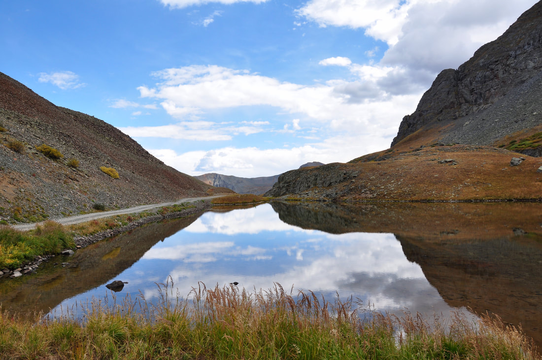
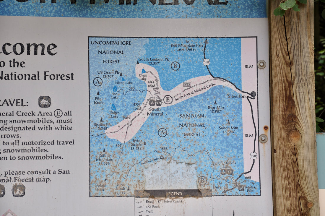
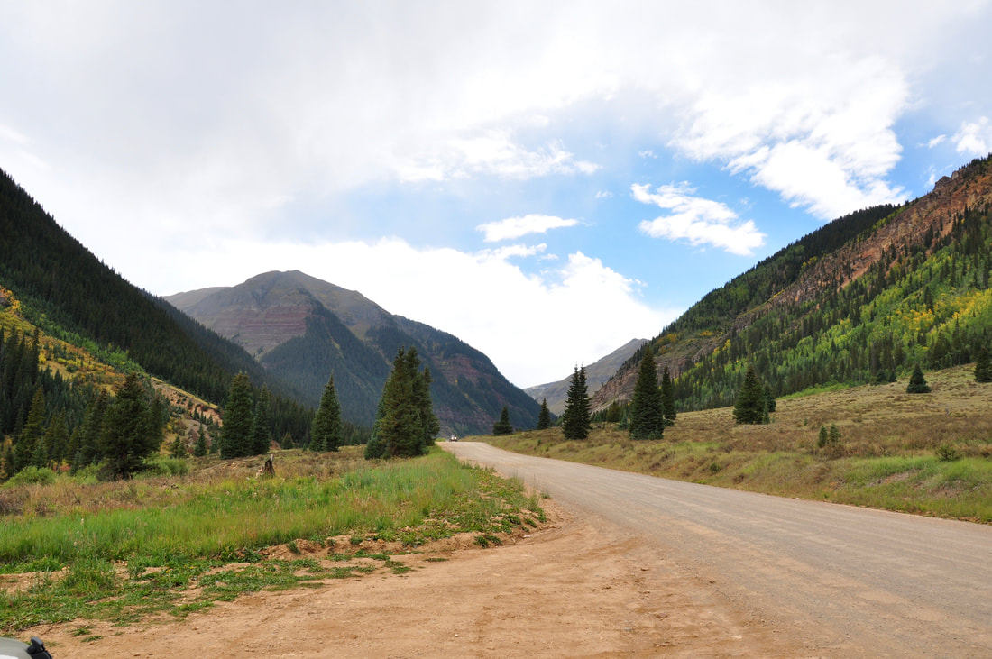
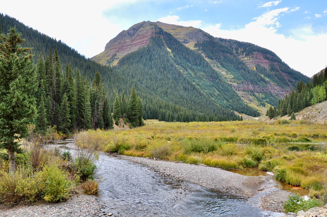
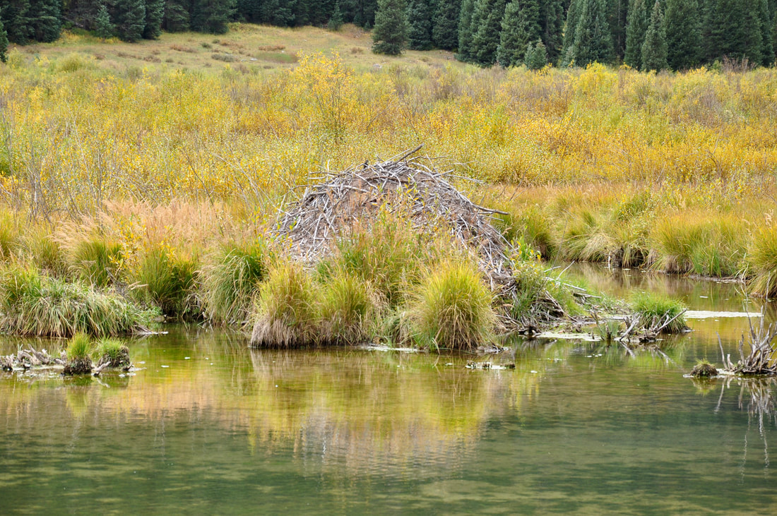
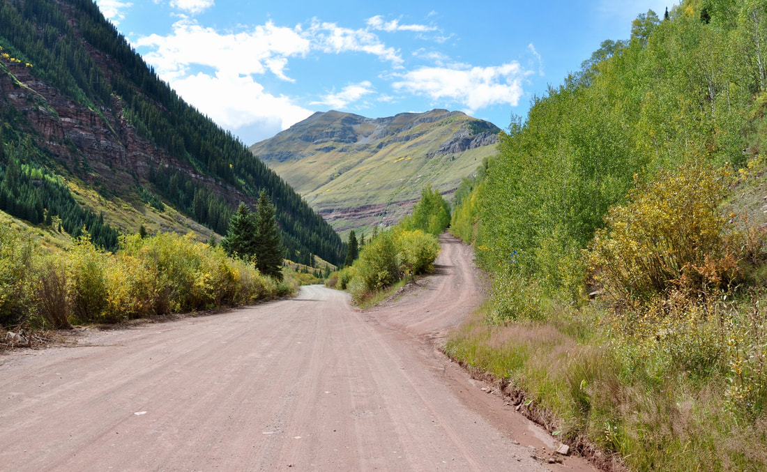
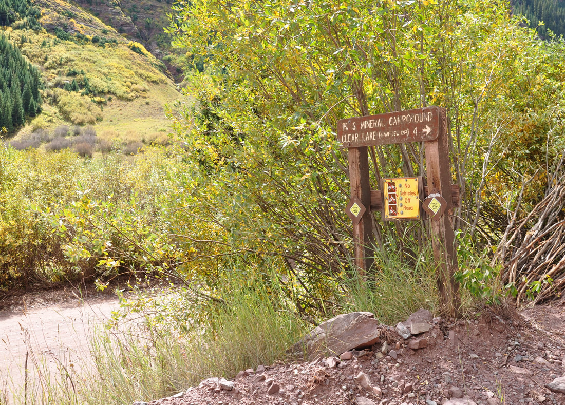
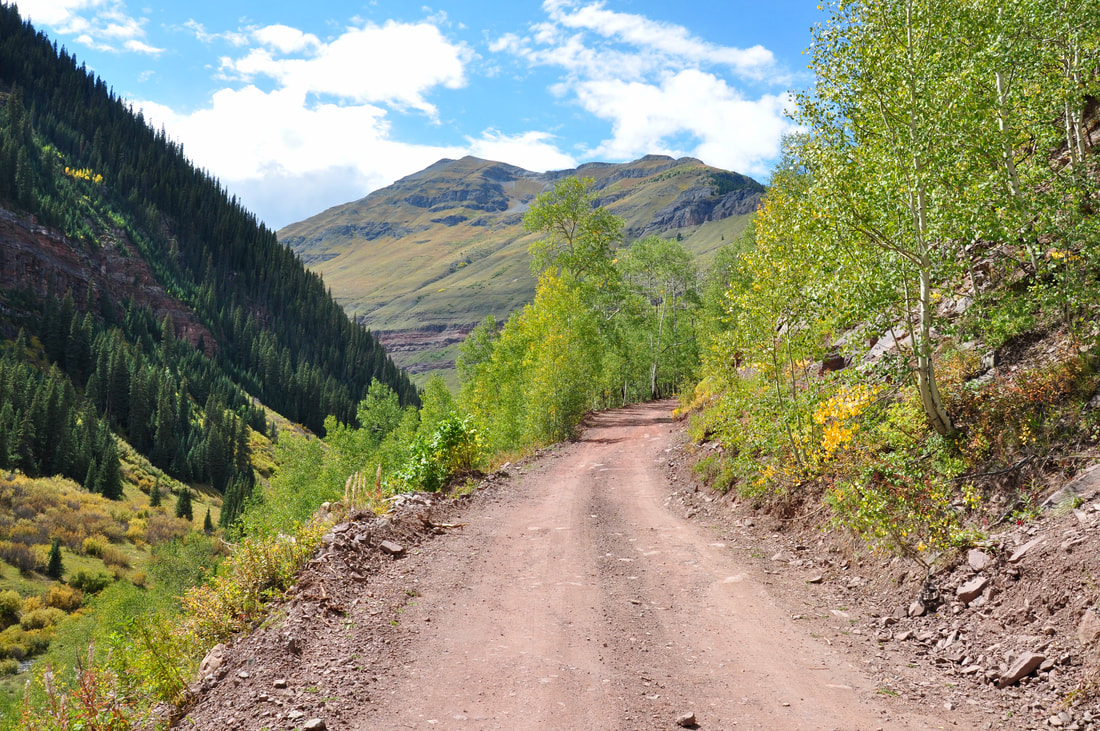
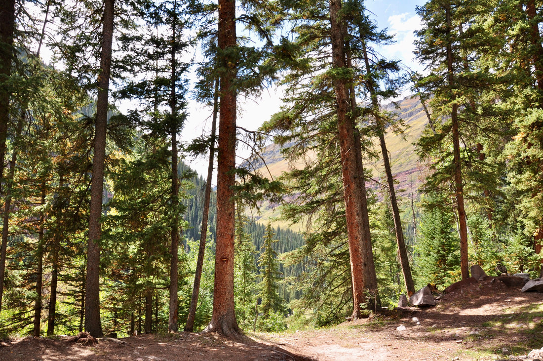
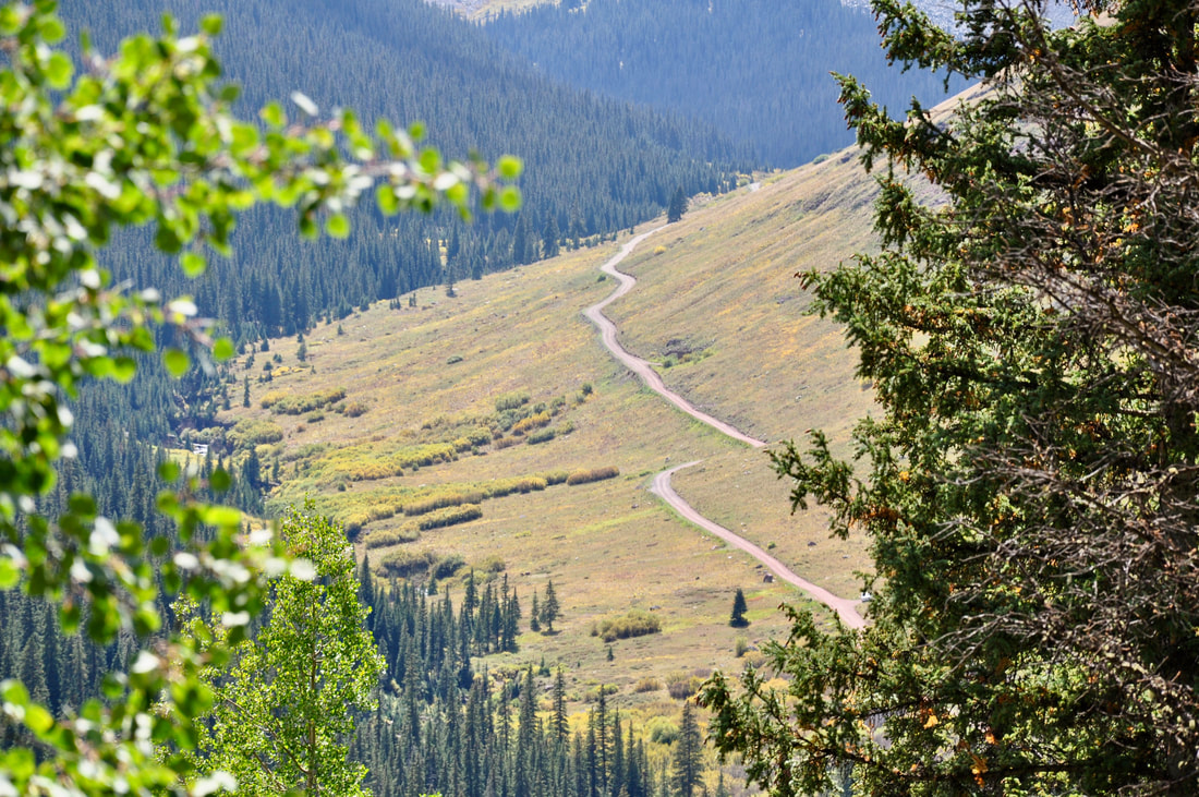
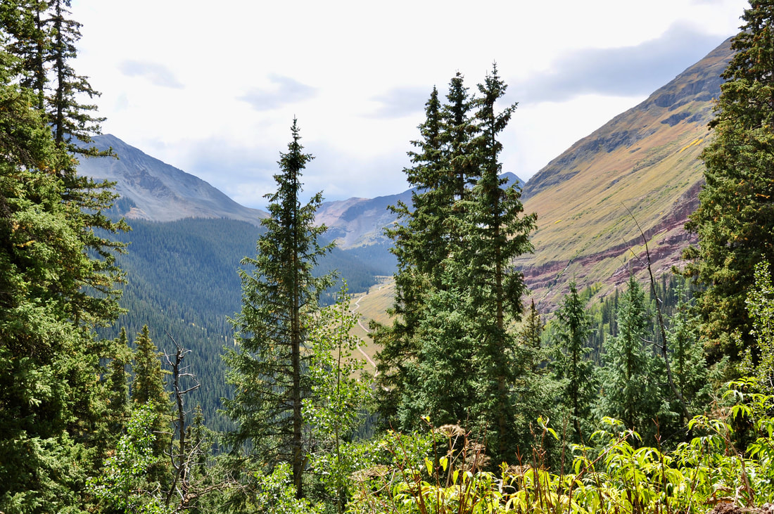
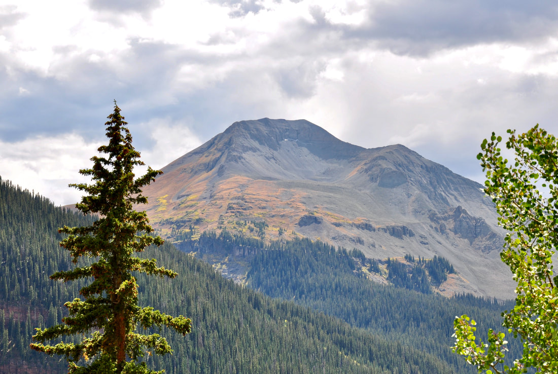
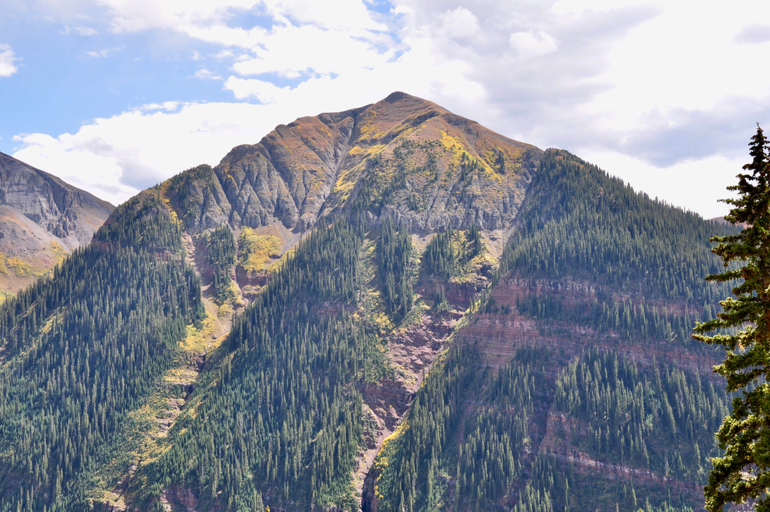
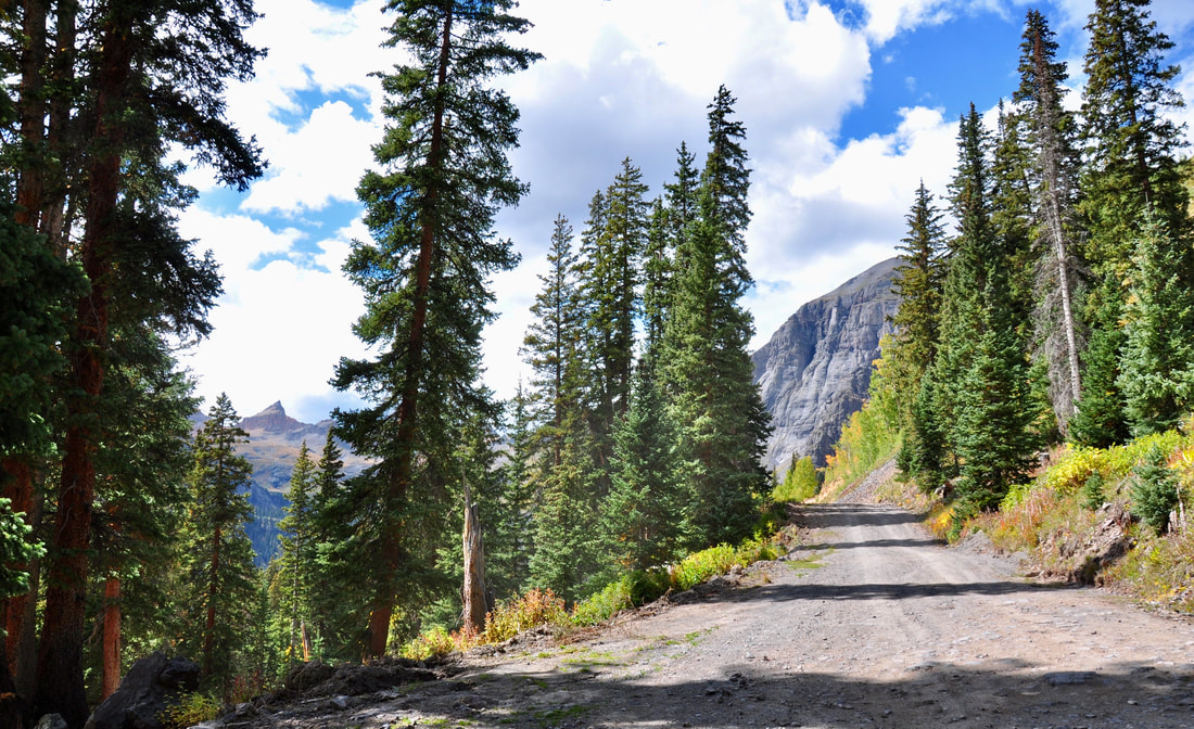
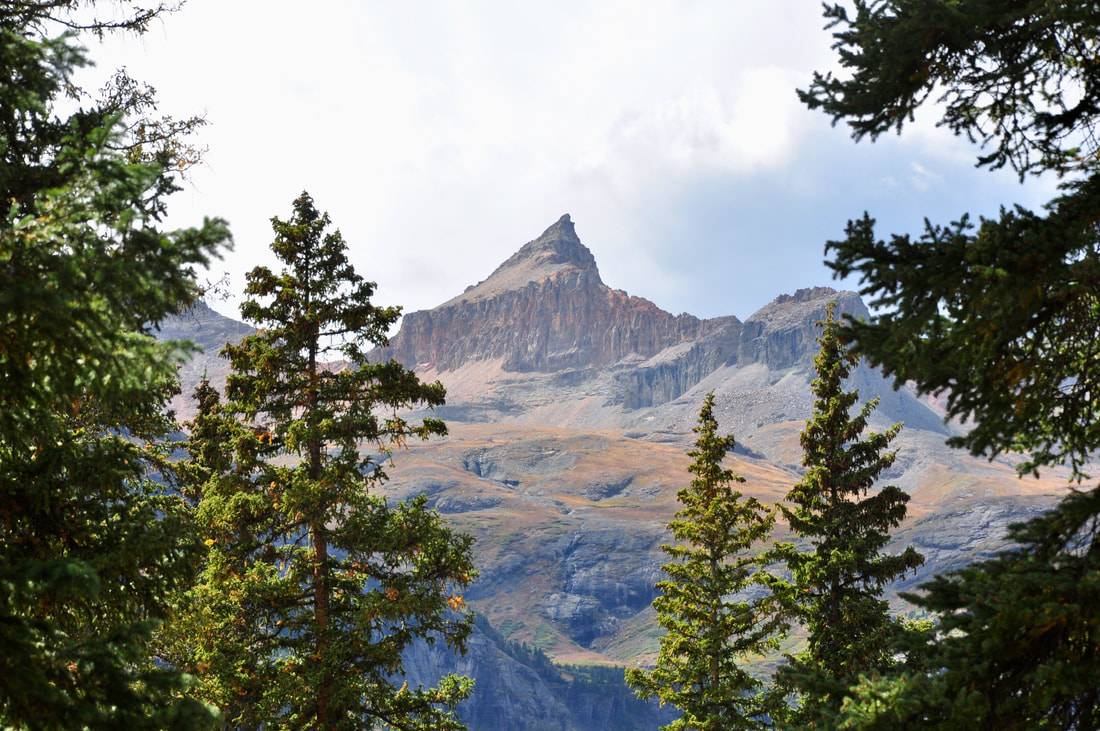
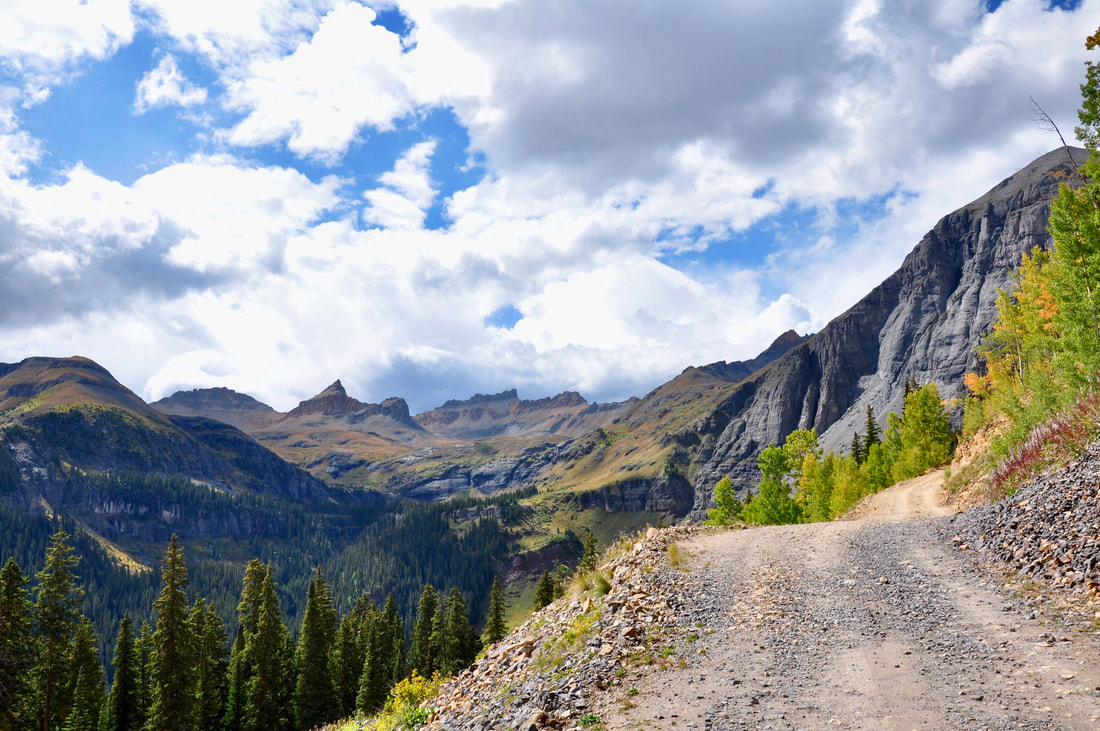
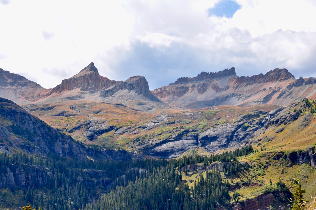
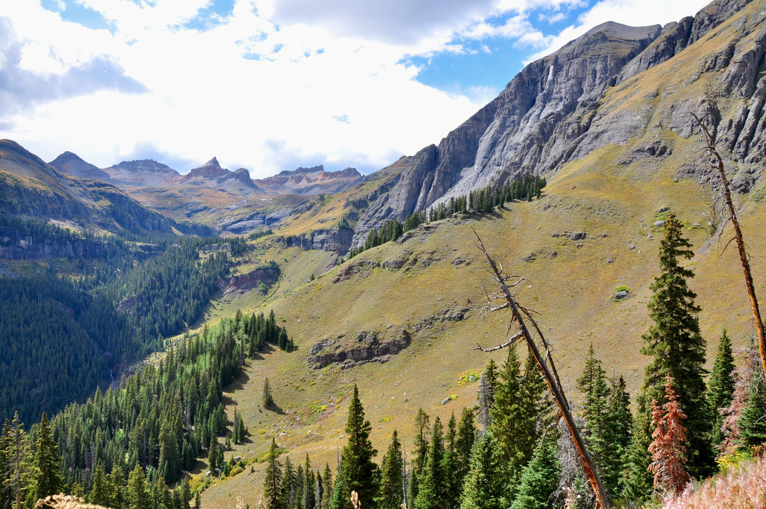
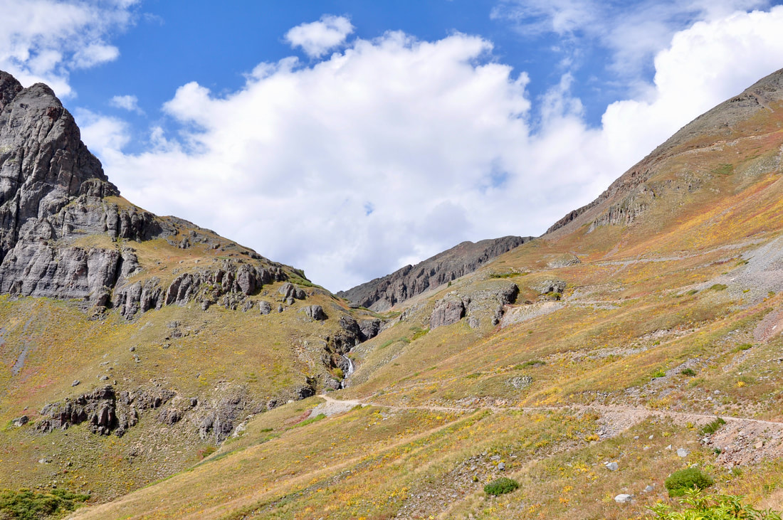
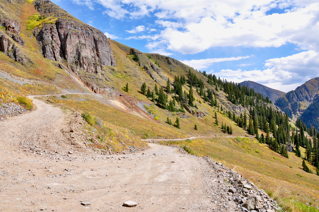
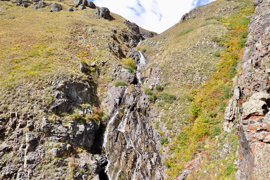
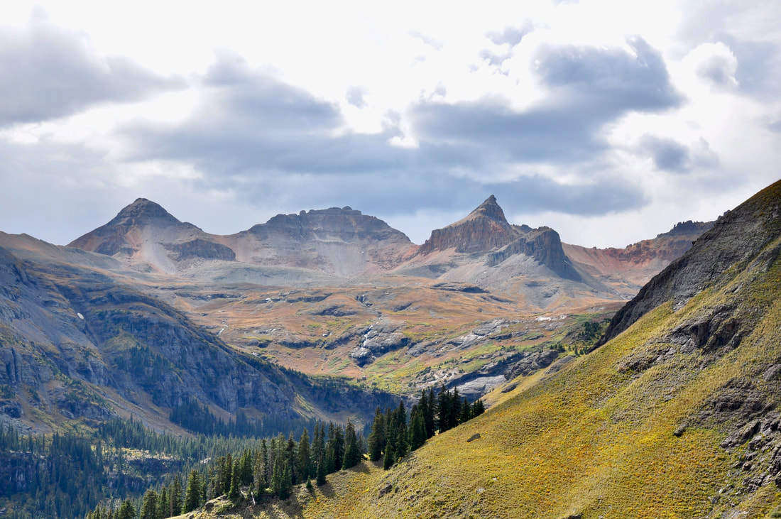
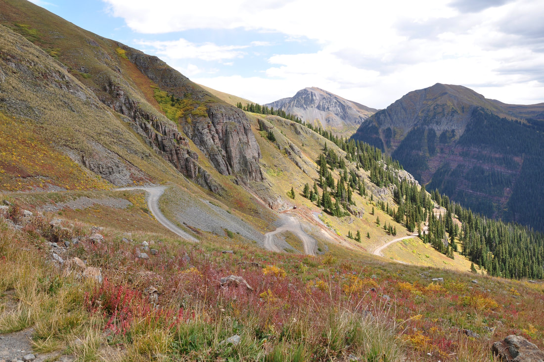
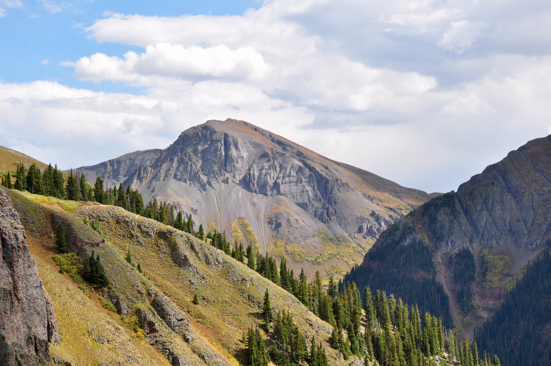
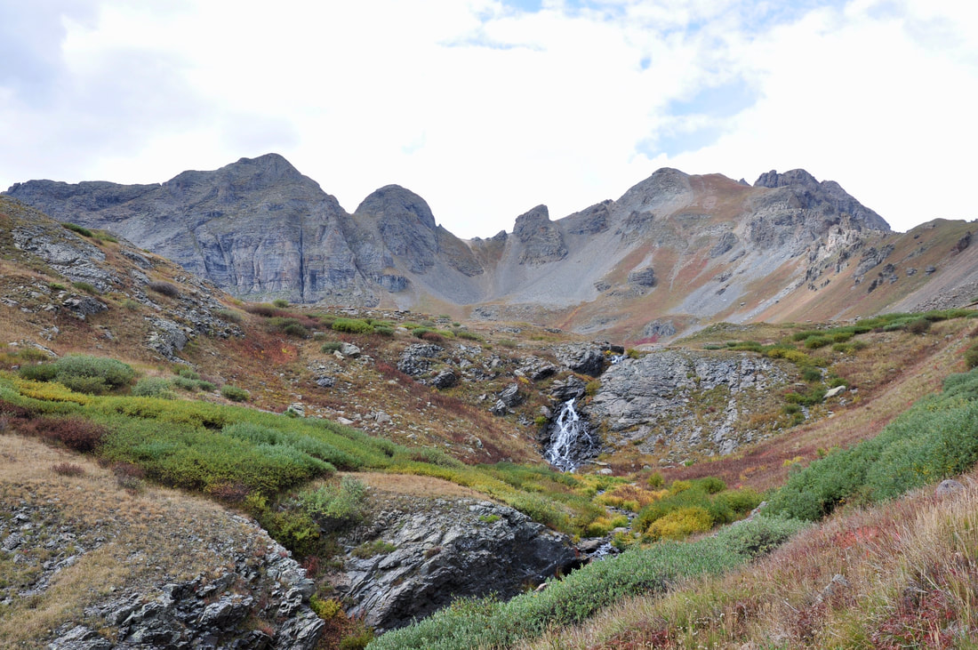
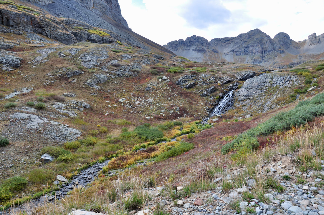
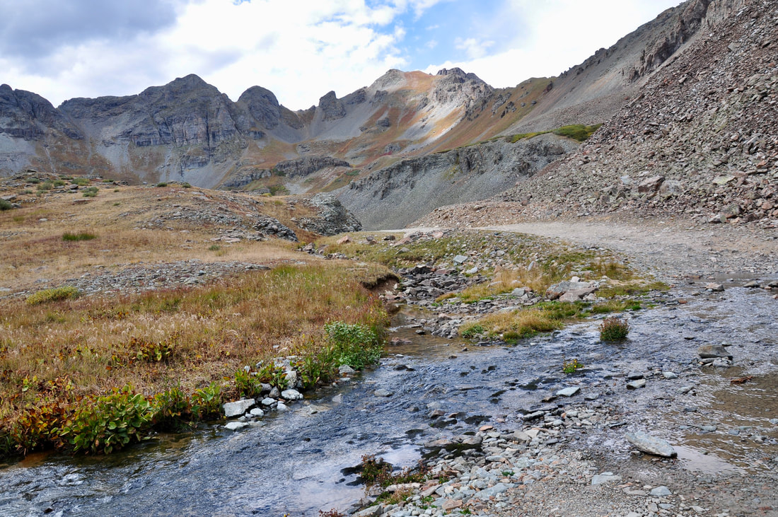
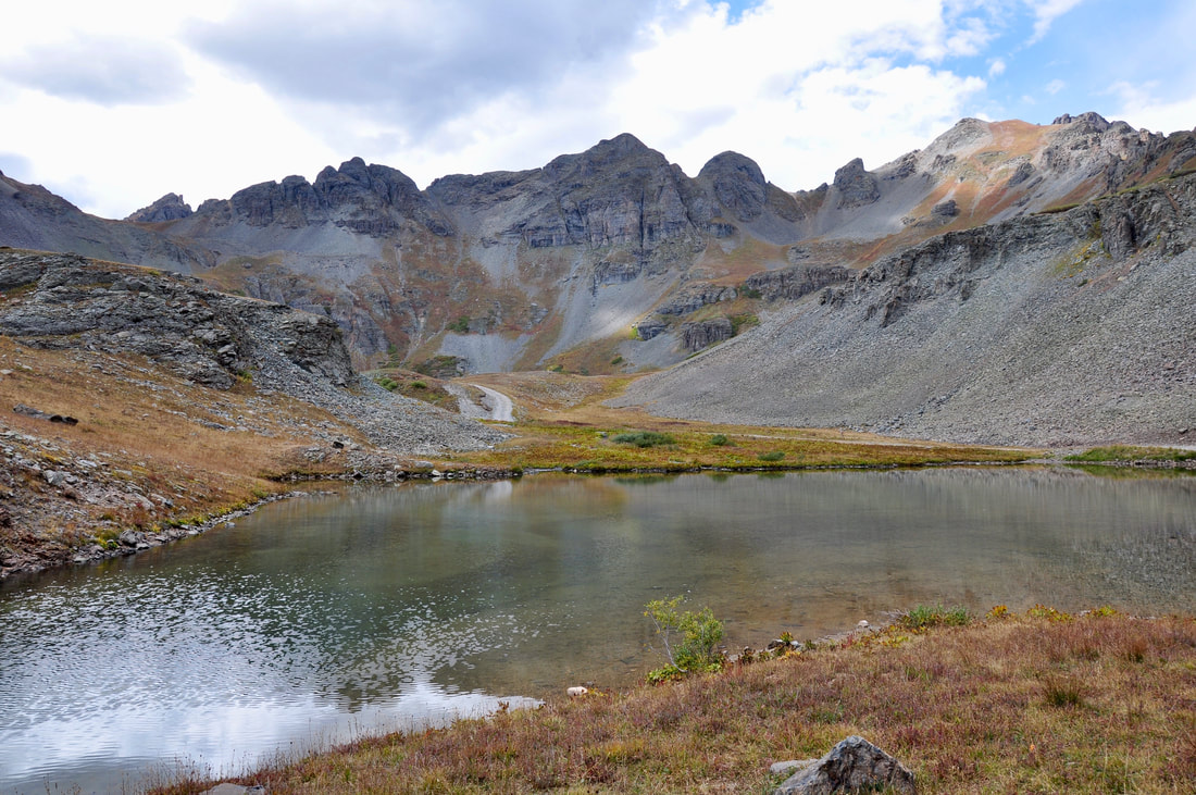
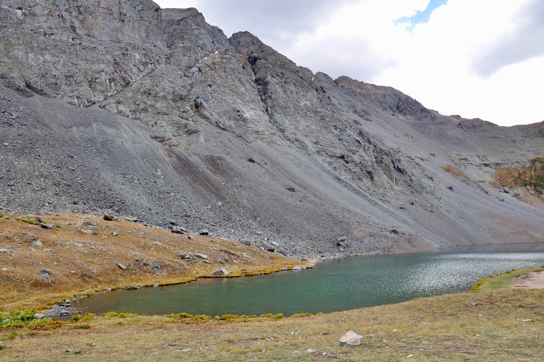
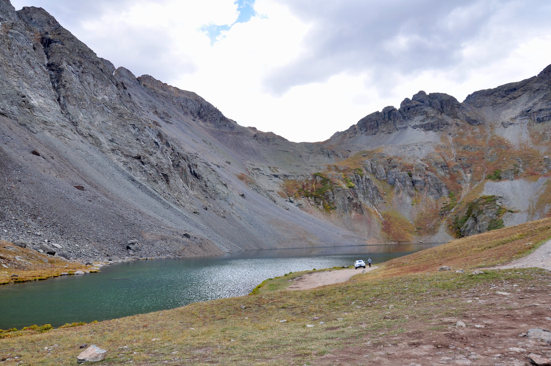
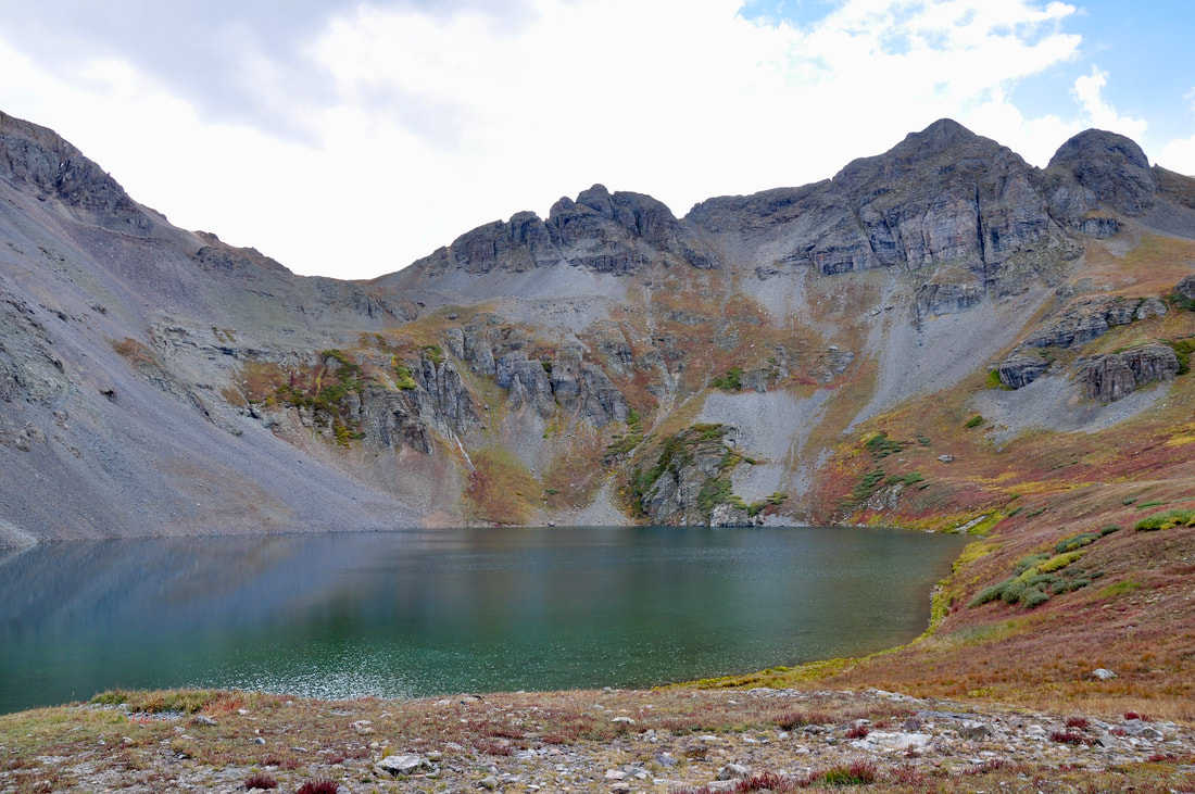
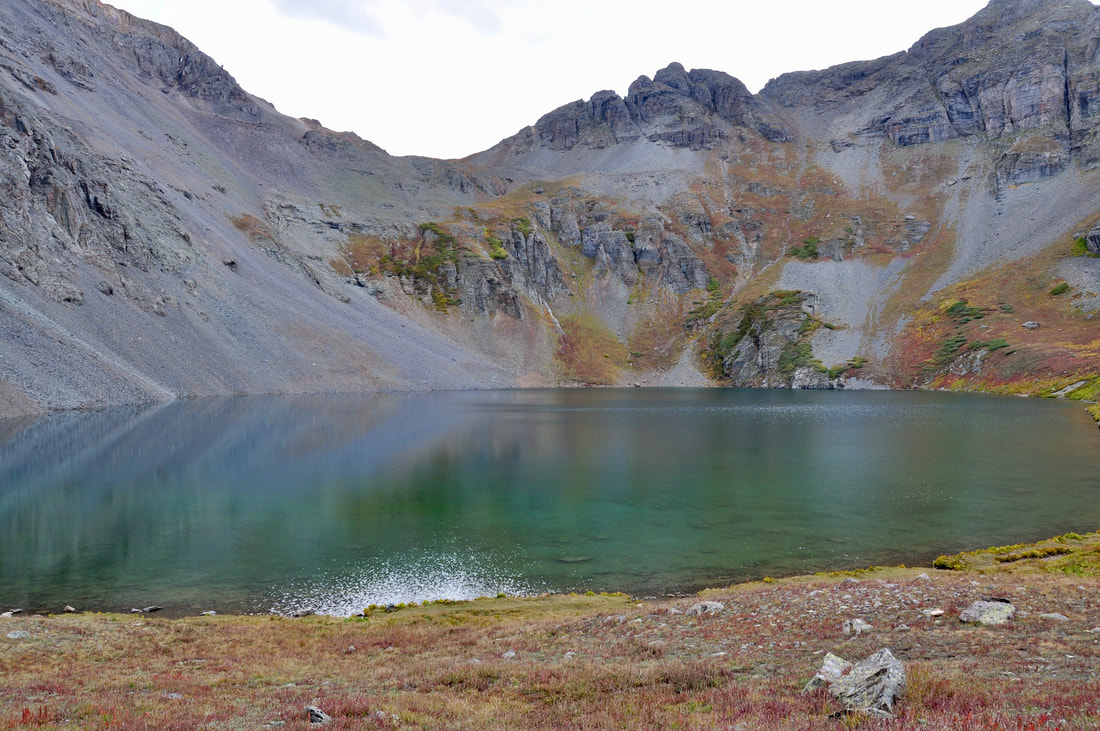

Driving the dirt roads way up in the mountains is a summer season tradition in the San Juan National Forest. Exactly when the high elevation dirt roads will be open depends upon the spring season snow melt. After a winter of drought the high elevation dirt roads may open in June, while a heavy winter snowpack may delay clearing the roads till sometime in early July. Either way, it takes time to clear the avalanches, rockslides and fallen trees. It also takes time for the water crossings to subside to a manageable level. When planning a San Juan National Forest 4x4 adventure, it is best to check on the dirt road conditions before setting sail. The National Forest Website is the best resource and the local 4x4 rental shops have up to date information too. Silverton, Colorado definitely is the basecamp headquarters for 4x4 adventures in the San Juan National Forest. The world famous Alpine Loop 4x4 trail system starts here and there are plenty of rentals in town. There are also dozens of 4x4 trails along Highway 550 near Silverton that are well worth checking out and the Clear Lake Jeep Trail by far is one of the best! About a mile or so north of Silverton on Highway 550, the Mineral Creek Campground sign is the one to look for. The name of the dirt road is County Road 7 or National Forest Road 585, depending on the map used. This dirt road goes down into a valley and continues to the South Mineral Creek Campground. About 3.7 miles down this road is where Clear Lake Road (NF Road 815) can be found. The signage may not be easy to spot because of vegetation, so be sure to keep an eye out when cruising along. After getting on Clear Lake Road, a map will not be needed because this is the only road that goes way up to the top of the mountains where Clear Lake is located. The Clear Lake Jeep Trail is rated as easy by the AllTrails website, which is a reputable resource, so this is a great choice for beginners. This trail is 4.4 miles long, so the round trip will be about 9 miles. It is the ascent that makes this Jeep trail challenging, because Clear Lake is almost 12,000 feet above sea level. There are plenty of narrow hairpin switchbacks and there certainly are no guard rails. There may be a few shallow water crossings and there are some rough bare bedrock sections, but overall the Clear Lake Jeep Trail is nothing but a real pleasure to drive! A word of forewarning must be mention, because Clear Lake is so high up in the mountains. Being a mile high is rough on some people and being over two miles high certainly can pose health risks, so it is best to take it easy when adjusting to the high elevations. Getting dizzy on a narrow dirt road with slopes that go nearly straight down can lead to a dangerous situation. A rescue will likely be a very long wait, so visitors must be self reliant. Resting often to catch the breath, staying extra hydrated and occasionally snacking is the best way to prevent altitude sickness. Preventing altitude sickness is the key to having a safe Clear Lake venture. A higher than average ground clearance vehicle can do this trip, but a 4x4 is recommended. I have seen a few modern SUV passenger cars up at Clear Lake, so this trail is fairly easy on vehicles. A 4x4 will make the drive safer, especially if the conditions are wet and muddy. The slopes are very steep in the mountainside section and the dirt road is narrow, so be prepared for a tight squeeze if there is oncoming traffic. The rule for oncoming traffic is the vehicle going uphill has the right of way and the vehicle going downhill must stop and make room. Knowing this will prevent some awkward moments. Clear Lake Road first goes through a deep pine forest and there are a few cozy spots along the way for a picnic under the shade trees. As the pine forest gives way to conifers in the Alpine elevation, the mountain peaks become easier to see and the views are nothing less than majestic! This part of the San Juan Mountains is as picturesque as can be and the views just keep getting better further uphill. When heading to Clear Lake on the final few switchback sections above the tree line, there will be stunning views of Beattie Peak, Golden Horn and Ulysses S Grant Peak. Mineral Creek can be seen way down below and there are several picturesque waterfalls near Clear Lake. Needless to say, be sure to bring a good camera along for the ride! After passing the waterfalls, the final section of road goes up and over the rim of the Clear Lake basin into a meadow with a small pond. This is a grassy green area and there are usually a few marmots waiting to greet visitors. This spot is where the turquoise color Clear Lake comes into view and the small pond also presents a great photo opportunity. The narrow Clear Lake basin is surrounded by mountain peaks, so the water is shielded from wind. The water in the pond looks like glass on any given day, so this is a great spot to play around with creating a water reflection photo! Clear Lake looks great from the high vantage point too. At 12,000 feet up, the water is too cold for swimming even in July, but most people go to Clear Lake just for the views. This is a cozy spot for an afternoon cookout and there are a few stone fire rings along the shoreline. Climbing the slopes to get a better view of the lake is rewarding and drone photographers will simply love this place. Clear Lake is a great place to skip rocks across the water, so just plan on sticking around for a while!
0 Comments
Your comment will be posted after it is approved.
Leave a Reply. |
Leave no trace!
New!
Destination West YouTube channel! https://www.youtube.com/@DestinationWestOrg *The Destination West website upgrading project is well underway. Unique YouTube slideshows are replacing the outdated Flickr photo galleries. The new videos feature modern graphics and alternative music instrumentals that enhance the viewing experience. Some articles are being condensed, while others are getting much needed edits. As everybody knows, the bulk of the original articles and photos were published on the fly during the Covid camping venture and there were limitations. Upgrading is the way to go and more articles will receive a makeover each week until this project is completed. After that, I will be able to gather new material. There is light at the end of the tunnel!
JD Lane Archives
July 2024
|
