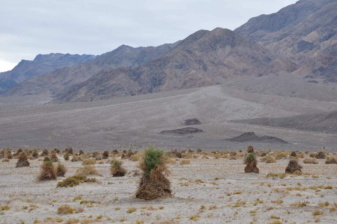
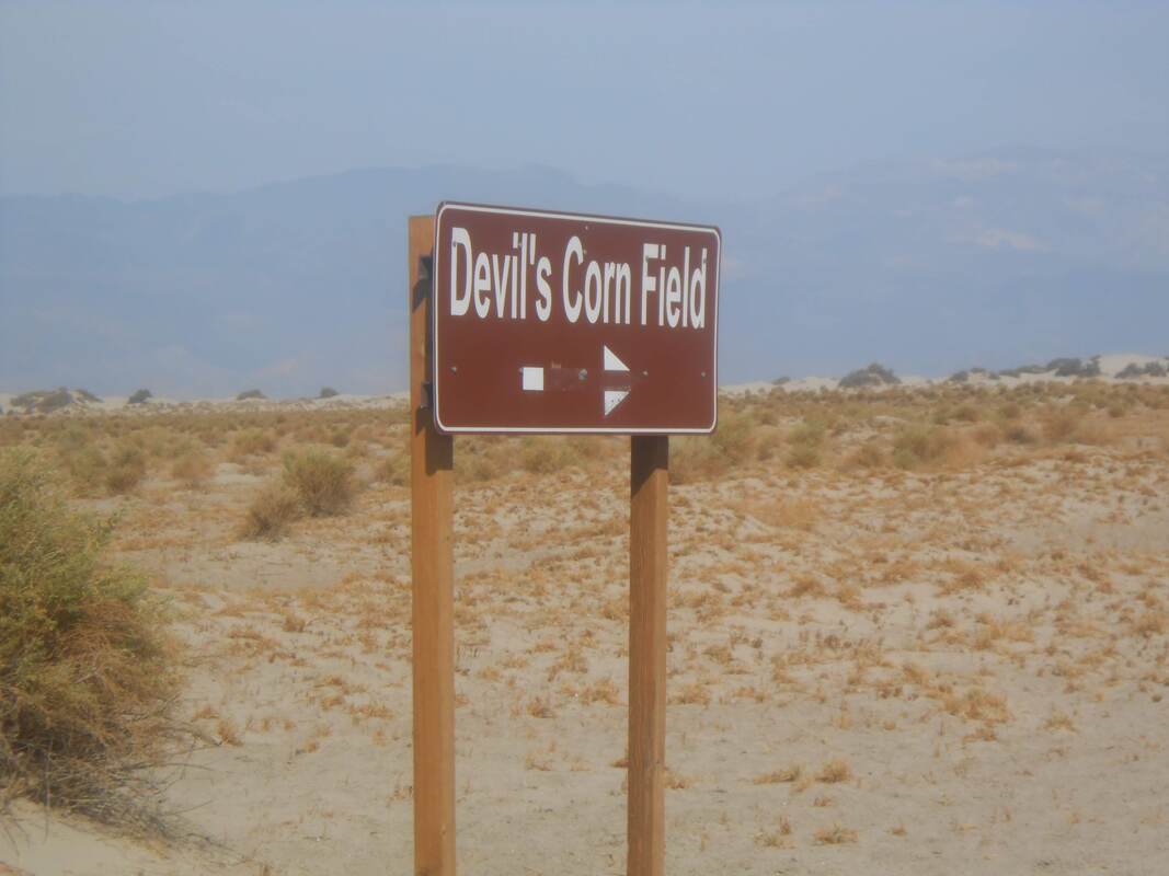
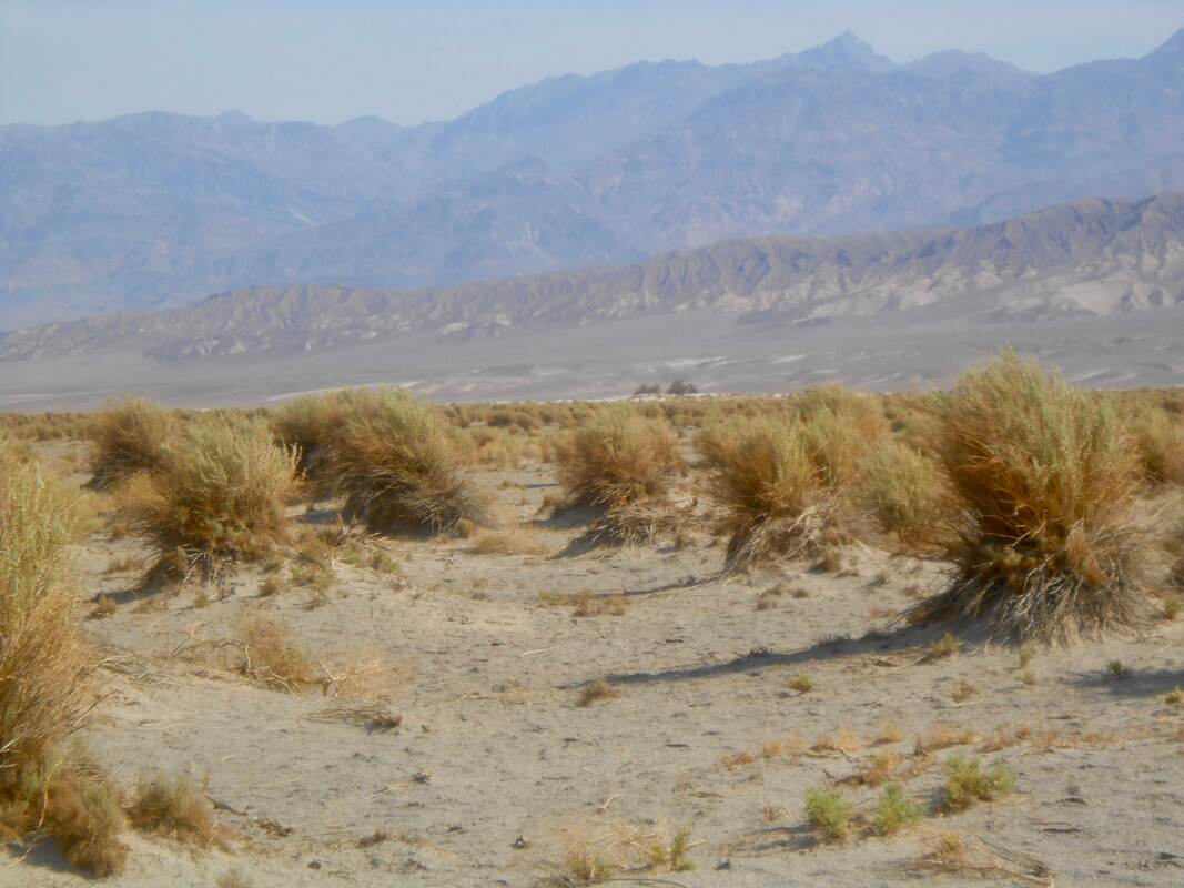
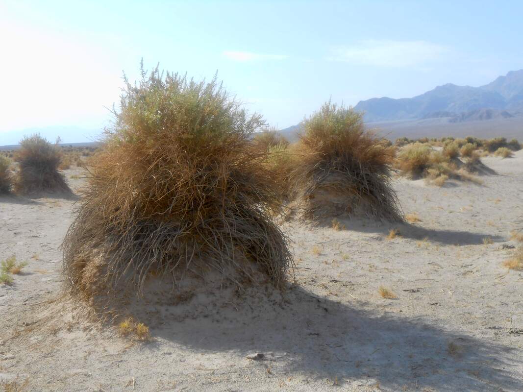
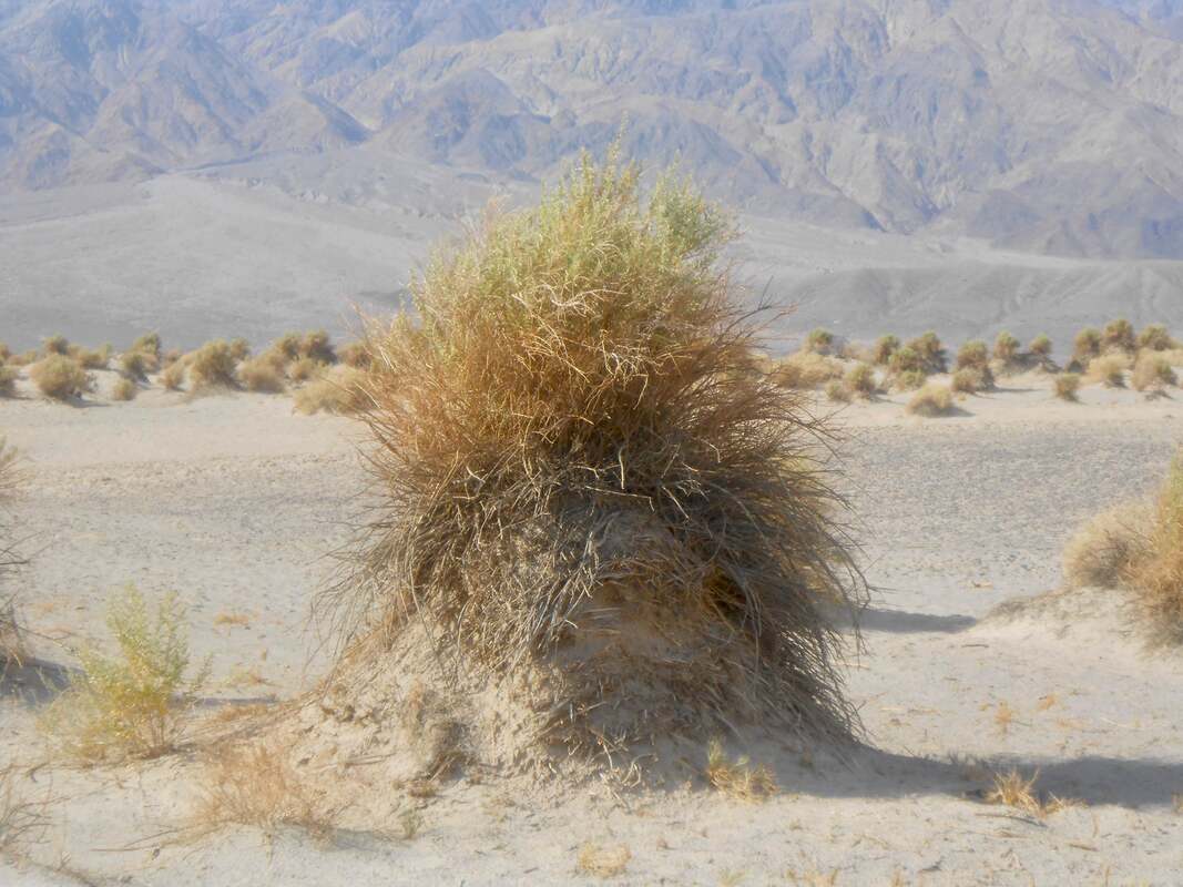
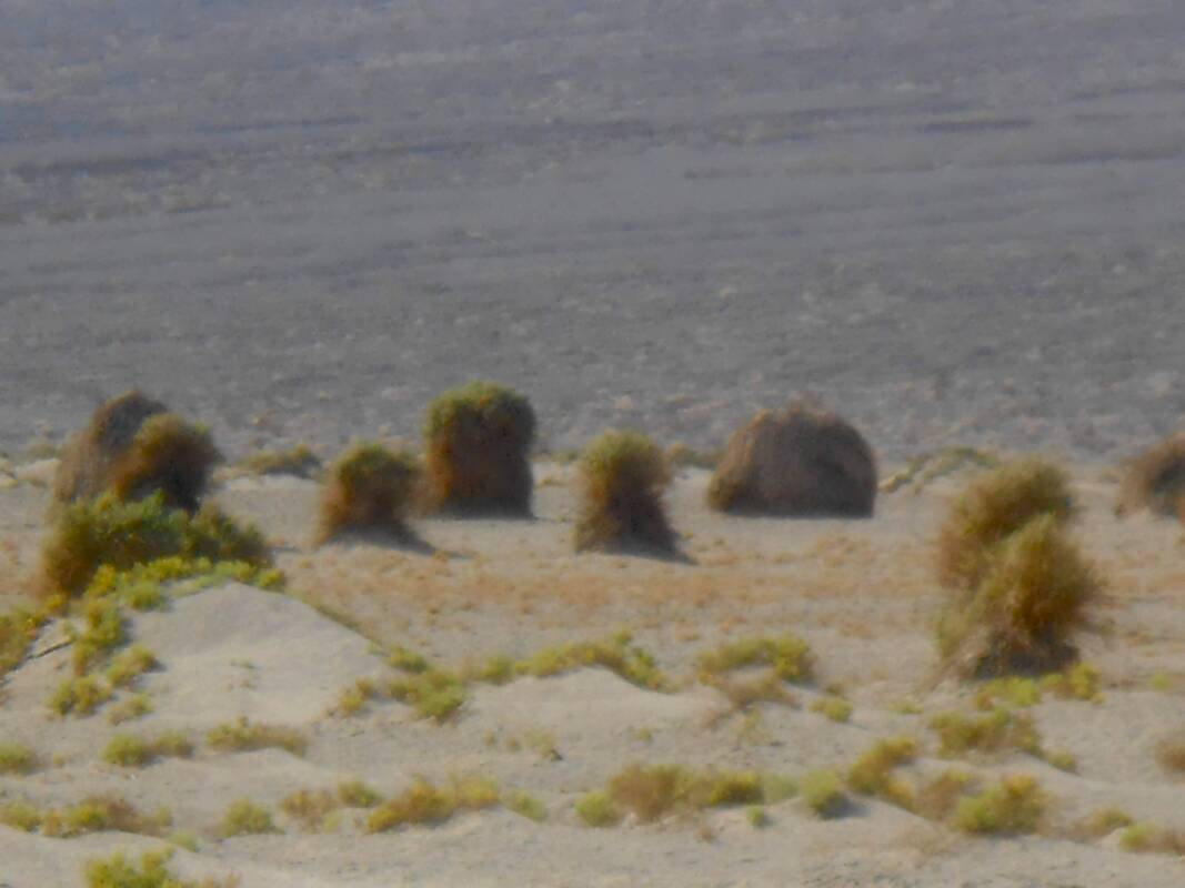
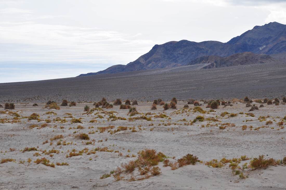
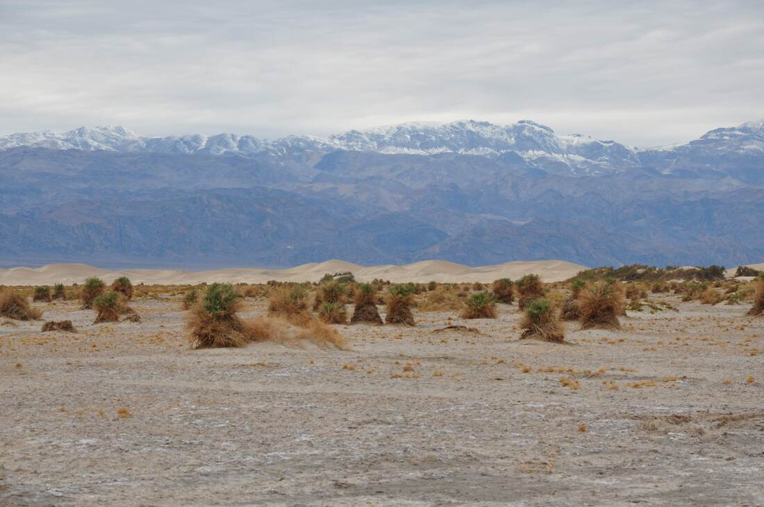
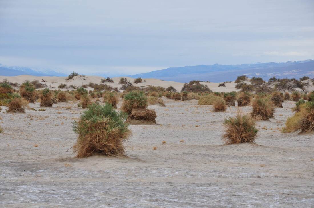
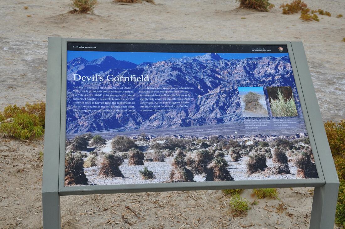
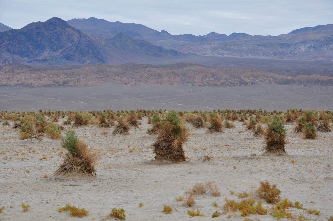
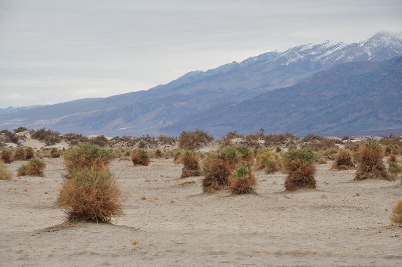
Death Valley National Park covers a vast amount of land in the Mojave Desert along the California-Nevada border. Death Valley is the largest National Park in the lower 48 states, so it goes without saying that a visitor can spend several weeks exploring this majestic place. Near Stovepipe Wells there are four interesting landmark features of Death Valley that are close by. Salt Creek, Mosaic Canyon, Mesquite Dunes and the Devil’s Cornfield are located next door to the resort and they can all be experienced in one day! The Death Valley National Park terrain offers a wide variety of extremes that are difficult for an outsider to fathom. The tallest mountain and the lowest basin in the lower 48 states are both located in this region. Death Valley is the hottest place on earth, yet during the winter months it can be freezing cold with snow capped mountain views. Water is scarce and the wildlife hides from view because of the extreme heat, while relief from high temperatures does not happen till well after midnight. There are towering cliffs, steep canyons, salt flats, badlands and old volcanic cinder cones. There is rarely a drop of rain that falls in this desolate place, yet flash floods that can move gigantic boulders are always a threat. The Death Valley region is so inhospitable, that the pioneers of the old west cursed this section of Mojave Desert as being only suitable for the Devil himself. It is no coincidence that the Devil name describes nearly every feature of this harsh landscape. The Funeral Mountains, Badwater Basin, Devil’s Golf Course, Devil’s Race Track, Dante’s View, Hells Gate, Red Cathedral and Furnace Creek are just a few examples. Of course, Death Valley also hosts one of the most devilishly deceptive optical illusions on earth and this place is called the Devil’s Cornfield. The Devil’s Cornfield covers a vast area adjacent to Mesquite Dunes and Stovepipe Wells. From a distance it is easy to see how this place got its name. Try to imagine being a weary, hungry and thirsty pioneer crossing Death Valley in the days of the old wild west. The sun bears down and the summertime temperature is over 125ºF. The ground heat index is over 165ºF and when one looks in the distance, the heat waves rising from the sun scorched earth distort the view. Mirages can be seen everywhere when staring into the void. All of a sudden, the sight of bundled shocks of corn appear on the horizon. All is saved, because where there are shocks of corn, there surely must be food, water and civilization. The vast field of corn shocks lured many pioneers during the early days of westward expansion, but after arriving disappointment quickly set in. The illusion of corn shocks was nothing more than gigantic Arrow Weed clumps that stand high above the desert floor. It is easy to imagine a bible thumping pioneer exclaiming that this fiendishly deceptive illusion surely must be the work of the Devil himself way back in the day. This is how the Devil’s Corn Field got its name! One look at the photos and it will be easy to see why many pioneers were fooled by the Devil’s Cornfield when making the perilous journey through Death Valley. The clumps of Arroweed resemble tied vertical bundles of oats, wheat or barley and these grain crops were called corn in old English long before American Maize was discovered, so even the diction is correct. During a moonlit night the Devil’s Cornfield is even more ominous, because the clumps of Arroweed seem to come alive and move around on their own. Corn Shocks are associated with Halloween and this adds to the creepy effect. The Devil’s Cornfield is a fun place to wander around and take pictures. There are a few small roadside parking areas and these access points should be used, so the fragile vegetation is not damaged. Winter is the best time to visit the Devil’s Cornfield because there is no excessive heat. During summer the temperatures are hot enough to cause a pocket camera to malfunction, which happened in my case during my first visit. It took hours to make the captured images look like something other than a heat distorted blur, which is par for the course when processing photos of the hottest place on earth!
0 Comments
Your comment will be posted after it is approved.
Leave a Reply. |
Leave no trace!
New!
Destination West YouTube channel! https://www.youtube.com/@DestinationWestOrg *The Destination West website upgrading project is well underway. Unique YouTube slideshows are replacing the outdated Flickr photo galleries. The new videos feature modern graphics and alternative music instrumentals that enhance the viewing experience. Some articles are being condensed, while others are getting much needed edits. As everybody knows, the bulk of the original articles and photos were published on the fly during the Covid camping venture and there were limitations. Upgrading is the way to go and more articles will receive a makeover each week until this project is completed. After that, I will be able to gather new material. There is light at the end of the tunnel!
JD Lane Archives
July 2024
|
