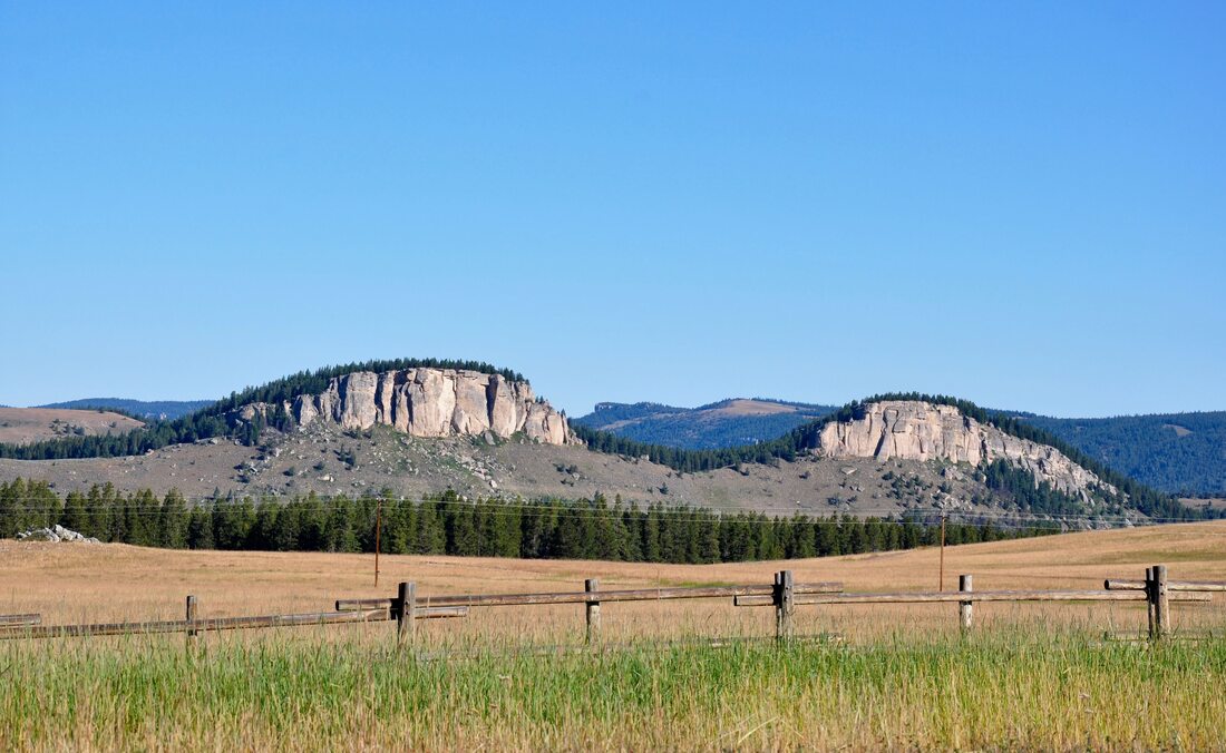
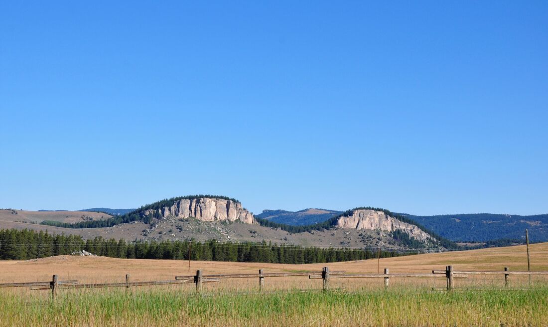
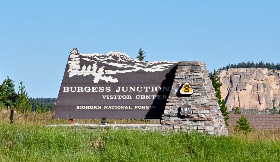
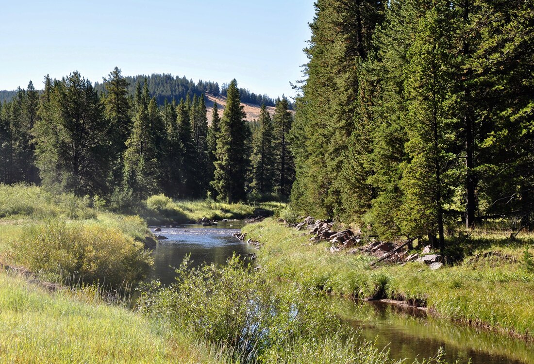
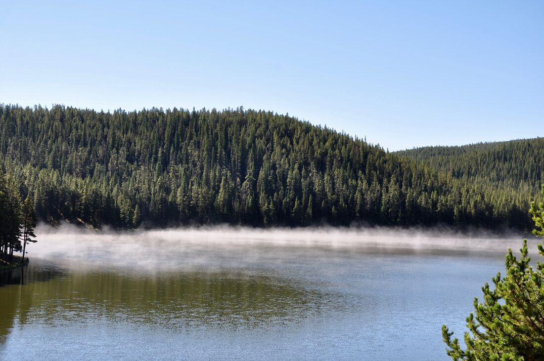
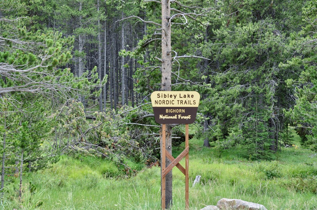
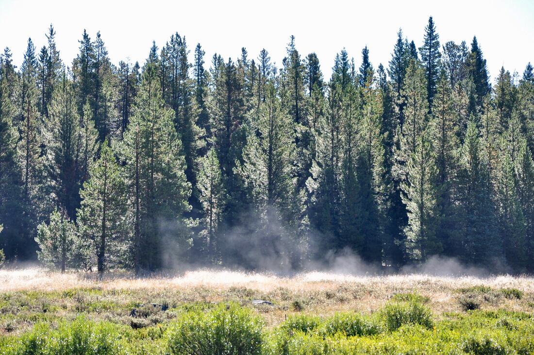
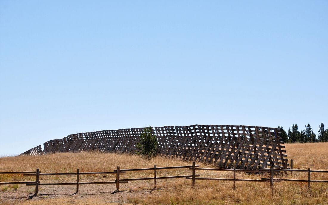
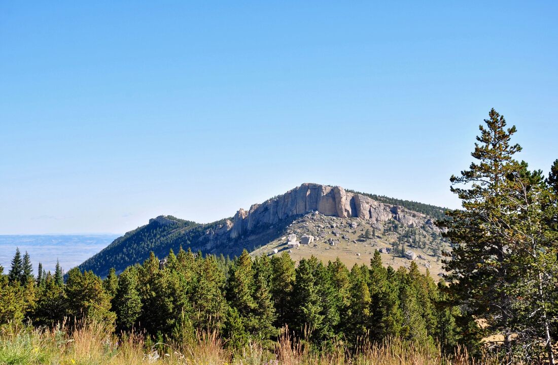
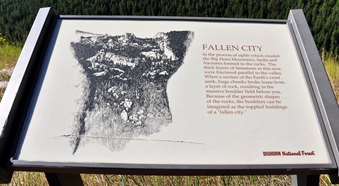
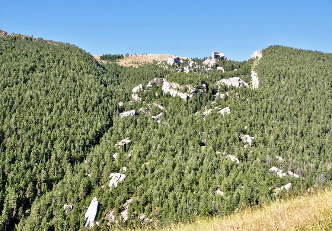
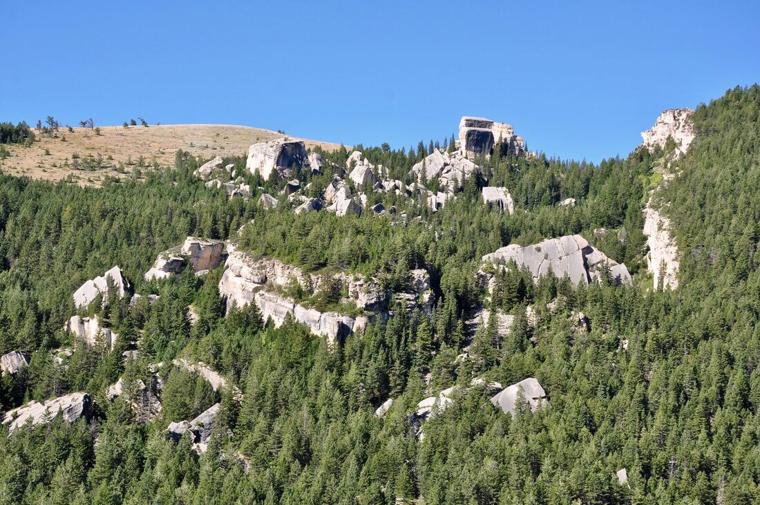
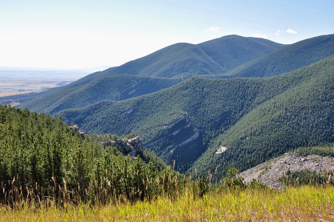
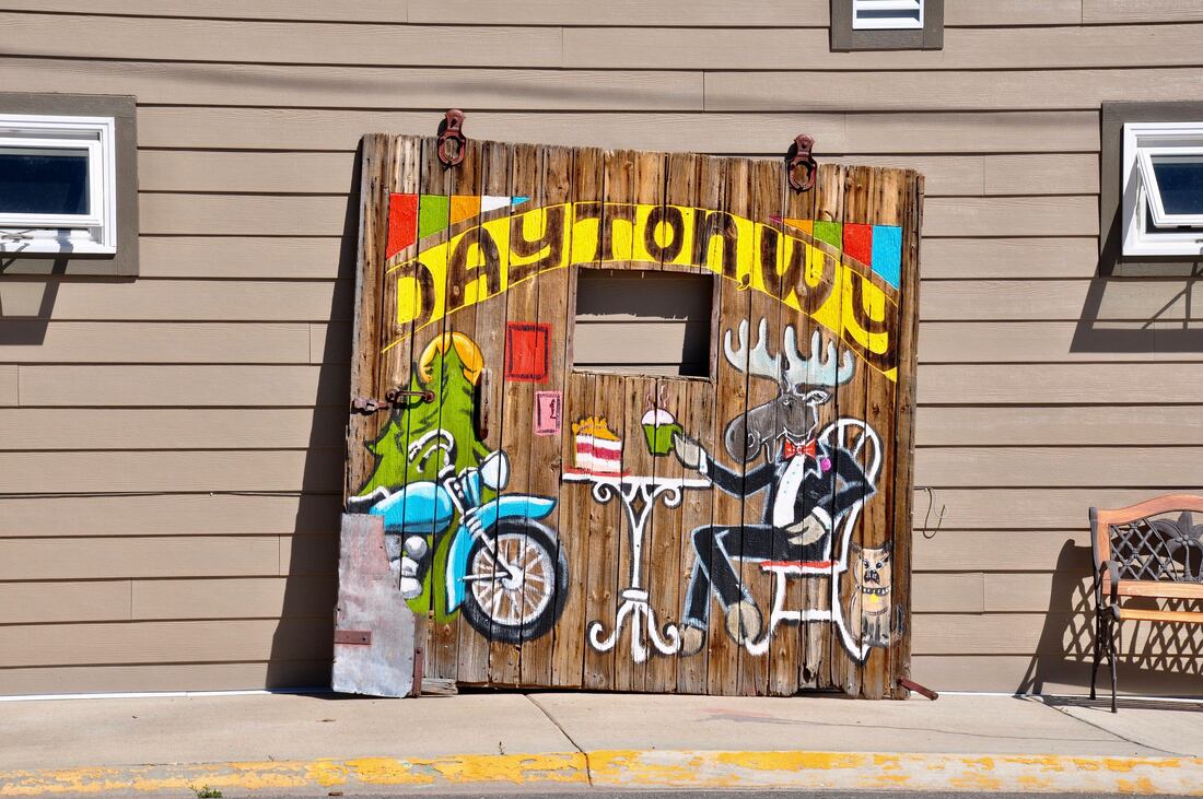
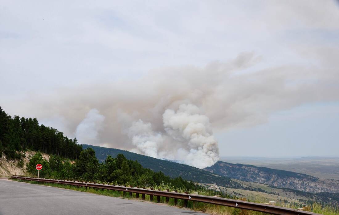
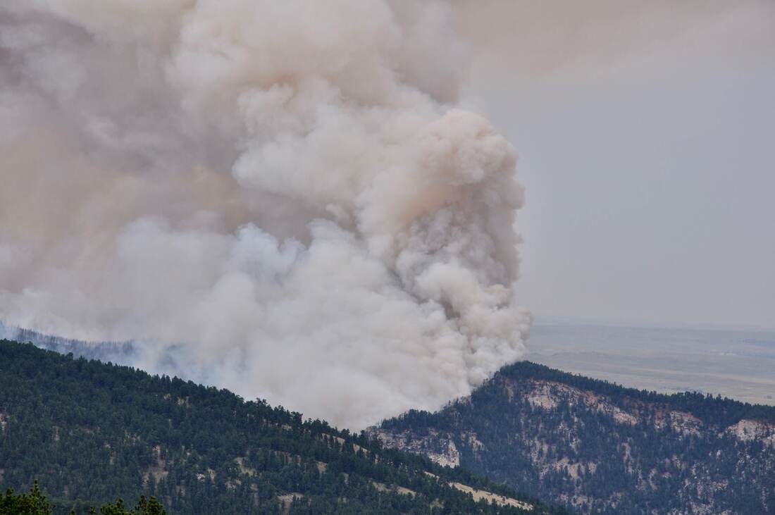
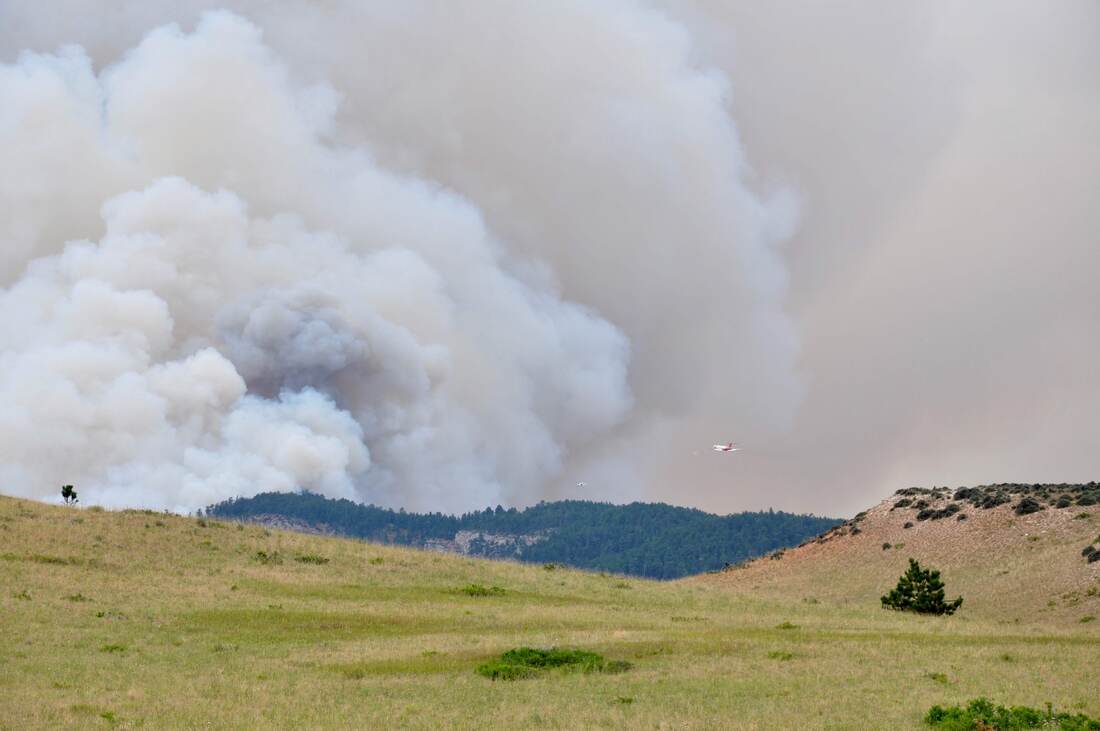
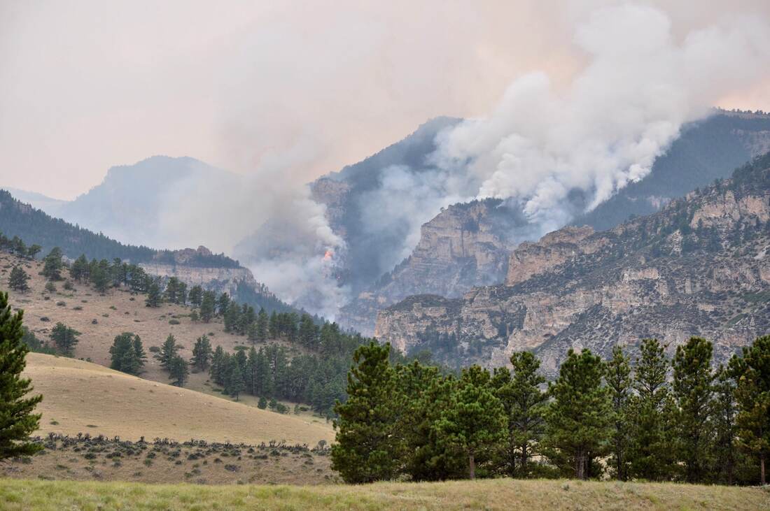
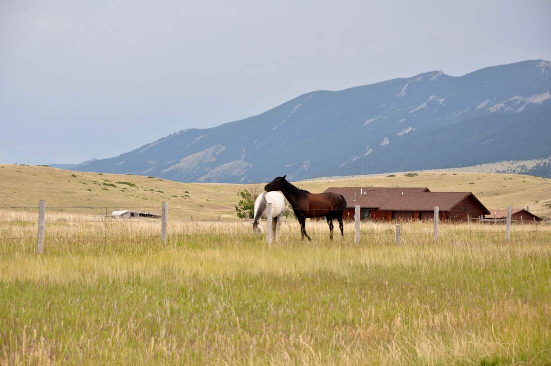

Burgess Junction is where all three U.S. Highway 14 travel routes meet in the north end of the Bighorn National Forest. Highway 14A West goes to Cody while Highway 14 South goes to Greybull. The third option is Highway 14 East to Dayton, Ranchester and Sheridan. Highway 14 East is the busiest tourism corridor, because this road connects with Interstate Highway 90 near Sheridan. Sheridan is a gateway town that offers modern amenities, super stores, grocery stores and outdoor outfitters. Another reason why 14 East is so busy is because there are no reliable communication options anywhere in the Bighorn and Dayton is where a strong cel phone signal can be found. It can literally take two days to load one single web page when using the antique internet access at the lodges in the mountains and this is another reason why so many visitors do a trip downhill on Highway 14 East. Reliable high speed internet access can be found in the Ranchester or Sheridan Public Libraries, which is good to know if communications are necessary during a Bighorn venture. The downhill drive going east to Dayton on Highway 14 begins with views of open range cattle ranches and rolling mountain meadows, then one of the most famous landmarks in the west comes into view. The two towering gray rock outcrops that can be seen a few miles east of Burgess Junction are called Twin Peaks. The Twin Peaks Landmark is very photogenic, so be sure to bring a camera along for the ride! When doing this drive early in the day, there can be plenty of ground fog in the high elevation mountain meadows, which is a dramatic effect to see. Burgess Junction is over 8,000 feet up, so the ice cold morning air condenses moisture over the ground. Views of ground fog rolling over Sibley Lake in the morning are definitely worth pulling off the highway to see. The evergreens are thick and the mountain slopes are steep as Highway 14 starts to go downhill. There is plenty of wildlife along this stretch of road because water is nearby, so it pays to proceed with caution. Prune Creek parallels the road and just one look at this peaceful stream is enough to turn just about anybody into an avid fly fisherman! Sibley Lake offers some great fishing too, so grilled trout and eggs for breakfast by the campfire certainly is an option. As the easy going drive through thick forest comes to an end, Highway 14 East heads straight for the cliffs overlooking the valley. This section of road has steep grades and tight hairpin turns that are guaranteed to smoke the brakes. Like all roads coming down from the Bighorn Mountains, the hair raising drive down Highway 14 to Dayton is not for the faint hearted! Gearing down and stopping to let the brakes cool will be necessary, especially for RV land yacht drivers. Fortunately there are many scenic overlooks along Highway 14 East, so frequent stops can be made. Every scenic overlook offers something interesting to see and the views of the valley from the high vantage point are nothing less than spectacular. One of the scenic overlooks has a great view of the Fallen City rock formation. The Fallen City literally looks like megalithic buildings cascading down the side of the steep mountain slope. Finally the crazy ride on Highway 14 down the steep mountain flattens out in ranch territory at the bottom of the hill and this is where the outskirts of Dayton come into view. Dayton offers limited amenities, cabin lodges, a convenience store, an RV park and a few small shops. Hunting guides and outfitters can be found here too. Dayton is also where cel phone service is available, so do not be surprised to see dozens of cars parked on the side of the road full of Bighorn visitors frantically texting messages! Mid to late summer is the wildfire season in the Bighorn Mountains, so it is best to heed Smokey The Bear’s warnings. While I was working in the Bighorn National Forest, there was a big wildfire in a canyon on the way to Dayton. As can be seen in the photos, the smoke was thick and this wildfire was threatening to head up the mountain. Wildfires are a real danger during the summer season and they can cause road closures or evacuations, so it pays to keep up to date on the fire reports when making travel plans. A simple AM/FM Radio with a Weather Channel or Emergency Channel is the only reliable source of wildfire information in the Bighorn, so be sure to pack one of these antiques for the ride. Late summer is also when the Sturgis Motorcycle Rally takes place. Highway 14 through the Bighorn is a traditional Sturgis touring route, so by all means, keep an eye out for the two wheel machines while touring this part of the Cowboy State! While working in the Bighorn there were no good communication options. I got used to doing the hair raising downhill run on Highway 14 East to the public libraries and I averaged one or two trips per day. Basically, I wore out a set of performance tires on this road in one month, which is an indication of just how demanding the roads are in this region. As always, drive safe and be sure to watch out for the deer, elk and moose road hazards when rolling downhill on Highway 14 East!
0 Comments
Your comment will be posted after it is approved.
Leave a Reply. |
Leave no trace!
New!
Destination West YouTube channel! https://www.youtube.com/@DestinationWestOrg *The Destination West website upgrading project is well underway. Unique YouTube slideshows are replacing the outdated Flickr photo galleries. The new videos feature modern graphics and alternative music instrumentals that enhance the viewing experience. Some articles are being condensed, while others are getting much needed edits. As everybody knows, the bulk of the original articles and photos were published on the fly during the Covid camping venture and there were limitations. Upgrading is the way to go and more articles will receive a makeover each week until this project is completed. After that, I will be able to gather new material. There is light at the end of the tunnel!
JD Lane Archives
July 2024
|
