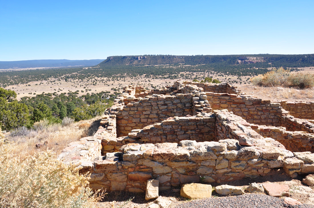
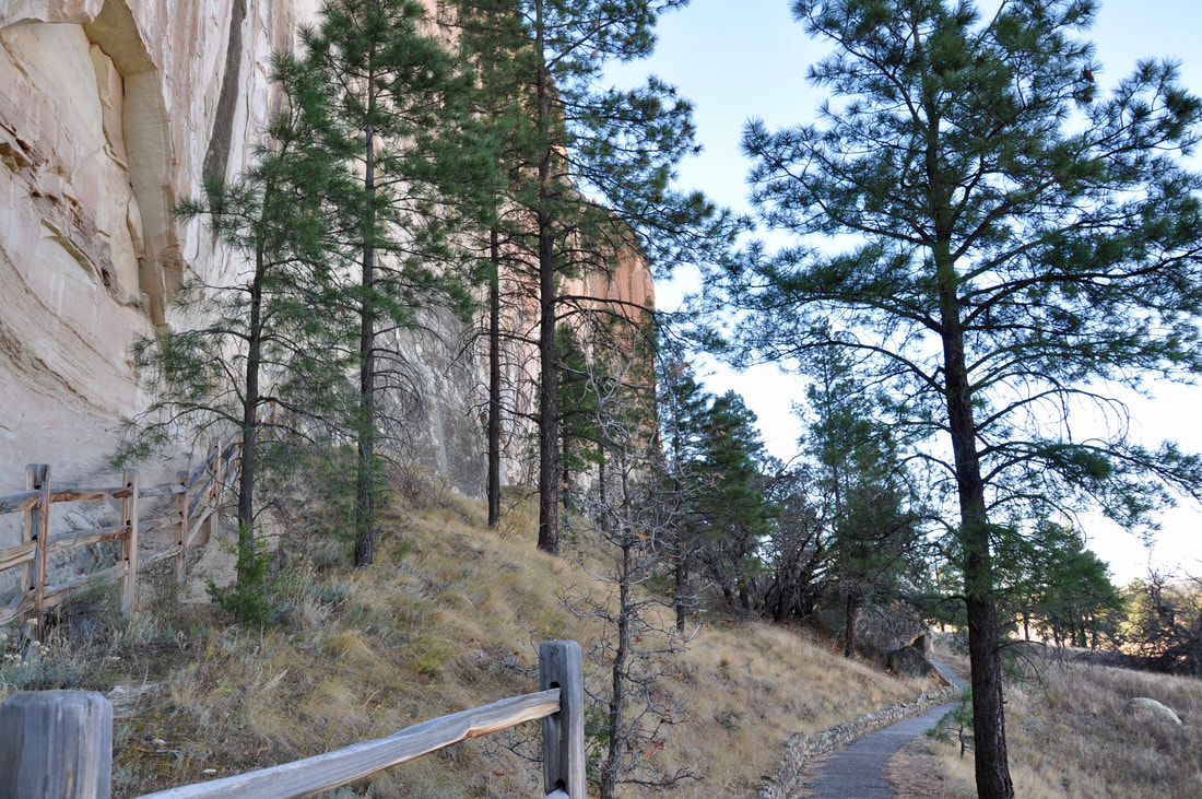
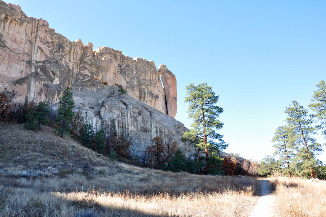
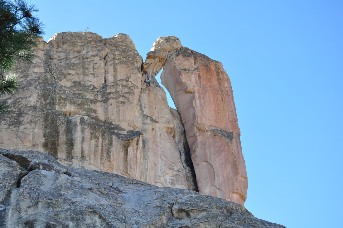
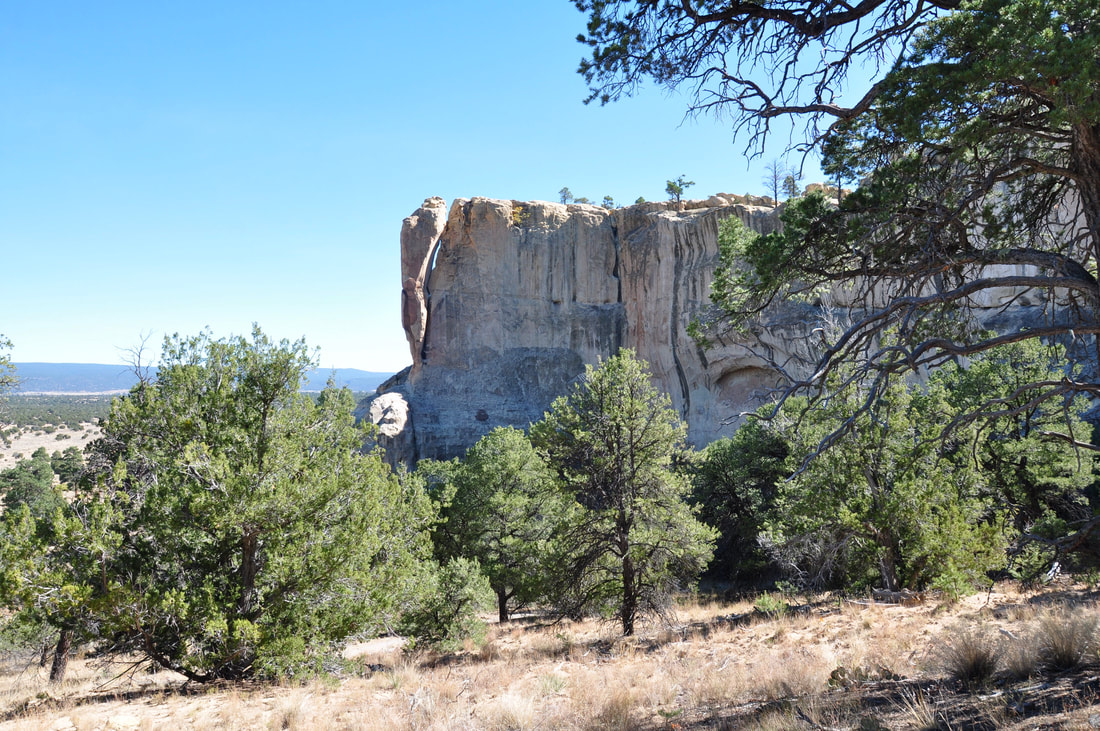
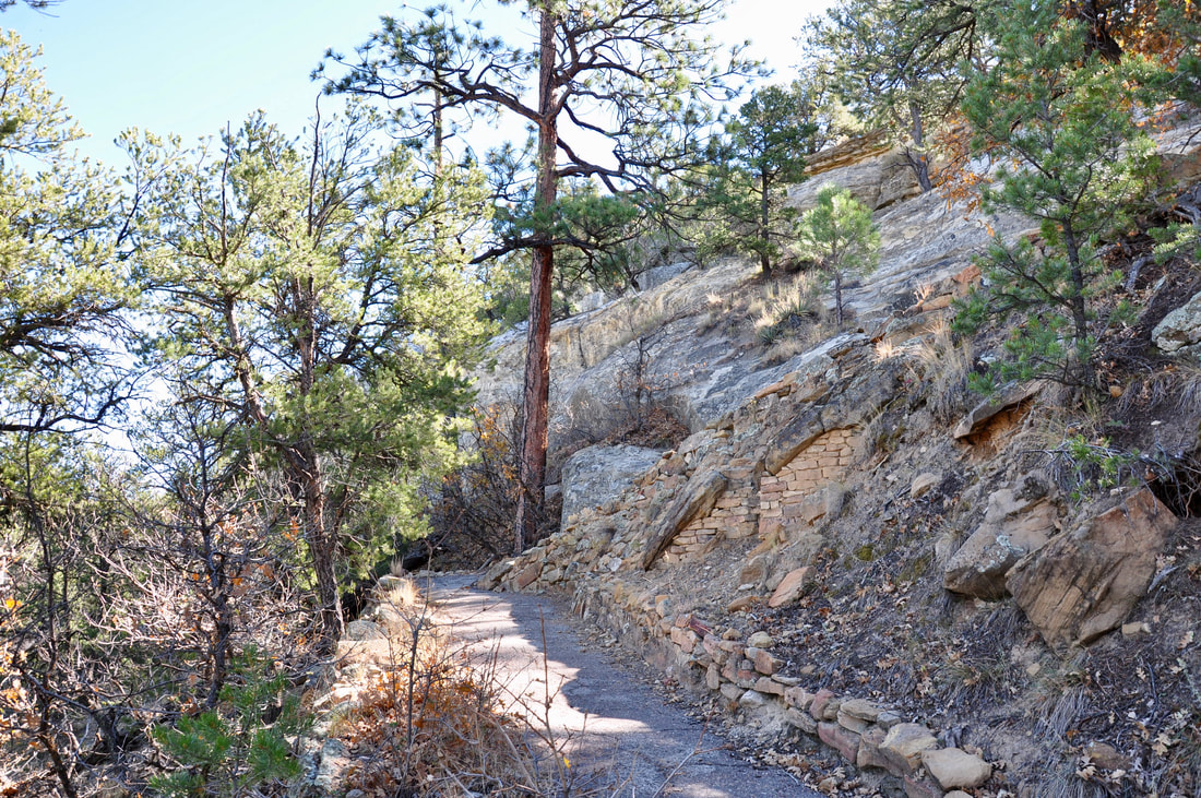
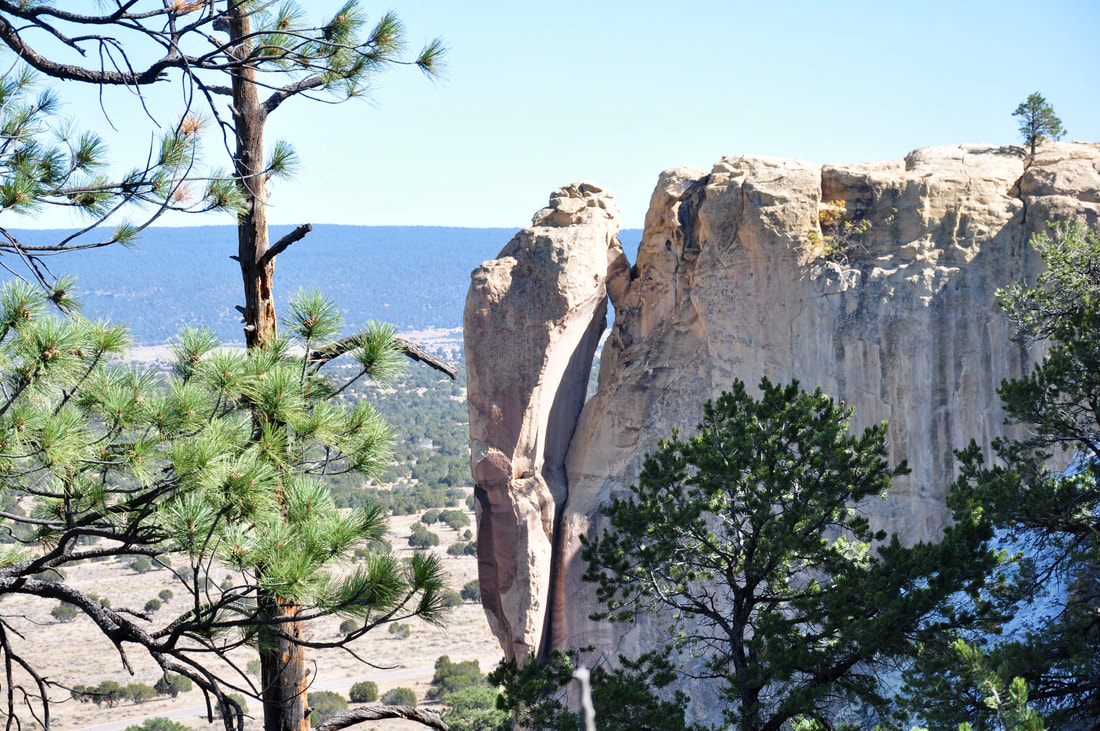
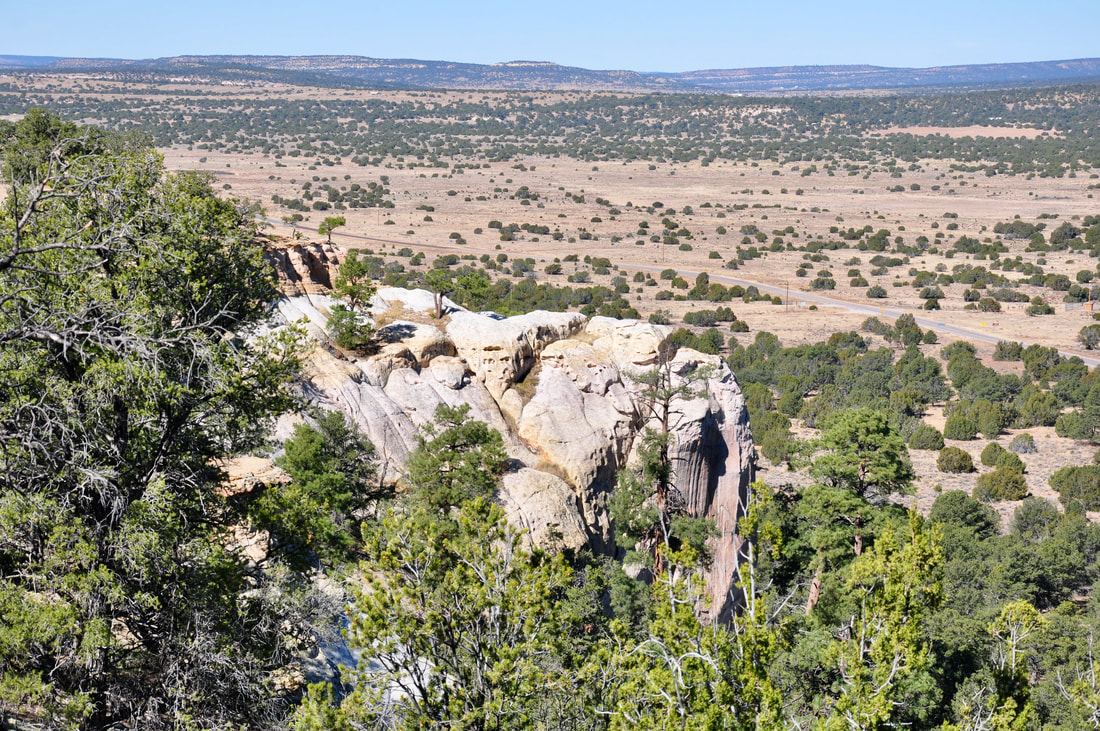
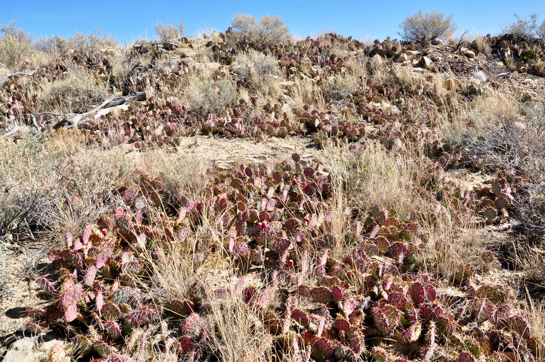
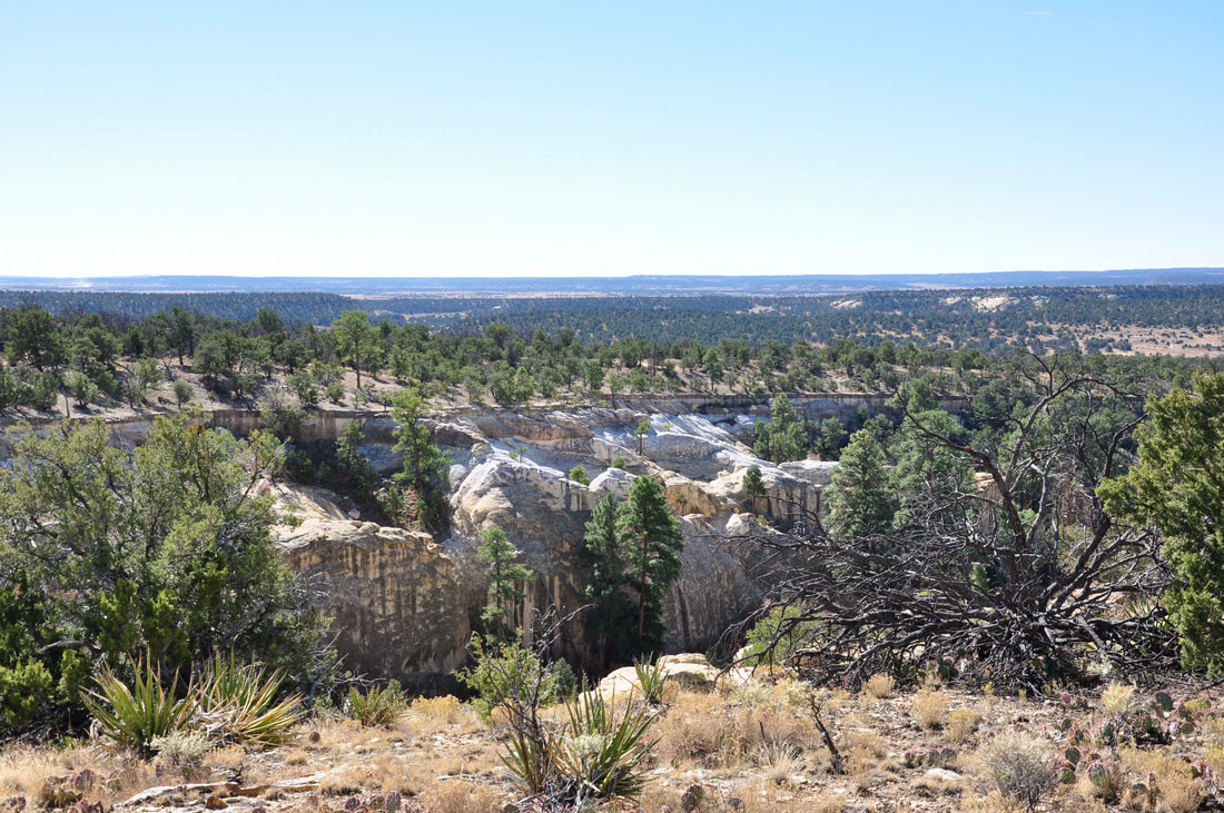
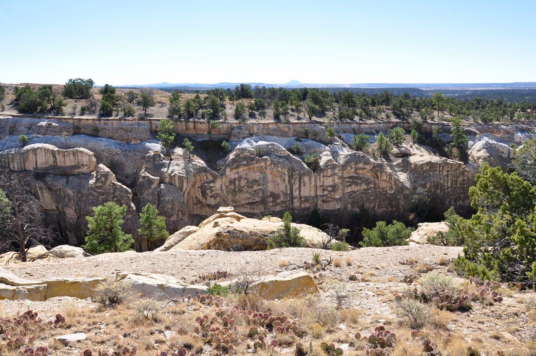
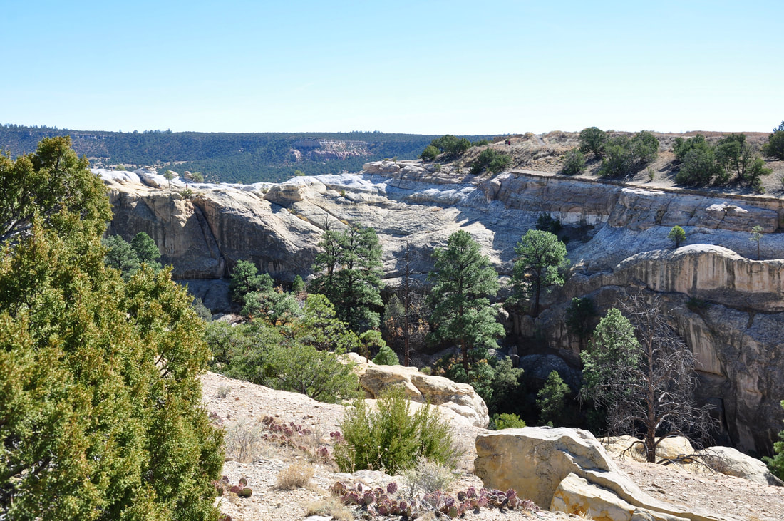
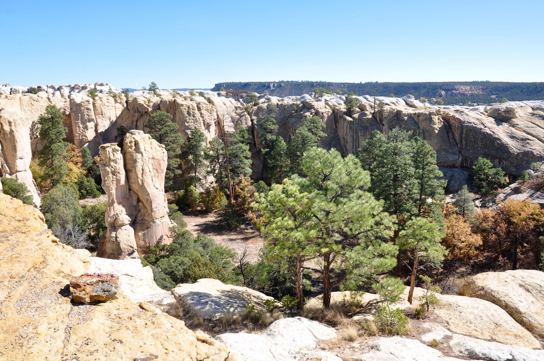
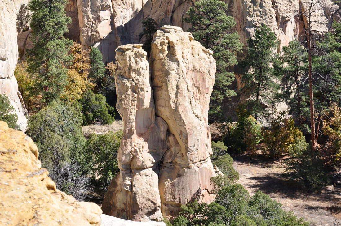
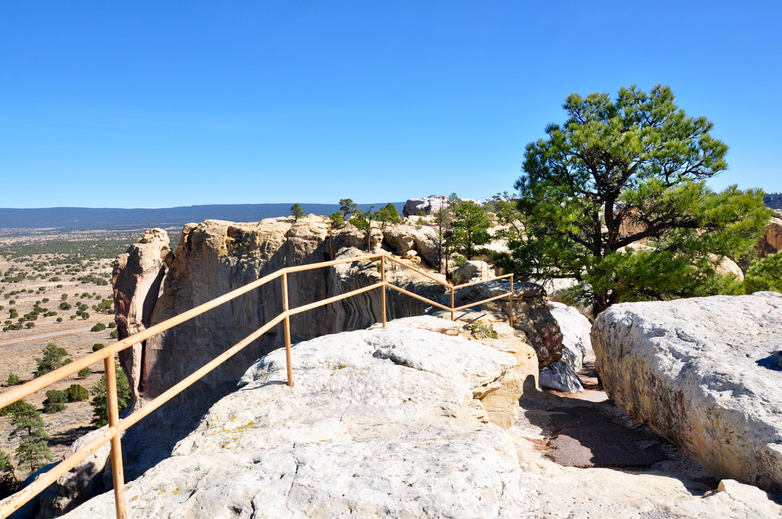
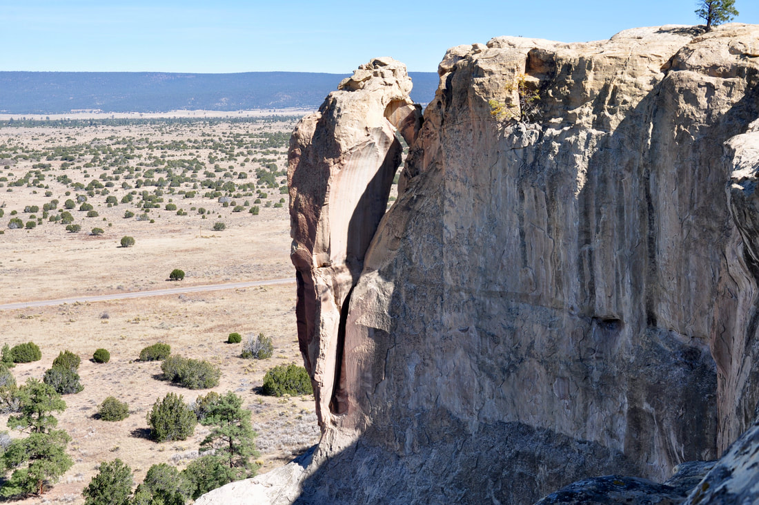
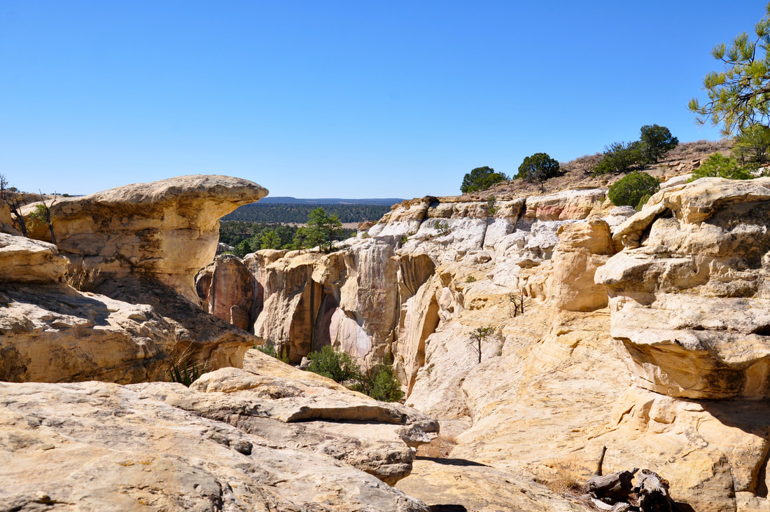
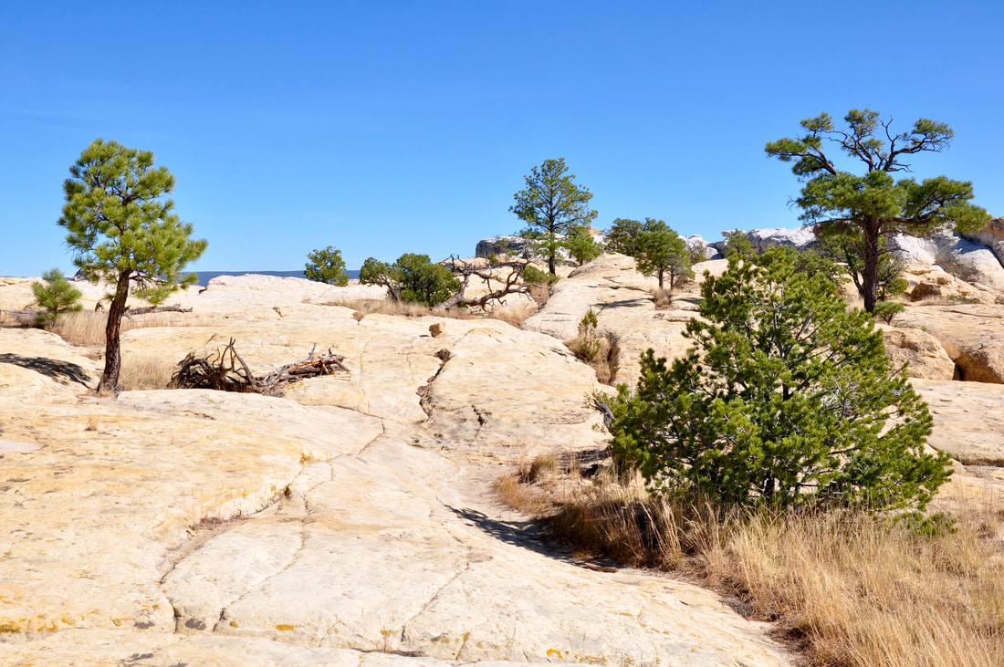
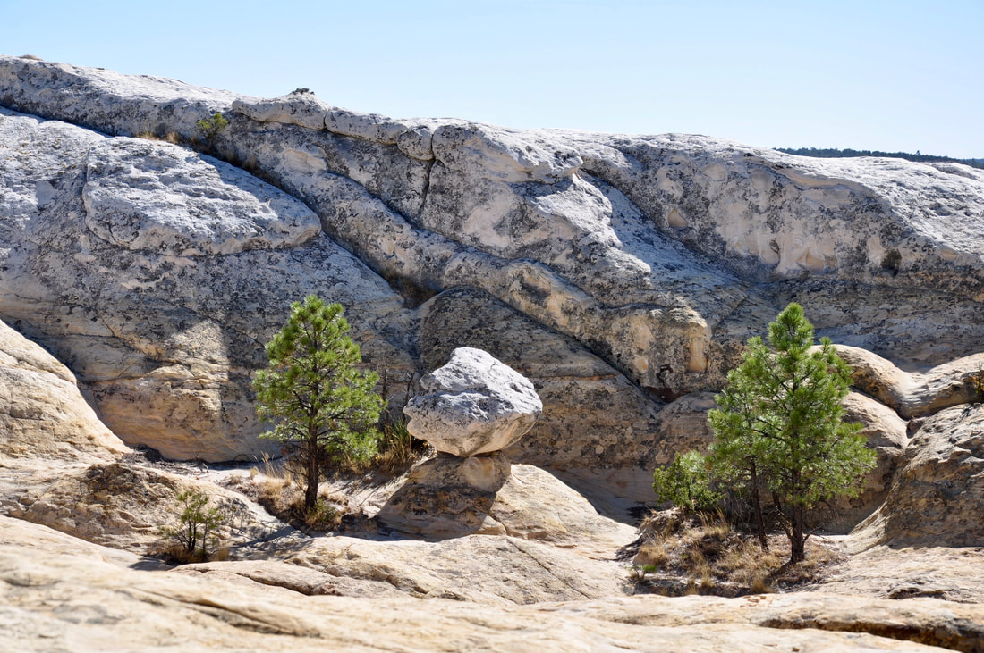
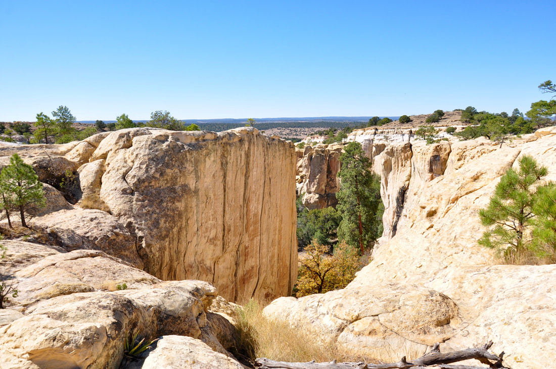
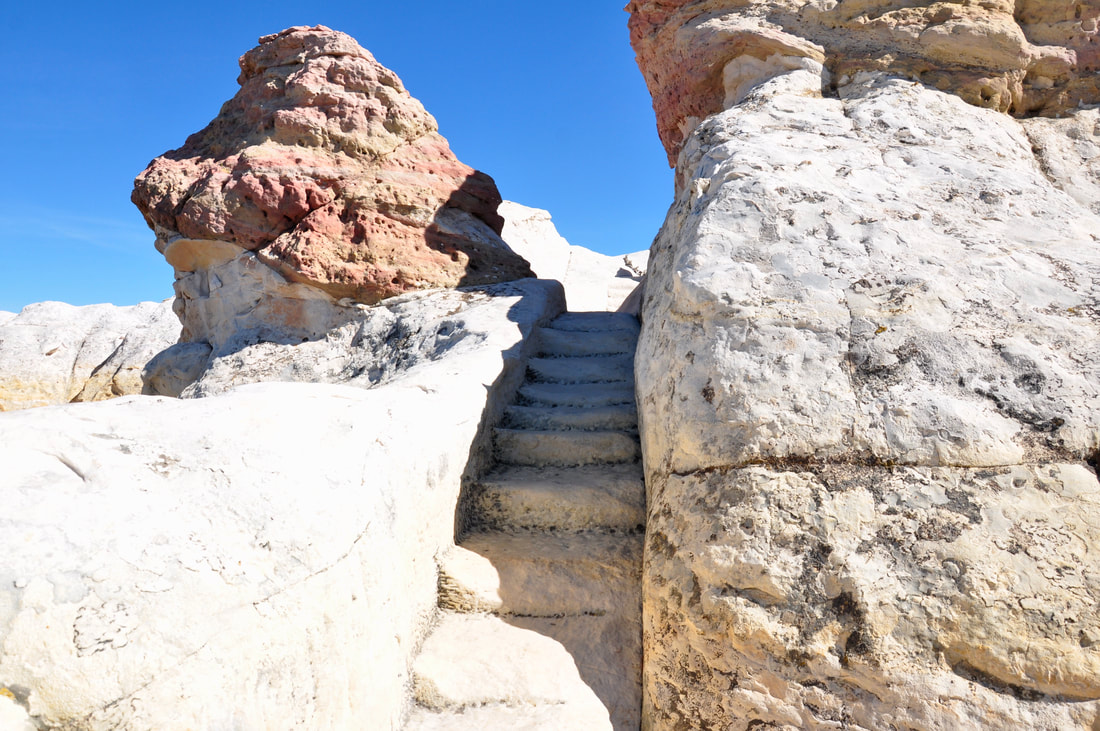
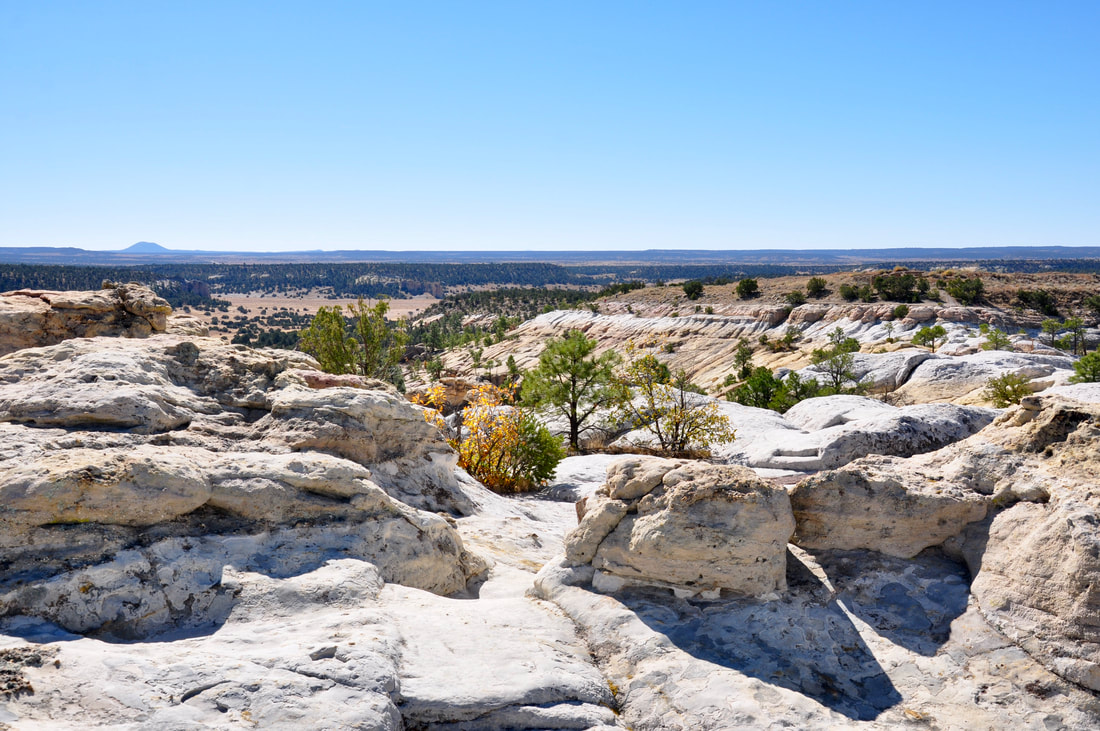
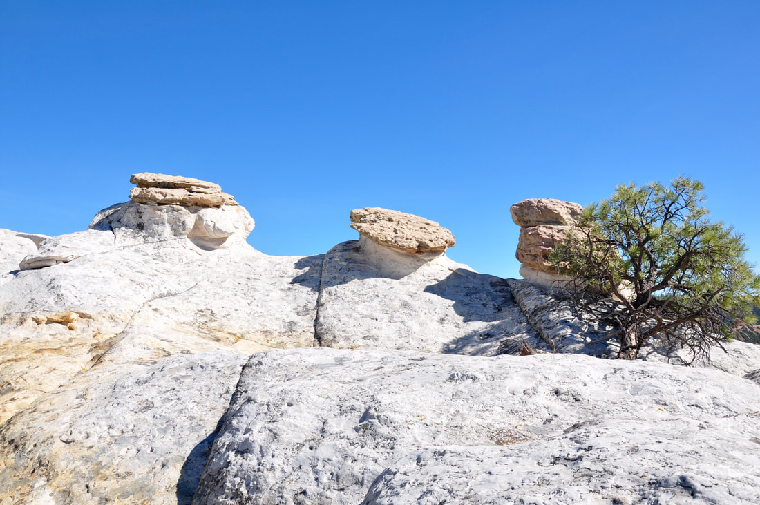
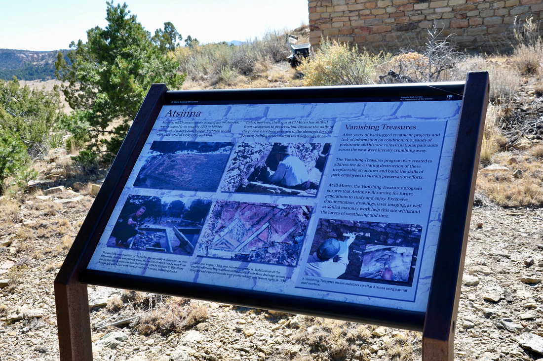
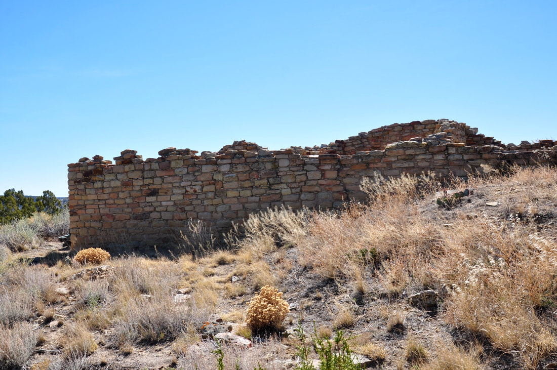
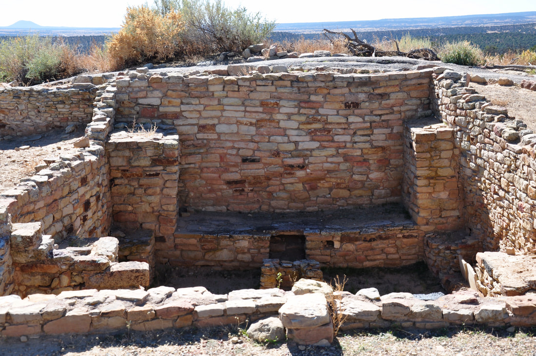
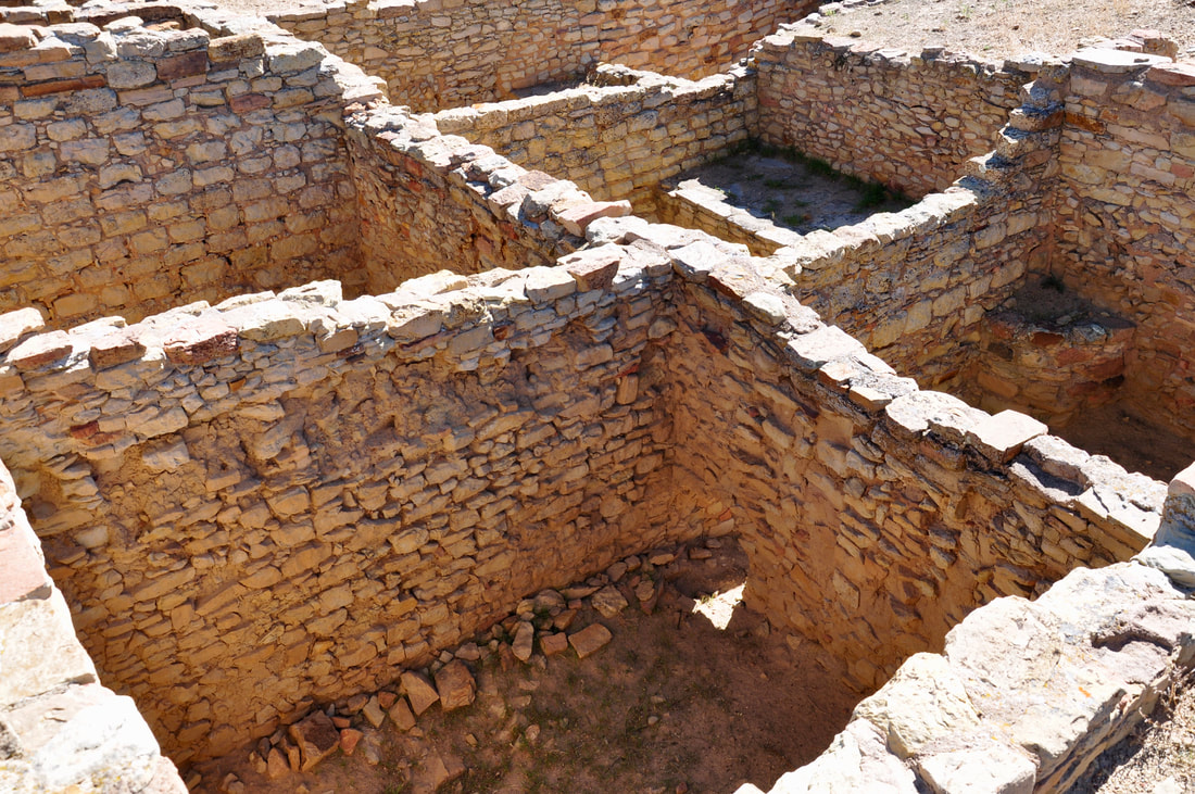
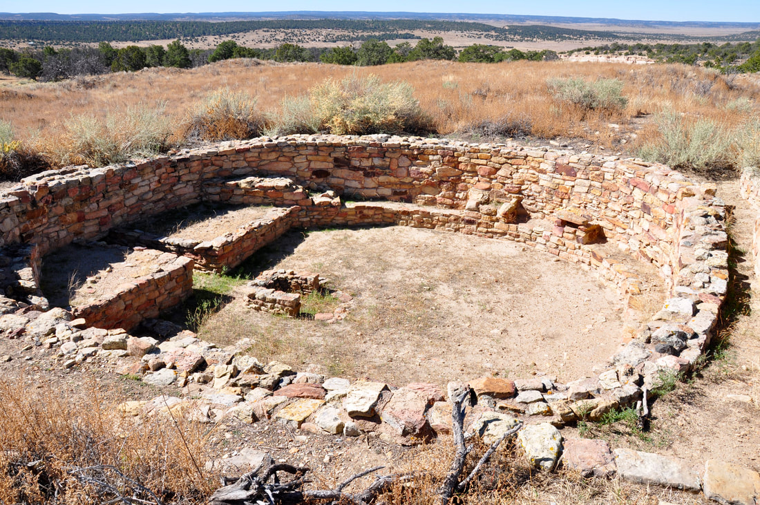
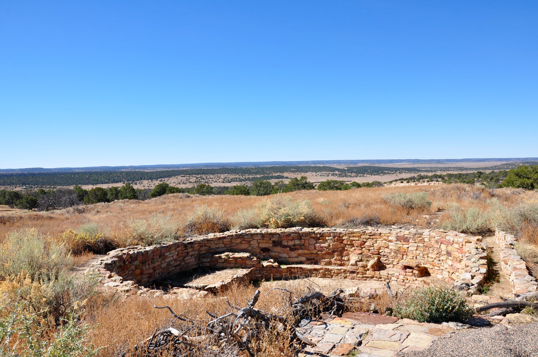
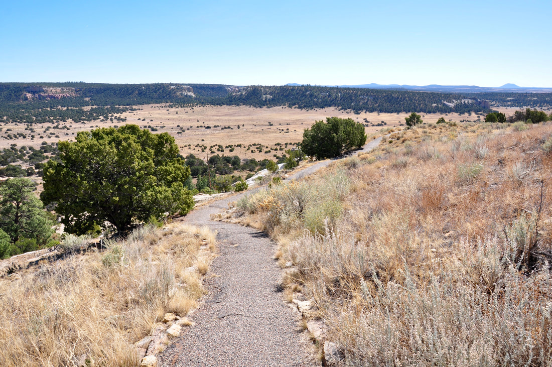
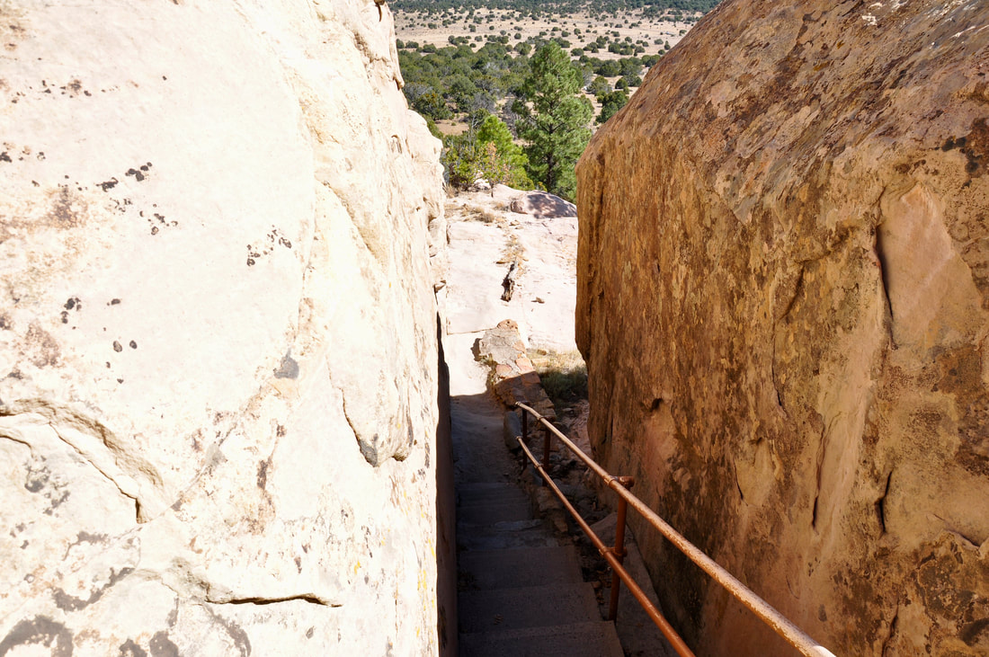
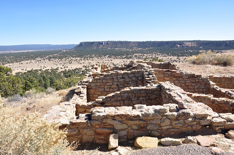
New Mexico certainly is mesa territory and these towering geological features look like islands in the vast grassy plains. Some of the mesas are barren inhospitable places, while others have been home to native people for thousands of years. Living on top of a mesa high above the desert floor may be difficult to imagine, yet there is a place to experience this lifestyle in person. El Morro National Monument features a mesa top pueblo that is fairly easy to access, so for those who wish to see what living on top of a mesa was like, this is the place to go! El Morro National Monument is located in western New Mexico about 55 miles southeast of Gallup. Gallup offers modern amenities and services, so this city is a good choice for a basecamp. Camping is an option in the neighboring El Malpais National Monument, which offers a unique volcanic environment. This region is the home of many ancient cultures, which include the Hopi, Navajo and Zuni in modern times. For this reason it is nearly a requirement to check out the trading posts in the nearby Zuni Village, which offer a unique opportunity to learn a little something from cultural exchange. Taking photos without permission is not allowed in this village, which is good to keep in mind. El Morro is one of the very few mesas in this region that has a natural water source, so the location of this landmark mesa has been well known since ancient times. The water was free for the asking and those who passed through left their mark on the towering El Morro Rock by the natural spring. The rock wall at El Morro is covered with thousands of ancient petroglyphs, as well as inscriptions made by Spanish explorers and pioneers. All this can be seen on the way to the mesa top pueblo, because the Mesa Loop Trail is an extension of the Inscription Rock Trail. The Mesa Top Trail is a little less than two miles long and the difficulty rating is within the easy end of the scale. One end of the Mesa Top Trail is made of smooth paved ramps, while the other end is a tall staircase. For those who have physical challenges, the ramp trail up the side of the tall mesa is the way to go. This trail zig-zags up the side of the mesa all the way to the top, but there are several small staircase sections, so assistance may be needed. There are also a few awkward trail sections on top of the mesa where the path dodges obstacles, but as long a a visitor is mindful of the footing, these sections will be easy to overcome. The climb up the big rock on the Mesa Loop Trail is strenuous, but there are plenty of good places to sit and catch the breath in this high elevation. After sitting down and looking around, it is easy to see that the pine forest covering this side of the mesa actually is a high elevation microclimate. The Ponderosa Pines are the only indication of the elevation, which is over 7,000 feet above sea level in this region. Staying extra hydrated and frequently snacking is the cure for altitude sickness, so packing some extra water is important for this hike! The higher you go, the better the panoramic views will be from this mesa! At the crest of the mesa it is shocking to see just how far out into the distance that the views extend. El Morro is one place where there really are no surprise visitors, because anybody approaching can be seen from a hundred miles away. The solitude on top of this big rock truly is like being in an eagle’s nest high above the desert floor. On the top of the mesa at El Morro it is like a completely different world. The ground is made up of gently rolling Zuni Sandstone mounds with patches of grassy meadow. The weathered layered sandstone has eroded unevenly through time, so there are many crevices, pocket canyons and tall rock spires. When compared to the flat desert ground below, the top of El Morro looks like as if it belongs somewhere else. Navigating the Mesa Loop Trail does get to be challenging up top, because there is not much visible evidence of a trail showing on the barren sandstone surface in some places. With no dirt footprints to follow, all that can be done is to look ahead for signs of the path and try to connect the dots. In some places the path looks like it was made with modern equipment and there actually are a few staircases carved into the rock. In other places, it looks as if the sandstone path has endured eons of wear and tear from heavy foot traffic. This may be correct because this mesa once was occupied by native civilizations for a very long time. As the Mesa Loop Trail winds its way across the top of El Morro almost to the point of descent, the Atsinna Pueblo will come into view. Atsinna is a large building complex that has over 800 rooms and kivas. All that remains is the ruins of what once was, but this ancient archaeological site is remarkably well preserved. Most of the original foundation walls are intact. Parts of the pueblo were reconstructed from the loose rubble, so it is easy for onlookers to imagine what Atsinna looked like back in its day. When standing by the Atsinna Pueblo and looking off into the distance from the top of the mesa, it becomes easy to realize how special this isolated place really is. This solid rock mesa certainly can make visitors completely forget about the modern world that they came from. As far as it goes, the rest of the world can come crashing down, but this lone pueblo atop the tall mesa will always be there, hidden and unseen by those that pass by down below. El Morro National Monument truly is a special destination and hiking the Mesa Top Trail will provide good memories to ponder over for many years to come!
0 Comments
Your comment will be posted after it is approved.
Leave a Reply. |
Leave no trace!
New!
Destination West YouTube channel! https://www.youtube.com/@DestinationWestOrg *The Destination West website upgrading project is well underway. Unique YouTube slideshows are replacing the outdated Flickr photo galleries. The new videos feature modern graphics and alternative music instrumentals that enhance the viewing experience. Some articles are being condensed, while others are getting much needed edits. As everybody knows, the bulk of the original articles and photos were published on the fly during the Covid camping venture and there were limitations. Upgrading is the way to go and more articles will receive a makeover each week until this project is completed. After that, I will be able to gather new material. There is light at the end of the tunnel!
JD Lane Archives
July 2024
|
