          00:00 Title
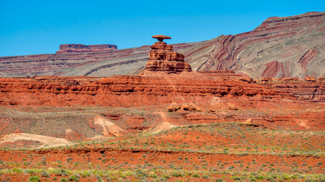
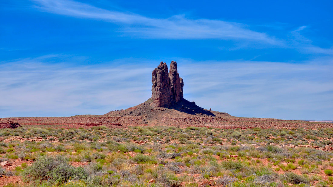
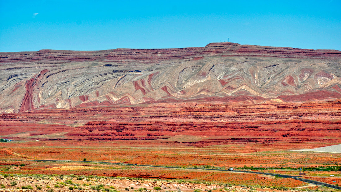
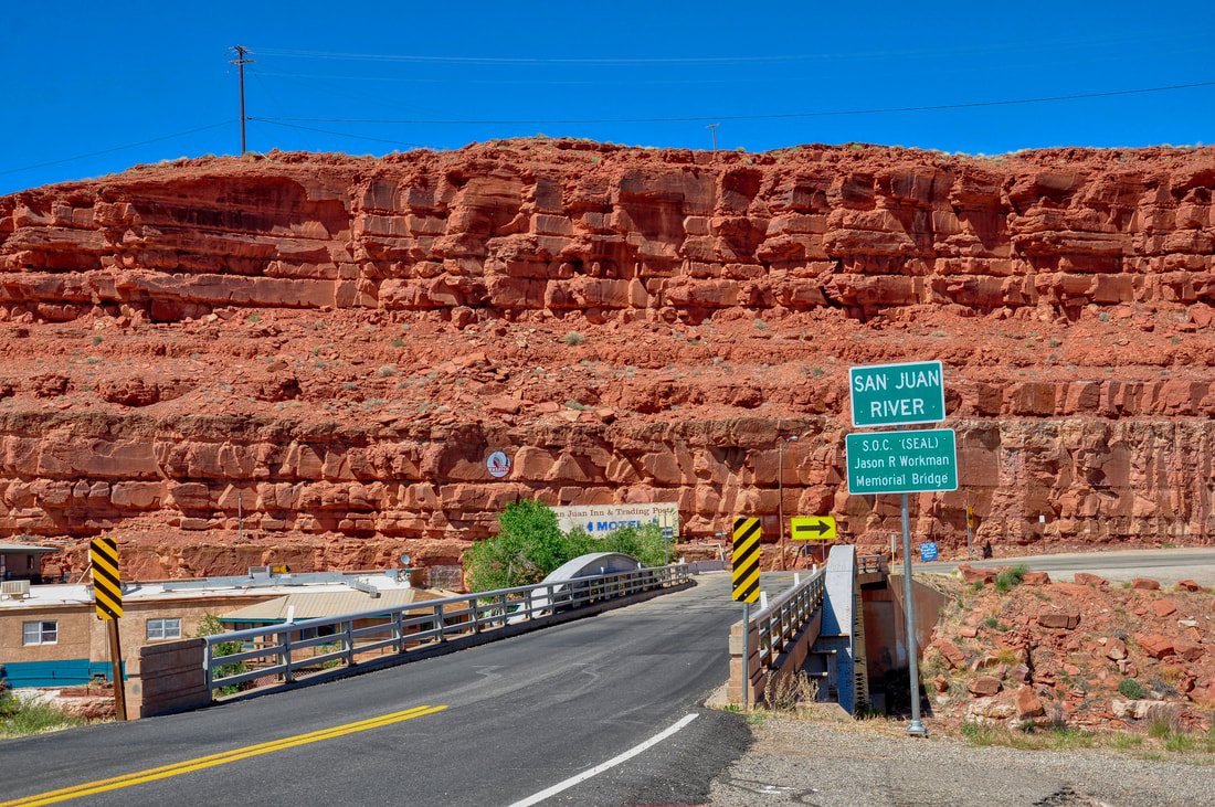
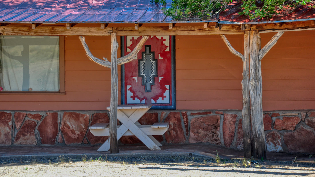
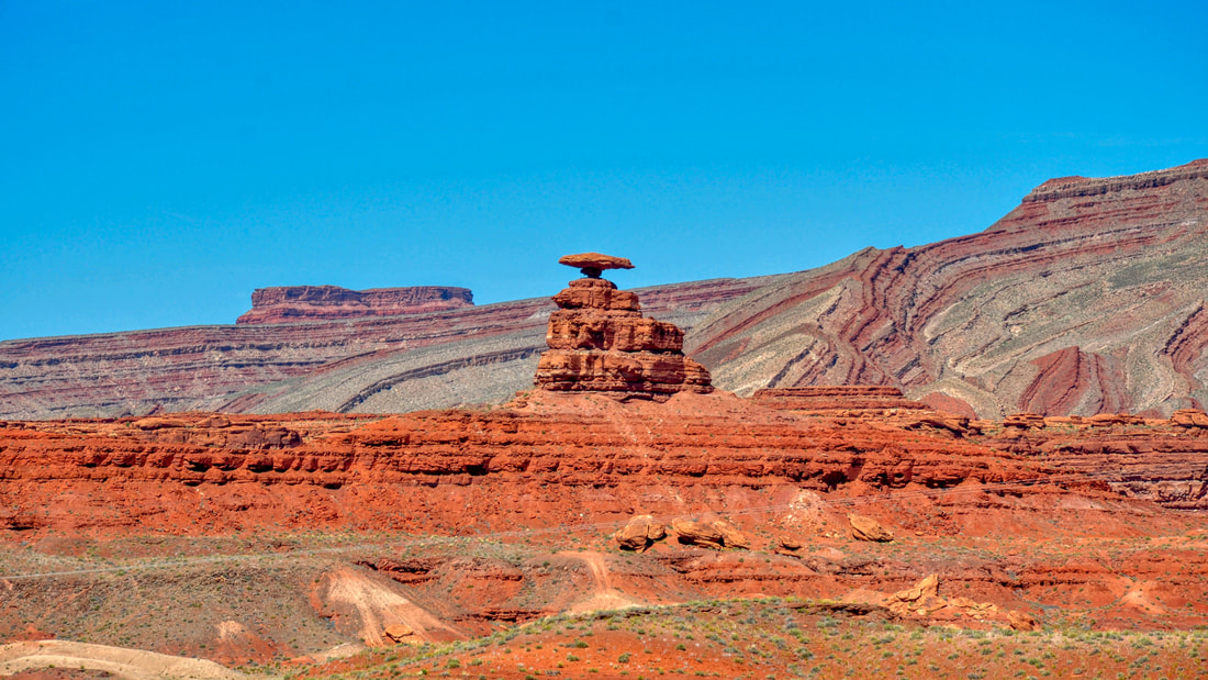
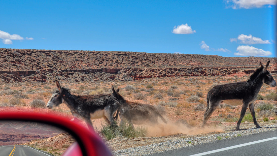
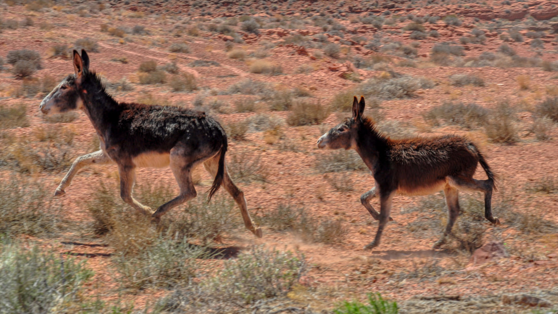
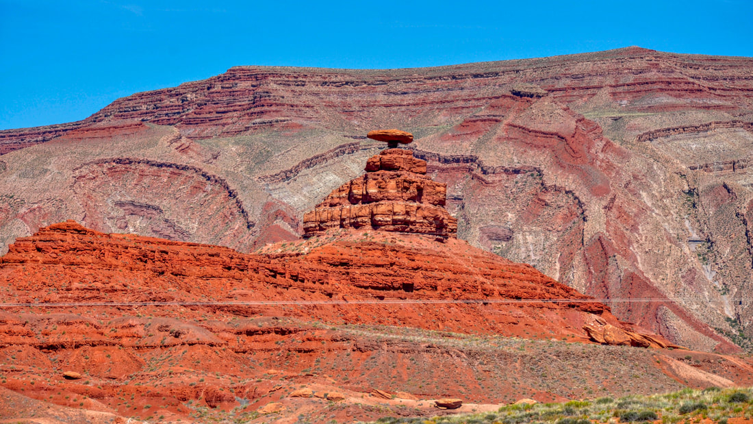
00:18 Goosenecks Utah State Park 04:29 Mexican Hat 07:40 Moki Dugway 12:11 Muley Point-Glen Canyon National Recreation Area 20:19 Fin If viewing some of the most captivating landscapes in the world is something that you have always dreamed about, then definitely point the car in the direction of southeastern Utah. This entire region offers scenic eye candy beyond belief! Monument Valley, Valley Of The Gods, Bears Ears, Canyonlands, Indian Creek, Natural Bridges, Goosenecks, Glen Canyon and Mexican Hat are all located in this corner of the state. As can be imagined, there are plenty of unique landscapes to experience in this neck of the woods and the Mexican Hat landmark is at the top of the list! The town of Mexican Hat is located on U.S. Highway 163 just a short drive north of the Monument Valley Navajo Tribal Park. There are only a few paved roads in this region, so finding this destination on a map is easy to do. The economy of Mexican Hat caters to local tourism and this town is a good place to set up a basecamp for adventures in the Bears Ears region. The landmark motels, RV campgrounds and restaurants have not changed much since the golden age of automobile touring, so those who yearn for a stay in a classic southwestern style setting will be right at home in the little town of Mexican Hat. The San Juan River runs through Mexican Hat, so touring this area by boat, raft or kayak is possible after obtaining permits. There are also plenty of 4×4 trails that go to scenic destinations that ordinary passenger cars cannot access. One of the best wheeler trails in the region happens to be the long dirt road that runs through the Valley Of The Gods section of Bears Ears National Monument. The Valley Of The Gods is a beautiful continuation of the Monument Valley landscape, so be sure to bring a good camera along for the ride. ATV or Jeep rentals and organized 4×4 excursions can be found in the base camp towns along Highway 163 and Highway 191 between Mexican Hat and Monticello. Horseback tours are an option and there are several local guides to choose from. The local hiking trails in Mexican Hat go to ancient pueblos, petroglyph sites and dramatic red rock formations, so Mexican Hat truly is a destination of its own. The Mexican Hat rock formation is what the town was named after, so this unique geological oddity naturally takes center stage. The Mexican Hat rock formation is a huge red sandstone slab that is balanced atop a tall eroded mesa. From a distance or from any angle, this rock formation looks like a man wearing a large sombrero sitting on top of a big rock! The red rock sombrero certainly stands out against the cobalt blue sky and the wavy pattern of the sandstone mountains in the background add a dramatic visual effect. The Mexican Hat rock formation is one of the most photographed landmarks in the southwest and pictures of this geological oddity adorn many travel brochures. There are good vantage points along the highway that are easy to access and there are hiking trails that run all the way up to the Mexican Hat. Southeast Utah is a rock climber’s paradise and many people do the Mexican Hat climb each year. Getting to the top of the platform where the Mexican Hat rests is not difficult to do, but getting on top of the sombrero does require some climbing ingenuity and a high degree of strength. When driving through this region, it is always best to expect the unexpected. This is open range ranching territory, so livestock have been known to roam the roads. Wild horses also cross the highway in this desolate region, so it pays to stay alert for these hazards. It is best to keep in mind that any chance of rescue might as well be a million miles away, so minimizing risks is essential. During a recent trip through Mexican Hat I saw a couple of wild burros standing on the edge of the road staring at me with a strange look on their faces. The wild burros were acting panicky and they looked like they were asking for help, which caused me to stop and check out the situation. All of a sudden the wild burros took off in a hurry before I could figure out what was the bother. The sight of wild burros trotting full speed was kind of shocking, because these animals are usually the laziest animals in the west and I actually have never seen a burro on the run before that moment. I was amazed at the way these animals gracefully trot like a pacer horse and then the thought occurred to me that there must be a good reason why the burros were in such a hurry to get away. Then I saw the dust cloud in the distance getting closer and I heard the sound of barking dogs. The dogs looked like they were having a good time chasing the wild burros through the desert and the burros were just fast enough to stay ahead of the pack. Watching the wild burros get chased around by the pack of wild dogs near Mexican Hat certainly was cheap entertainment at its best! Highway 163 is a major tourism corridor that runs from Kayenta in the Navajo Nation north through Mexican Hat. Businesses in these parts do gear up for a busy tourism season every summer, because so many people want to experience the unique landscapes and ancient sacred places in Bears Ears. When touring this region one will inevitably pass through the town of Mexican Hat and when the gigantic red sandstone sombrero is seen high in the sky, it is well worth taking the time to check out this iconic symbol of the west!
0 Comments
Your comment will be posted after it is approved.
Leave a Reply. |
Leave no trace!
New!
Destination West YouTube channel! https://www.youtube.com/@DestinationWestOrg *The Destination West website upgrading project is well underway. Unique YouTube slideshows are replacing the outdated Flickr photo galleries. The new videos feature modern graphics and alternative music instrumentals that enhance the viewing experience. Some articles are being condensed, while others are getting much needed edits. As everybody knows, the bulk of the original articles and photos were published on the fly during the Covid camping venture and there were limitations. Upgrading is the way to go and more articles will receive a makeover each week until this project is completed. After that, I will be able to gather new material. There is light at the end of the tunnel!
JD Lane Archives
July 2024
|
