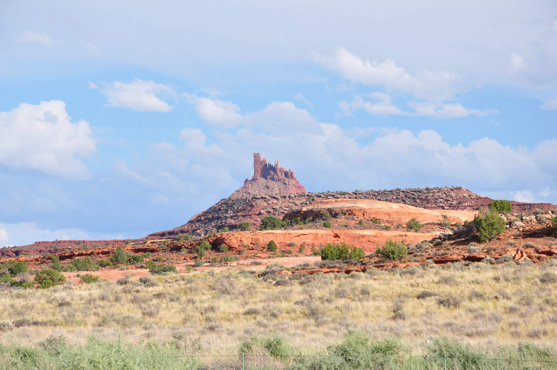
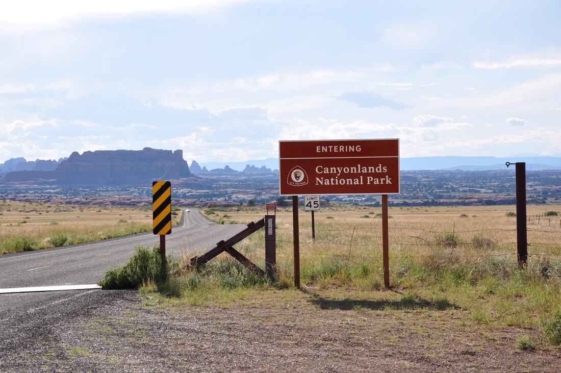
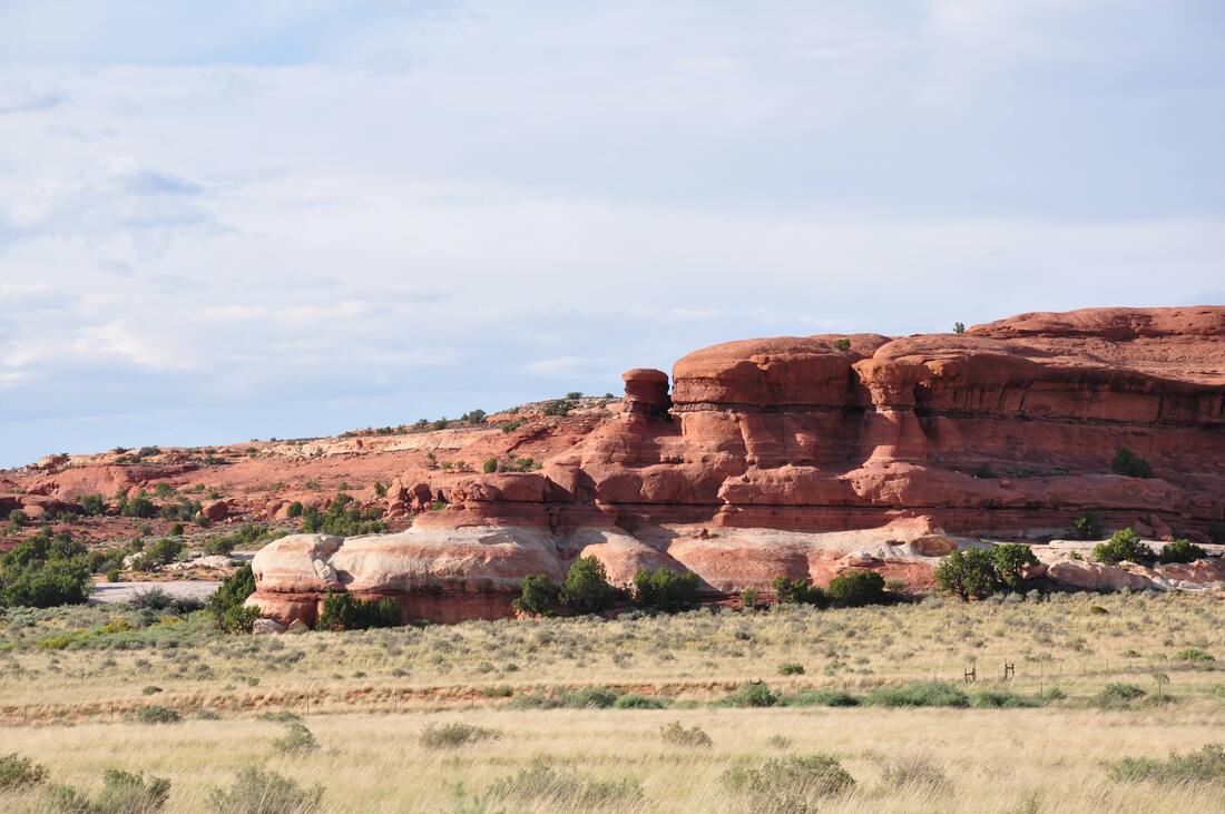
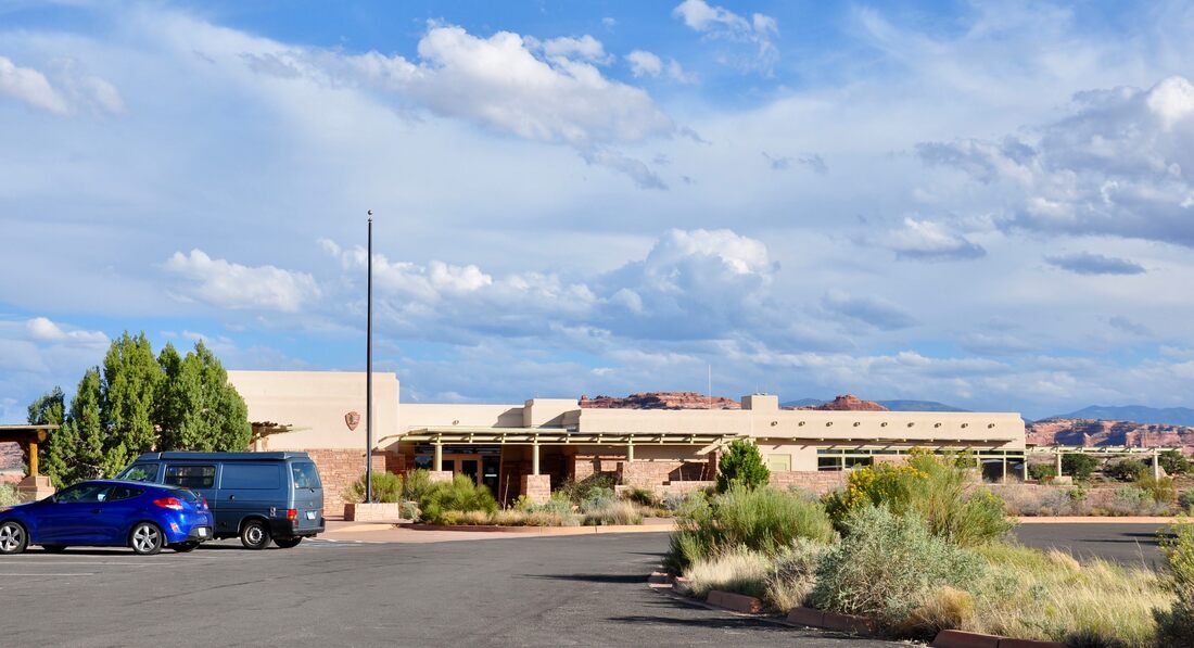
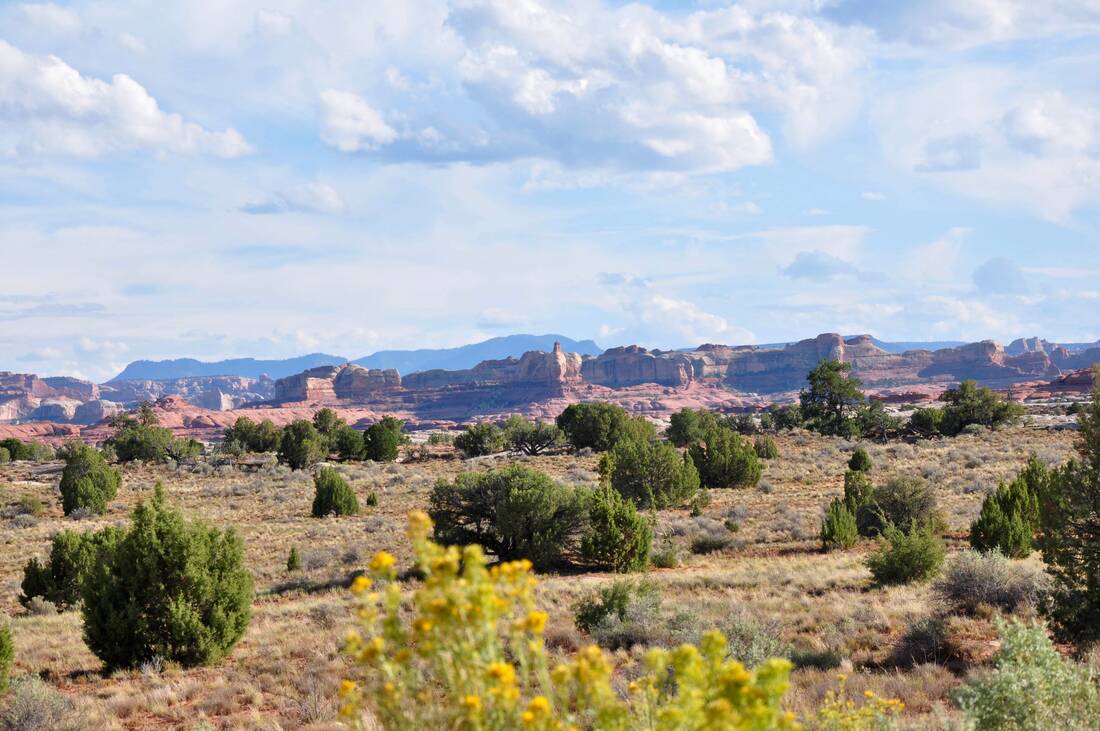
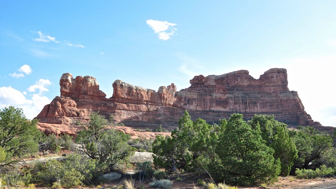
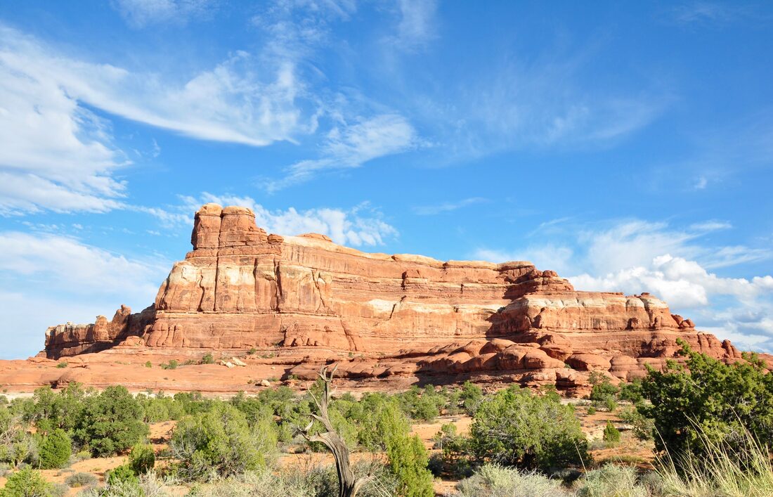
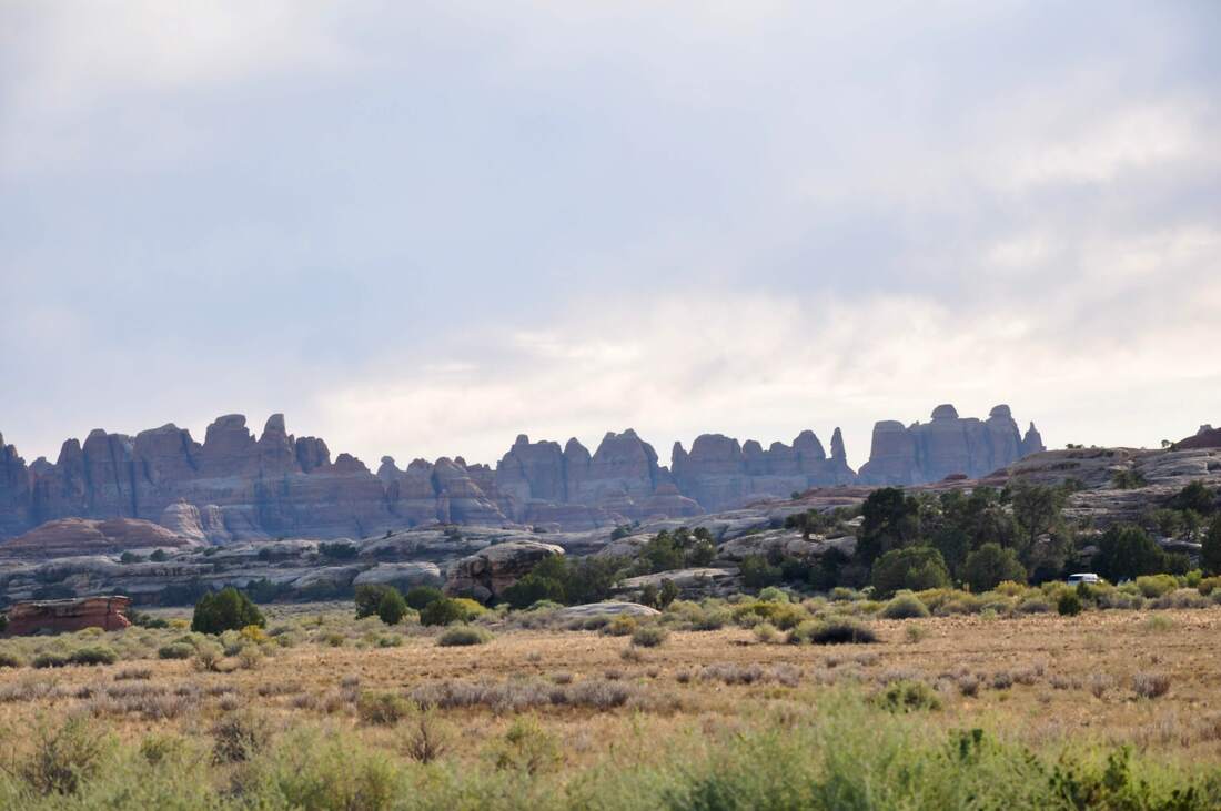
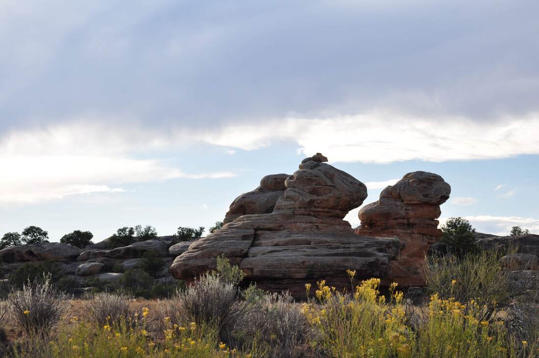
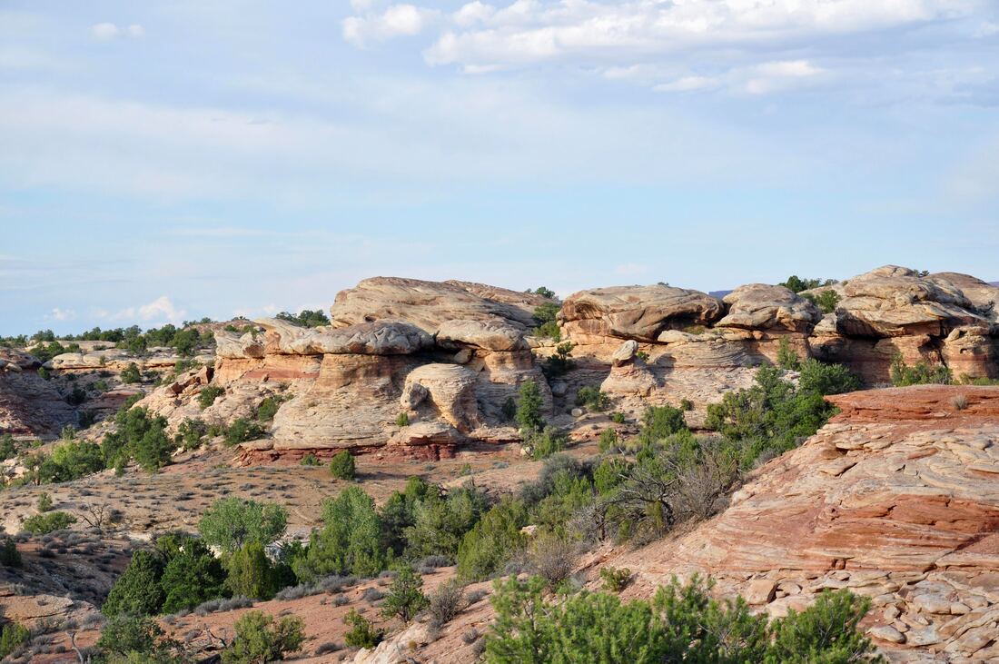
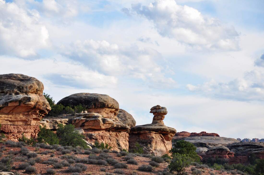
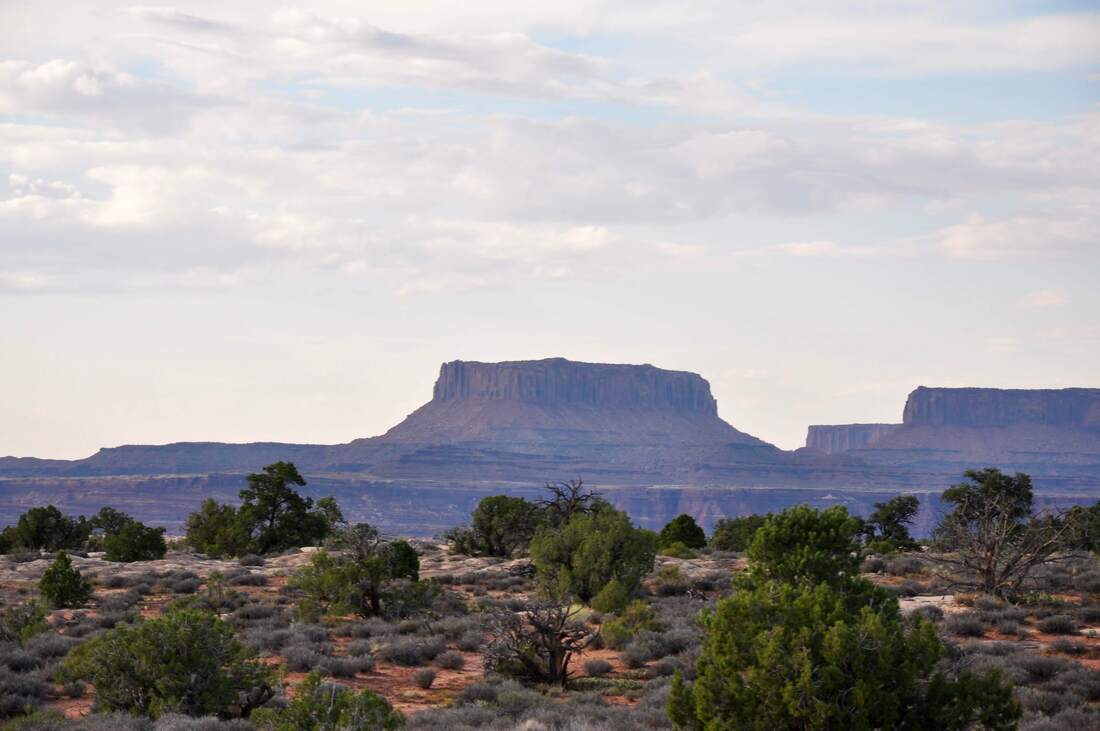
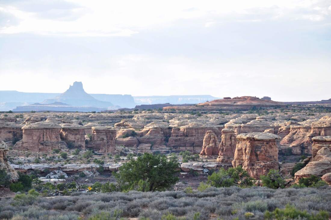
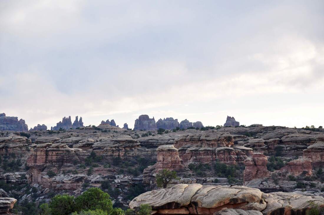
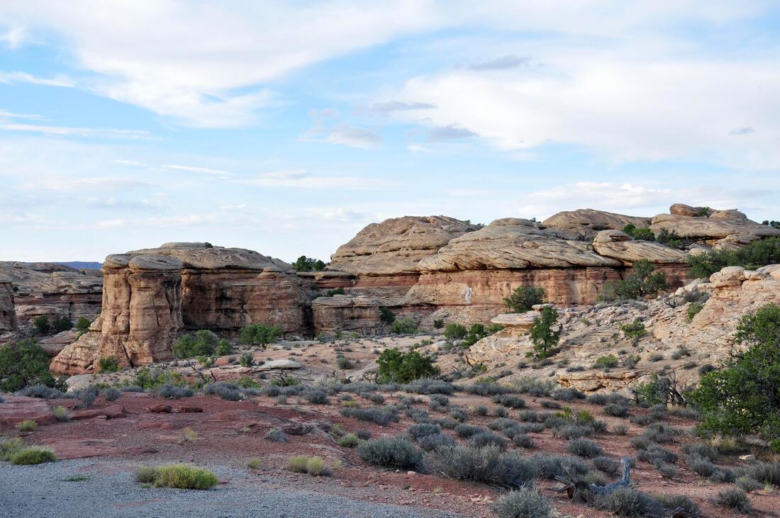
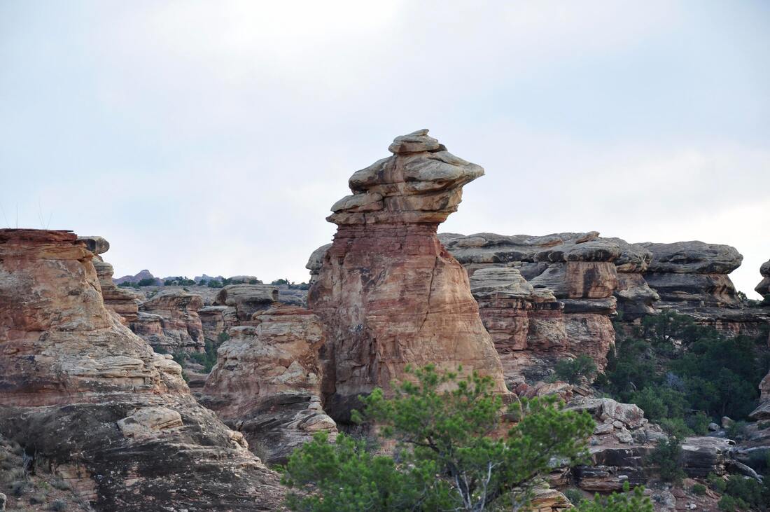
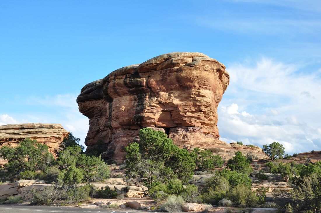
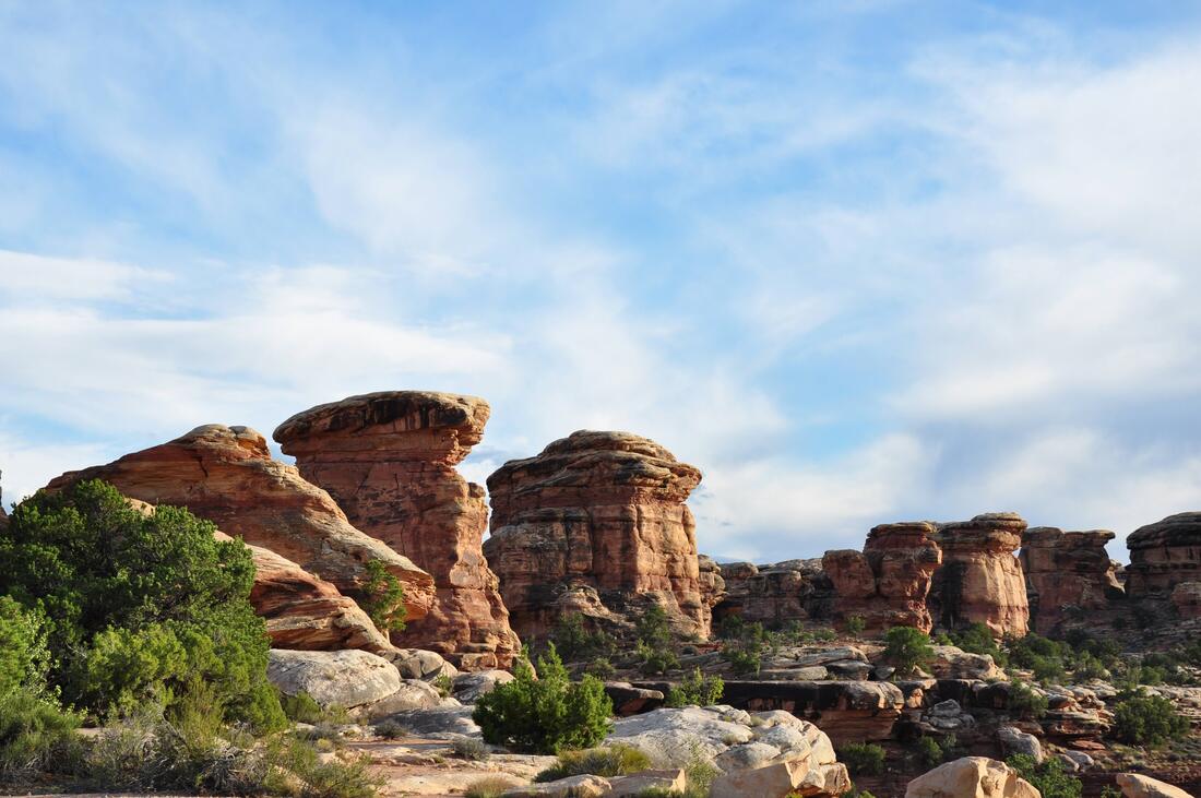
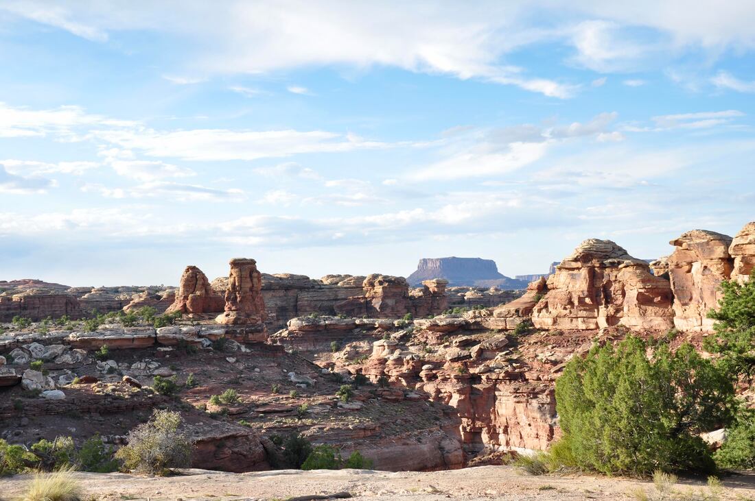
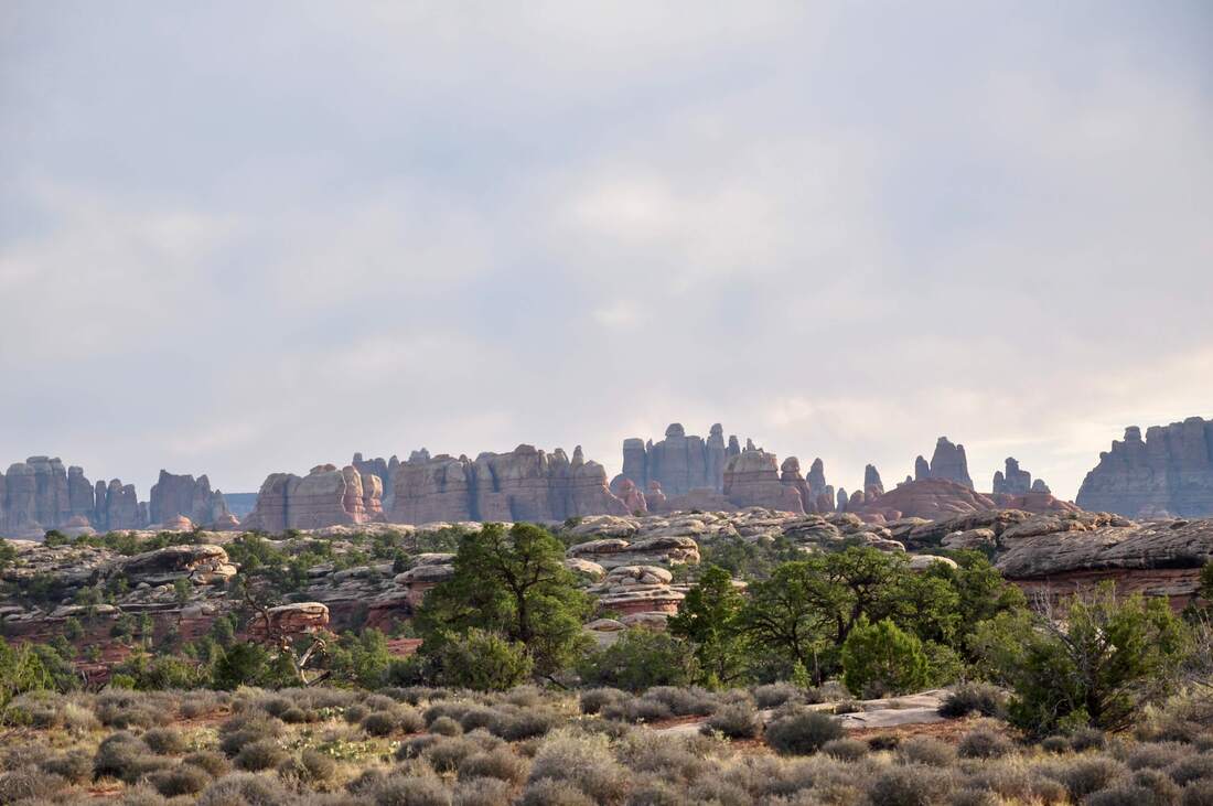
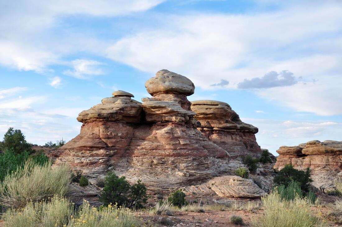
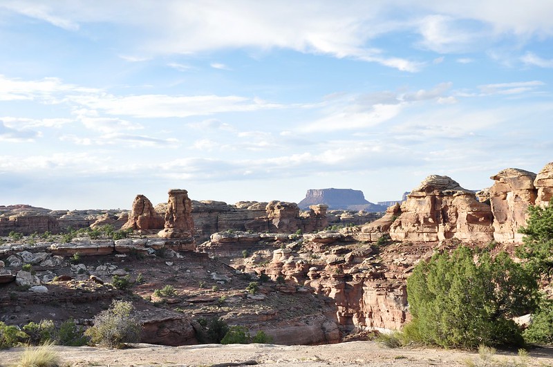
The Canyonlands landscape is so harsh and forbidding that it looks like it does not belong on earth. In fact, if you look at photos of the roughest landscapes on Mars, these two places can easily be compared. Two big rivers converge in this region, but the terrain is so rough that it would take plenty of luck for a lost explorer to find the life giving waters without a compass, map and climbing gear. Canyonlands are a vast maze of ravines, deep canyons, towering eroded rock outcrops and mesas that cover well over 500 square miles. Getting lost in this big National Park during adverse weather conditions can be dangerous, so planning a Canyonlands back country venture should not be taken lightly. Canyonlands National Park is so large that it is divided into four sections that represent four different terrains. The Island In The Sky section is the big central high mesa in the north end of the park. The Maze section is a very rugged section to the west and the Needles section covers a large area in the southern end of the park. The fourth section covers the two navigable rivers, which are the Colorado and Green River. These two big rivers meander through the deep canyons of this National Park like snakes, yet when looking from afar they cannot be seen at all. There are several access points to the four Canyonlands National Park sections, but only the main thoroughfares are paved. Most of the travel routes in this National Park are rough unpaved dirt roads that barely show up on a map. For those who have a Jeep, 4×4 or ATV, getting into the back country areas is easy, while those who drive a regular passenger car will be limited to sticking to the paved roads and doing the hiking trails. Both of the Canyonlands Visitor Centers can be found along the paved roads and one is located in the Canyonlands Needles District. The Visitor Center is the best starting point for all Canyonlands adventures, because this is where maps, information and back country permits can be found. Canyonlands is a big place and it is 106 miles of road between the Island In The Sky Visitors Center and the Needles Visitors Center, so it pays to not get these two places mixed up! The entrance to the Canyonlands Needles District can be found on U.S. Highway 191 near the town of Monticello. The paved road to look for is Utah State Road 211, which runs all the way to the Canyonlands Needles District. On the way to the Canyonlands National Park Needles District boundary, SR 211 also goes through the Newspaper Rock State Historic Monument, a few Bears Ears National Monument access points and the Indian Creek Recreation Area. BLM campsites can be found throughout the Indian Creek Recreation Area, which is good to keep in mind on busy weekends. The nearby towns of Monticello and Blanding are the best choice for basecamps and ATV rentals can be found there too. The paved road to the Canyonlands National Park Needles District certainly is full of surprises and an entire week long vacation could be planned for this region alone. The Indian Creek Recreation Area is a world famous rock climber’s destination, so as can be imagined, the local terrain is quite challenging. In this region there are so many tall rock outcrop spire landmarks, after a while they all start to look the same. To say the least, this is the last place on earth that a visitor would want to get lost in, so be sure to stay on the trails. Pictured in the photos is the landscape that can be viewed from the scenic overlooks along the paved road in the Needles District. When heading west beyond the Canyonlands National Park welcome sign, the landscape quickly changes from high mesa grassy meadows to colorful sandstone outcrops, before the harsh looking spires of the Canyonlands Needles appear further down the road. There are a couple of landmarks that are definitely worth checking out along the way, which include the Roadside Ruin, Wooden Shoe Arch and the Hamburger Rocks. Wildlife can be seen throughout the lush Indian Creek Recreation Area and the wild turkeys are usually easy to spot, so be sure to keep the eyes peeled when passing through! At the end of the paved road there is a parking area that has several Needles District hiking trailheads nearby. Some of the trails lead to the nearby confluence of the Green River and Colorado River and the hiking distance is perfect for a day trip excursion. Other trails go to hidden hoodoo gardens, remote campsites near the Hamburger Rocks and there is a longer back country trail goes to the Needles rock formations in the distance. The Needles District covers about one fourth of the Canyonlands National Park, so there are over 125 square miles of rugged wilderness to explore. This is why the Canyonlands Needles is one of the top back country hiker destinations in the west! No matter whether you want to just take a leisurely cruise and capture a few good pictures at the scenic overlooks or you plan to do a challenging back country hiking excursion, the Canyonlands National Park Needles District is the place to go! Not many people venture to this remote location in Canyonlands National Park, so overcrowding is rarely a problem. There is plenty of peace and quiet to be found in this destination, which happens to be one of the most inhospitable, yet most beautiful places on earth. If you are into a world of adventure, then the Canyonlands Needles District is the place to go!
0 Comments
Your comment will be posted after it is approved.
Leave a Reply. |
Leave no trace!
New!
Destination West YouTube channel! https://www.youtube.com/@DestinationWestOrg *The Destination West website upgrading project is well underway. Unique YouTube slideshows are replacing the outdated Flickr photo galleries. The new videos feature modern graphics and alternative music instrumentals that enhance the viewing experience. Some articles are being condensed, while others are getting much needed edits. As everybody knows, the bulk of the original articles and photos were published on the fly during the Covid camping venture and there were limitations. Upgrading is the way to go and more articles will receive a makeover each week until this project is completed. After that, I will be able to gather new material. There is light at the end of the tunnel!
JD Lane Archives
July 2024
|
